
KNOWPIA
WELCOME TO KNOWPIA

Hida River 
Summary
The Hida River (飛騨川, Hida-gawa) has its source in Mount Norikura (乗鞍岳 Norikura-ga-take) in Takayama, Gifu Prefecture, Japan. It flows from the northern to the southern section of the prefecture before emptying into the Kiso River in Minokamo.
| Hida River | |
|---|---|
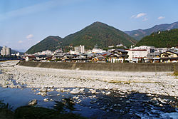 The Hida River flowing through Gero | |
| Native name | 飛騨川 (Japanese) |
| Location | |
| Country | Japan |
| Physical characteristics | |
| Source | |
| • location | Mount Norikura |
| • elevation | 3,026 m (9,928 ft) |
| Mouth | |
• location | Kiso River |
| Length | 148 km (92 mi) |
| Basin size | 2,170 km2 (840 sq mi) |
| Basin features | |
| River system | Kiso River |
River communities edit
The river passes through or forms the boundary of the communities listed below.
References edit
External links edit
35°26′46″N 137°03′09″E / 35.446241°N 137.052444°E (mouth)