


Summary
|
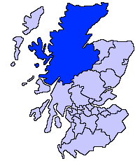
| Highland council area Shown as one of the council areas of Scotland |
| 1995 to 1999 wards |
| 1999 to 2007 wards |
| 2007 to 2017 wards |
| 2017 wards |
The second set of Highland Council wards, 80 in number, became effective for election purposes in 1999, for the second general election of the Highland Council,[1] and were used also for the third general election in 2003. These wards replaced 72 older wards, and were themselves replaced by a set of 22 wards for the fourth general election in 2007.
The Highland Council (Comhairle na Gaidhealtachd in Gaelic) had become a local government authority in 1996, when the two-tier system of regions and districts was abolished and the Highland region became a unitary council area, under the Local Government etc (Scotland) Act 1994. The first Highland Council election, however, was one year earlier, in 1995. Until 1996 councillors shadowed the regional and district councils and planned for the transfer of powers and responsibilities. Elections to the council are normally on a four-year cycle, all wards being contestable at each election.
For the periods 1995 to 1999 and 1999 to 2007, each ward elected one councillor by the first past the post system. In 2007, this arrangement was replaced with one of multi-member wards, each electing three or four councillors by the single transferable vote system, to produce a form of proportional representation.
The wards used from 1995 to 1999 had been subdivisions of eight council management areas, with councillors elected from each area forming an area committee. The wards created in 1999, however, were not exactly subdivisions of the management areas, management area boundaries were not adjusted to take account of new ward boundaries and, therefore, area committees ceased to be exactly representative of areas for which they were named and for which they took decisions.
In 2007, the management areas were replaced with three new corporate management areas, each consisting of a whole number of the new multi-member wards.
Lists of wards, 1999 to 2007 edit
Wards are listed by management area to which linked for area committee purposes.
Badenoch and Strathspey wards edit
There were five wards related to the Badenoch and Strathspey management area:
| Ward | Description |
|---|---|
| Badenoch East | Included parts of the villages of Aviemore and Kingussie |
| Badenoch West | Included the village of Newtonmore and part of the village of Kingussie |
| Grantown on Spey | Included the town of Grantown on Spey |
| Strathspey North East | A rural area around the town of Grantown on Spey |
| Strathspey South | Included part of the village of Aviemore |
Caithness wards edit
There were 10 wards related to the Caithness management area:
| Ward | Description |
|---|---|
| Caithness Central | Included the village of Halkirk |
| Caithness North East | Included the villages of Dunnet and John o' Groats |
| Caithness North West | Included the village of Castletown |
| Caithness South East | Included the village of Lybster |
| Pultneytown | Included the Pultneytown area of the town of Wick |
| Thurso Central | Part of the town of Thurso |
| Thurso East | Part of the town of Thurso |
| Thurso West | Part of the town of Thurso |
| Wick | Included part of the town of Wick and a more rural area to the north |
| Wick West | Included part of the town of Wick |
Inverness wards edit
The management area included Loch Ness, Strathglass and the former royal burgh of Inverness.
Inverness was granted city status in 2001 and the Highland Council then used the 'city' title in reference to the Inverness management area. Letters patent refer, however, to the 'Town of Inverness' and, although there is a former 'royal burgh' which had defined boundaries, there is no 'town' with such boundaries.
'Urban Inverness', below, refers to the area centred on the former royal burgh and generally urban in character during the 1999 to 2007 period.
There were 23 wards related to the management area:
| Ward | Description |
|---|---|
| Ardersier, Croy and Petty | A rural area to the east of urban Inverness Included Fort George, Inverness Airport, and the village of Ardersier. |
| Ballifeary | The Ballifeary and Bught areas of western urban Inverness. |
| Balloch | The Balloch and southern Culloden areas to the east of urban Inverness. |
| Beauly and Strathglass | A rural area to the far west of the management area. Included Strathglass and Glen Affric, and the villages of Beauly and Cannich. |
| Canal | The Dalneigh and Muirtown areas of western urban Inverness. |
| Culduthel | The Culduthel and Castle Heather areas in southern urban Inverness, and the rural Slackbuie area further south. |
| Culloden | The Seafield and northern Culloden area to the east of urban Inverness. |
| Crown | The Crown area in central urban Inverness. |
| Drumossie | The urban Cradlehall area east of Inverness, and the rural Drumossie district to its south. Included the villages of Daviot, Moy, and Tomatin. |
| Hilton | The New Hilton area in southern urban Inverness. |
| Inshes | The Culcabock and Drakies areas in eastern urban Inverness, and the Inshes and Milton of Leys areas to their south. |
| Inverness Central | The City Centre, Haugh, and Longman areas of central and northern urban Inverness. |
| Inverness West | The Kinmylies, Leachkin, and Torvean areas of western urban Inverness, and the rural area to the south-west. Included the villages of Dochgarroch and Lochend. |
| Kirkhill | The Clachnaharry area in north-western urban Inverness and the rural Aird district to the west. Included the villages of Kirkhill and Kiltarlity. |
| Lochardil | The Drummond and Lochardil areas in southern urban Inverness. |
| Loch Ness East | A rural area to the east of Loch Ness. Included the villages of Dores and Foyers. |
| Loch Ness West | A rural Glen Urquhart and Glen Moriston areas to the west of Loch Ness. Included the villages of Drumnadrochit and Fort Augustus. |
| Merkinch | The South Kessock and northern Merkinch areas in north-western urban Inverness. |
| Milton | The Milton and Old Hilton areas of southern urban Inverness. |
| Muirtown | The Carse and southern Merkinch areas of western urban Inverness. |
| Raigmore | The Raigmore area in eastern urban Inverness. |
| Scorguie | The Scorguie area in the western urban Inverness. |
| Westhill and Smithton | The Westhill and Smithton areas east of urban Inverness. |
Lochaber wards edit
There were eight wards related the Lochaber management area:
| Ward | Description |
|---|---|
| Ardnamurchan and Morvern | Included the Ardnamurchan and Morvern peninsulas and the village of Acharacle |
| Caol | Caol area of Fort William |
| Claggan and Glen Spean | Included the village of Spean Bridge |
| Fort William North | Part of Fort William |
| Fort William South | Part of Fort William and a more rural area to the south |
| Glencoe | Included the village of Kinlochleven |
| Kilmallie and Invergary | Included Loch Lochy |
| Mallaig and Small Isles | Included the town of Mallaig and the Small Isles |
Nairn wards edit
The Nairn management area was mostly rural.
Ward boundaries radiated from the town of Nairn (a former burgh), dividing the town between all four wards:
| Ward | Description |
|---|---|
| Nairn Alltan | The north-western part of the town and an area further west |
| Nairn Auldearn | The south-eastern part of the town, and the rural southern area of the management area Included the villages of Auldearn and Piperhill |
| Nairn Cawdor | The Tradespark area in the south-west of the town, and the rural area further south-west Included the village of Cawdor |
| Nairn Ninian | The central Fishertown and Town Centre areas of the town, and a rural area to the east |
Ross and Cromarty wards edit
There were 18 wards related to the Ross and Cromarty management area:
| Ward | Description |
|---|---|
| Alness and Ardross | Included the town of Alness and the village of Ardross |
| Avoch and Fortrose | Part of the Black Isle, with coastline along the Moray Firth Includes the villages of Avoch and Fortrose |
| Black Isle North | Part of the Black Isle, with coastline along the Cromarty Firth Includes the village of Cromarty |
| Conon and Maryburgh | Included the village of Conon Bridge |
| Dingwall North | Includes part of the town of Dingwall |
| Dingwall South | Included part of the town of Dingwall |
| Ferindonald | Had coastline on the north side of the Cromarty Firth, between Dingwall and Alness |
| Gairloch | Included the village of Gairloch |
| Invergordon | Includes the town of Invergordon |
| Knockbain and Killearnan | Part of the Black Isle, with coastline along the Beauly Firth and the Moray Firth Included the village of Munlochy and North Kessock |
| Lochbroom | Included the town of Ullapool |
| Lochcarron | Included the village of Lochcarron |
| Muir of Ord | Included the village of Muir of Ord |
| Rosskeen and Saltburn | Had coastline on the north side of the Cromarty Firth, east of Alness |
| Seaboard | Included the Seaboard Villages |
| Strathpeffer and Strathconon | Included the village of Strathpeffer and upper Strathconon |
| Tain East | Included part of the town of Tain |
| Tain West | Included part of the town of Tain |
Skye and Lochalsh wards edit
The Skye and Lochalsh management area included the islands of Skye, Raasay and Scalpay, the village of Kyle of Lochalsh on the mainland, and a rural area to the east of Kyle of Lochalsh. There were six wards related to the Skye and Lochalsh area:
| Ward | Description |
|---|---|
| Kinlochshiel | A mainland area, east of the village of Kyle of Lochalsh |
| Kyle and Sleat | Included the villages of Kyle of Lochalsh, on the mainland, and Kyleakin, on the Isle of Skye, and the Sleat peninsular of the Isle of Skye |
| Portree | Included the town of Portree, on the Isle of Skye |
| Skye Central | Included the town of Broadford, one the Isle of Skye, and the islands of Raasay and Scalpay |
| Skye West | Included the village of Dunvegan, on the Isle of Skye |
| Snizort and Trotternish | Trotternish peninsular, north of Portree, on the Isle of Skye Included the village of Uig |
Sutherland wards edit
There were six wards related to the Sutherland management area:
| Ward | Towns and villages |
|---|---|
| Brora | Included the town of Brora |
| Dornoch Firth | Areas both sides of the Dornoch Firth Included the town of Dornoch |
| Golspie and Rogart | Included the villages of Golspie and Rogart |
| Sutherland Central | Included the villages of Lairg and Bonar Bridge |
| Sutherland North West | Included the villages of Durness and Lochinver |
| Tongue and Farr | Included the villages of Tongue, Farr, Bettyhill and Reay |
See also edit
Notes and references edit
- ^ Highland Council website, accessed 29 February 2008