


Summary
Himachal Pradesh (/hɪˌmɑːtʃəl prəˈdɛʃ/; Hindi: [ɦɪˈmäːtʃəl pɾəˈd̪eːʃ] ⓘ; lit. "Snow-laden Mountain Province"[9]) is a state in the northern part of India. Situated in the Western Himalayas, it is one of the thirteen mountain states and is characterised by an extreme landscape featuring several peaks and extensive river systems. Himachal Pradesh is the northernmost state of India and shares borders with the union territories of Jammu and Kashmir and Ladakh to the north, and the states of Punjab to the west, Haryana to the southwest, Uttarakhand to the southeast and a very narrow border with Uttar Pradesh to the south. The state also shares an international border to the east with the Tibet Autonomous Region in China. Himachal Pradesh is also known as Dev Bhoomi or Dev Bhumi, meaning 'Land of Gods'[10] and Veer Bhoomi which means 'Land of the Brave'.[11]
Himachal Pradesh | |
|---|---|
| Etymology: "Land of the snow-clad mountains" | |
| Nickname: "Mountain State" | |
| Motto(s): Satyameva Jayate (Truth alone triumphs) | |
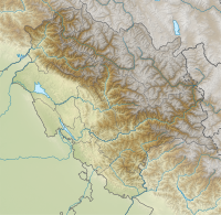
 Location of Himachal Pradesh in India | |
| Coordinates: 31°6′12″N 77°10′20″E / 31.10333°N 77.17222°E | |
| Country | |
| Region | North India |
| Before was | Punjab States Agency |
| As state | 25 January 1971 |
| Formation | 1 November 1956 |
| Capital | Shimla Dharamshala (winter) |
| Largest city | Shimla |
| Districts | 12 |
| Government | |
| • Body | Government of Himachal Pradesh |
| • Governor | Shiv Pratap Shukla[1] |
| • Chief minister | Sukhvinder Singh Sukhu (INC) |
| State Legislature | Unicameral |
| • Assembly | Himachal Pradesh Legislative Assembly[2] (68 seats) |
| National Parliament | Parliament of India |
| • Rajya Sabha | 3 seats |
| • Lok Sabha | 4 seats |
| High Court | Himachal Pradesh High Court |
| Area | |
| • Total | 55,673 km2 (21,495 sq mi) |
| • Rank | 18th |
| Dimensions | |
| • Length | 300 km (200 mi) |
| • Width | 200 km (100 mi) |
| Elevation | 350 m (1,150 ft) |
| Highest elevation | 6,813 m (22,352 ft) |
| Lowest elevation | 232 m (761 ft) |
| Population (2011)[5] | |
| • Total | |
| • Rank | 21st |
| • Density | 123/km2 (320/sq mi) |
| • Urban | 10.03% |
| • Rural | 89.97% |
| Demonym | Himachalis |
| Language | |
| • Official | Hindi |
| • Additional official | Sanskrit |
| • Official script | Devanagari script |
| GDP | |
| • Total (2024–2025) | |
| • Rank | 22nd |
| • Per capita | |
| Time zone | UTC+05:30 (IST) |
| ISO 3166 code | IN-HP |
| Vehicle registration | HP |
| HDI (2021) | |
| Literacy (2011) | |
| Sex ratio (2011) | 972♀/1000 ♂ (32nd) |
| Website | himachal |
| Symbols of Himachal Pradesh | |
 | |
| Bird | Western tragopan |
| Fish | Golden Mahseer[8] |
| Flower | Pink rhododendron |
| Mammal | Snow leopard |
| Tree | Deodar cedar |
| State highway mark | |
 | |
| State highway of Himachal Pradesh HP SH1 - HP SH43 | |
| List of Indian state symbols | |


The predominantly mountainous region comprising the present-day Himachal Pradesh has been inhabited since pre-historic times, having witnessed multiple waves of human migrations from other areas.[12] Through its history, the region was mostly ruled by local kingdoms, some of which accepted the suzerainty of larger empires. Prior to India's independence from the British, Himachal comprised the hilly regions of the Punjab Province of British India. After independence, many of the hilly territories were organised as the Chief Commissioner's province of Himachal Pradesh, which later became a Union Territory. In 1966, hilly areas of the neighbouring Punjab state were merged into Himachal and it was ultimately granted full statehood in 1971.
Himachal Pradesh is spread across valleys with many perennial rivers flowing through them. Agriculture, horticulture, hydropower, and tourism are important constituents of the state's economy. The hilly state is almost universally electrified, with 99.5% of households having electricity as of 2016. The state was declared India's second open-defecation-free state in 2016.[13] According to a survey of CMS-India Corruption Study in 2017, Himachal Pradesh is India's least corrupt state.[14][15]
Himachal Pradesh is divided into 12 districts.
Etymology edit
The name of the state is a reference to its setting: Himachal means "snowy slopes" (Sanskrit: hima, meaning "snow"; acala/achala meaning "slopes", or "land", or "abode"). Himachal Pradesh (ɦɪˈmaːtʃəl pɾəˈdeːʃ; literally "snow-laden province"). Himachal refers to being in the "aanchal" of the Himalayas hence, sheltered by the Himalayas or by the snow. It means "the land in the lap of snowy Himalayas". Pradesh means "state". Himachal was named by Diwakar Datt Sharma, a Sanskrit scholar.[16][17]
History edit
Early history edit

Tribes such as the Koli, Hali, Dagi, Dhaugri, Dasa, Khasa, Kanaura, and Kirati inhabited the region from the prehistoric era.[18] The foothills of the modern state of Himachal Pradesh were inhabited by people from the Indus valley civilisation, which flourished between 2250 and 1750 BCE.[19] The Kols and Mundas are believed to be the original inhabitants to the hills of present-day Himachal Pradesh, followed by the Bhotas and Kiratis.[19]
During the Vedic period, several small republics known as Janapada existed which were later conquered by the Gupta Empire. After a brief period of supremacy by King Harshavardhana, the region was divided into several local powers headed by chieftains, including some Rajputs principalities. These kingdoms enjoyed a large degree of independence and were invaded by Delhi Sultanate several times.[19] Mahmud Ghaznavi conquered Kangra at the beginning of the 11th century. Timur and Sikander Lodi also marched through the lower hills of the state, captured several forts, and fought many battles.[19] Several hill states acknowledged Mughal suzerainty and paid regular tribute to the Mughals.[20]
The Kingdom of Gorkha conquered many kingdoms and came to power in Nepal in 1768.[19] They consolidated their military power and began to expand their territory.[19] Gradually, the Kingdom of Nepal annexed Sirmour and Shimla. Under the leadership of Amar Singh Thapa, the Nepali army laid siege to Kangra. They managed to defeat Sansar Chand Katoch, the ruler of Kangra, in 1806 with the help of many provincial chiefs. However, the Nepali army could not capture Kangra fort which came under Maharaja Ranjit Singh in 1809. After the defeat, they expanded towards the south of the state. However, Raja Ram Singh, Raja of Siba State, captured the fort of Siba from the remnants of Lahore Darbar in Samvat 1846,[19] during the First Anglo-Sikh War.
They came into direct conflict with the British along the tarai belt, after which the British expelled them from the provinces of the Satluj.[19] The British gradually emerged as the paramount power in the region.[19] In the revolt of 1857, or first Indian war of independence, arising from several grievances against the British,[19] the people of the hill states were not as politically active as were those in other parts of the country.[19] They and their rulers, except Bushahr, remained more or less inactive.[19] Some, including the rulers of Chamba, Bilaspur, Bhagal and Dhami, rendered help to the British government during the revolt.
The British territories came under the British Crown after Queen Victoria's proclamation of 1858. The states of Chamba, Mandi and Bilaspur made good progress in many fields during the British rule.[19] During World War I, virtually all rulers of the hill states remained loyal and contributed to the British war effort, both in the form of men and materials. Among these were the states of Kangra, Jaswan, Datarpur, Guler, Rajgarh, Nurpur, Chamba, Suket, Mandi, and Bilaspur.[19]
Partition and post-independence edit
After independence, the Chief Commissioner's Province of Himachal Pradesh was organised on 15 April 1948 as a result of the integration of 30 petty princely states (including feudal princes and zaildars) in the promontories of the western Himalayas. These were known as the Simla Hills States and four Punjab southern hill states under the Himachal Pradesh (Administration) Order, 1948 under Sections 3 and 4 of the Extra-Provincial Jurisdiction Act, 1947 (later renamed as the Foreign Jurisdiction Act, 1947 vide A.O. of 1950). The State of Bilaspur was merged into Himachal Pradesh on 1 July 1954 by the Himachal Pradesh and Bilaspur (New State) Act, 1954.[21]
Himachal became a Part 'C' state on 26 January 1950 when the Constitution of India came into effect and the Lieutenant Governor was appointed. The Legislative Assembly was elected in 1952. Himachal Pradesh became a union territory on 1 November 1956.[19] Some areas of the Punjab State, namely, Simla, Kangra, Kullu and Lahul and Spiti Districts, Lohara, Amb and Una Kanungo circles, some areas of Santokhgarh Kanungo circle and some other specified area of Una Tehsil of Hoshiarpur District, as well as Kandaghat and Nalagarh Tehsils of erstwhile PEPSU State, besides some parts of Dhar Kalan Kanungo circle of Pathankot District—were merged with Himachal Pradesh on 1 November 1966 on the enactment by Parliament of the Punjab Reorganisation Act, 1966.[21] On 18 December 1970, the State of Himachal Pradesh Act was passed by Parliament, and the new state came into being on 25 January 1971. Himachal became the 18th state of the Indian Union with Dr. Yashwant Singh Parmar as its first chief minister.[19]
Geography edit
Himachal is in the western Himalayas situated between 30°22′N and 33°12′N latitude and 75°47′E and 79°04′E longitude. Covering an area of 55,673 square kilometres (21,495 sq mi),[3] it is a mountainous state. The Zanskar range runs in the northeastern part of the state and the great Himalayan range run through the eastern and northern parts, while the Dhauladhar and the Pir Panjal ranges of the lesser Himalayas, and their valleys, form much of the core regions. The outer Himalayas, or the Shiwalik range, form southern and western Himachal Pradesh. At 6,816 m, Reo Purgyil is the highest mountain peak in the state of Himachal Pradesh.[22]
The drainage system of Himachal is composed both of rivers and glaciers. Himalayan rivers criss-cross the entire mountain chain. Himachal Pradesh provides water to both the Indus and Ganges basins.[23] The drainage systems of the region are the Chandra Bhaga or the Chenab, the Ravi, the Beas, the Sutlej, and the Yamuna. These rivers are perennial and are fed by snow and rainfall. They are protected by an extensive cover of natural vegetation.[23] Four of the five Punjab rivers flow through Himachal Pradesh, three of them originating in the state. These rivers run through a maze of valleys separated by the mountain ranges of the state. The Satluj Valley is formed by the Satluj river entering the state near Shipki La, while the Spiti and Baspa Valleys are formed by the river's two major tributaries in the state. The Beas river flows though the Kullu and the Kangra Valleys, with tributary Parvati forming the Parvati Valley. The Chenab river, formed by the confluence of the Chandra and Bhaga, forms much of the northern regions of Lahaul and Pangi, and the Ravi river flows principally through Chamba. The Pabbar and Giri rivers in the southeast are part of the Yamuna basin.
Due to extreme variation in elevation, great variation occurs in the climatic conditions of Himachal Pradesh. The climate varies from hot and humid subtropical in the southern tracts to, with more elevation, cold, alpine, and glacial in the northern and eastern mountain ranges.[24] The state's winter capital, Dharamsala receives very heavy rainfall, while areas like Lahaul and Spiti are cold and almost rainless. Broadly, Himachal experiences three seasons: summer, winter, and rainy season. Summer lasts from mid-April until the end of June and most parts become very hot (except in the alpine zone which experiences a mild summer) with the average temperature ranging from 28 to 32 °C (82 to 90 °F). Winter lasts from late November until mid-March. Snowfall is common in alpine tracts. Pollution is affecting the climate of almost all the states of India. Due to steps taken by governments to prevent pollution, Himachal Pradesh has become the first smoke-free state in India which means cooking in the entire state is free of traditional chulhas.[25]
-
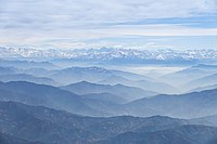
 Topographic map of Himachal Pradesh. Most of the state is mountainous.
 -
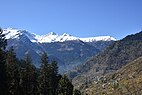
 View of the Shivalik Hills and the Middle Himalayas in Himachal Pradesh


Flora and fauna edit
Himachal Pradesh is one of the states that lies in the Indian Himalayan Region (IHR), one of the richest reservoirs of biological diversity in the world. As of 2002, the IHR is undergoing large scale irrational extraction of wild, medicinal herbs, thus endangering many of its high-value gene stock. To address this, a workshop on 'Endangered Medicinal Plant Species in Himachal Pradesh' was held in 2002 and the conference was attended by forty experts from diverse disciplines.[26]
According to 2003 Forest Survey of India report, legally defined forest areas constitute 66.52% of the area of Himachal Pradesh.[27] Vegetation in the state is dictated by elevation and precipitation. The state is endowed with a high diversity of medicinal and aromatic plants.[28] Lahaul-Spiti region of the state, being a cold desert, supports unique plants of medicinal value including Ferula jaeschkeana, Hyoscyamus niger, Lancea tibetica, and Saussurea bracteata.[29][30]
Himachal is also said to be the fruit bowl of the country,[31] with widespread orchards. Meadows and pastures are also seen clinging to steep slopes. After the winter season, the hillsides and orchards bloom with wild flowers, white gladiolas, carnations, marigolds,[32] roses, chrysanthemums, tulips and lilies are carefully cultivated. Himachal Pradesh Horticultural Produce Marketing and Processing Corporation Ltd. (HPMC) is a state body that markets fresh and processed fruits.[33]
Himachal Pradesh has around 463 bird, and Tragopan melanocephalus is the state bird of Himanchal Pradesh[34] 77 mammalian, 44 reptile and 80 fish species.Himachal Pradesh has currently five National Parks.[35] Great Himalayan National Park, oldest and largest National park in the state, is a UNESCO World Heritage Site. Pin Valley National Park, Inderkilla, Khirganga and Simbalbara are the other national Parks located in the state.[35][36][37][38] The state also has 30 wildlife sanctuaries and 3 conservation reserves.[38] The state bird of Himachal Pradesh is the Western tragopan, locally known as the jujurana.[39] It is one of the rarest living pheasants in the world. The state animal is the snow leopard, which is even rarer to find than the jujurana.[40]
-
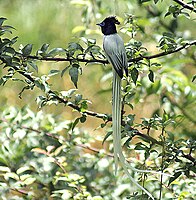 Indian paradise flycatcher (Terpsiphone paradisi) in Kullu
 -
 Black bulbul (Hypsipetes leucocephalus)


Government edit
The Legislative Assembly of Himachal Pradesh has no pre-constitution history. The State itself is a post-independence creation. It came into being as a centrally administered territory on 15 April 1948 from the integration of thirty erstwhile princely states.[41]
Himachal Pradesh is governed through a parliamentary system of representative democracy, a feature the state shares with other Indian states. Universal suffrage is granted to residents. The legislature consists of elected members and special office bearers such as the Speaker and the Deputy Speaker who are elected by the members. Assembly meetings are presided over by the Speaker or the Deputy Speaker in the Speaker's absence. The judiciary is composed of the Himachal Pradesh High Court and a system of lower courts.
Executive authority is vested in the Council of Ministers headed by the Chief Minister, although the titular head of government is the Governor. The governor is the head of state appointed by the President of India. The leader of the party or coalition with a majority in the Legislative Assembly is appointed as the Chief Minister by the governor, and the Council of Ministers are appointed by the governor on the advice of the Chief Minister. The Council of Ministers reports to the Legislative Assembly. The Assembly is unicameral with 68 Members of the Legislative Assembly (MLA).[42] Terms of office run for five years, unless the Assembly is dissolved prior to the completion of the term. Auxiliary authorities known as panchayats, for which local body elections are regularly held, govern local affairs.
In the assembly elections held in November 2022, the Indian National Congress secured an absolute majority, winning 40 of the 68 seats while the BJP won only 25 of the 68 seats. Sukhvinder Singh Sukhu was sworn in as Himachal Pradesh's 15th Chief Minister in Shimla on 11 December 2022. Mukesh Agnihotri was sworn in as his deputy the same day.
Administrative divisions edit
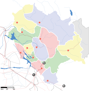
The state of Himachal Pradesh is divided into 12 districts[43] which are grouped into three divisions, Shimla, Kangra and Mandi.[44] The districts are further divided into 73 subdivisions, 78 blocks and 172 Tehsils.[43]
| Divisions | Districts[45] |
|---|---|
| Kangra | Chamba, Kangra, Una |
| Mandi | Bilaspur, Hamirpur, Kullu, Lahaul and Spiti, Mandi |
| Shimla | Kinnaur, Shimla, Sirmaur, Solan |
| Administrative Structure[46] | |
|---|---|
| Divisions | 3 |
| Districts | 12 |
| Tehsils/ Sub-Tehsils | 172 |
| Developmental Blocks | 78 |
| Urban Local Bodies | 54[47] |
| Towns | 59 |
| Gram Panchayats | 3615 |
| Villages | 20690 |
| Police Stations | 130[48] |
| Lok Sabha seats | 4[49] |
| Rajya Sabha seats | 3 |
| Assembly Constituencies | 68[49] |
Economy edit
| Year | Gross State Domestic Product |
|---|---|
| 1980 | 794 |
| 1985 | 1,372 |
| 1990 | 2,815 |
| 1995 | 6,698 |
| 2000 | 13,590 |
| 2005 | 23,024 |
| 2006 | 25,435 |
| 2010 | 57,452 |
| 2013 | 82,585 |
| 2014 | 92,589 |
| 2015 | 101,108 |
| 2016 | 110,511[50] |
| 2017 | 124,570[51] |
| 2018 | 135,914[52] |
| 2021 | 172,174 |
Planning in Himachal Pradesh started in 1951 along with the rest of India with the implementation of the first five-year plan. The First Plan allocated ₹52.7 million to Himachal Pradesh.[53] More than 50% of this expenditure was incurred on transport and communication; while the power sector got a share of just 4.6%, though it had steadily increased to 7% by the Third Plan.[54] Expenditure on agriculture and allied activities increased from 14.4% in the First Plan to 32% in the Third Plan, showing a progressive decline afterwards from 24% in the Fourth Plan to less than 10% in the Tenth Plan.[54] Expenditure on energy sector was 24.2% of the total in the Tenth Plan.[54]
The total GDP for 2005–06 was estimated at ₹254 billion as against ₹230 billion in the year 2004–05, showing an increase of 10.5%.[55] The GDP for fiscal 2015–16 was estimated at ₹1.110 trillion,[50] which increased to ₹1.247 trillion in 2016–17, recording growth of 6.8%.[51] The per capita income increased from ₹130,067 in 2015–16 to ₹147,277 in 2016–17.[50][51] The state government's advance estimates for fiscal 2017–18 stated the total GDP and per capita income as ₹1.359 trillion and ₹158,462, respectively.[52] As of 2018, Himachal is the 22nd-largest state economy in India with ₹1.52 lakh crore (US$19 billion) in gross domestic product and has the 13th-highest per capita income (₹160,000 (US$2,000)) among the states and union territories of India.[56]
Himachal Pradesh also ranks as the second-best performing state in the country on human development indicators after Kerala.[57] One of the Indian government's key initiatives to tackle unemployment is the National Rural Employment Guarantee Act (NREGA). The participation of women in the NREGA has been observed to vary across different regions of the nation. As of the year 2009–2010, Himachal Pradesh joined the category of high female participation, recording a 46% share of NREGS (National Rural Employment Guarantee Scheme) workdays for women. This was a drastic increase from the 13% that was recorded in 2006–2007.[58]
Agriculture edit

Agriculture accounts for 9.4% of the net state domestic product.[59] It is the main source of income and employment in Himachal. About 90% of the population in Himachal depends directly upon agriculture, which provides direct employment to 62% of total workers of state.[59] The main cereals grown include wheat, maize, rice and barley with major cropping systems being maize-wheat, rice-wheat and maize-potato-wheat.[60][61] Pulses, fruits, vegetables and oilseeds are among the other crops grown in the state.[60] Centuries-old traditional Kuhl irrigation system is prevalent in the Kangra valley,[62] though in recent years these Kuhls have come under threat from hydroprojects on small streams in the valley.[63] Land husbandry initiatives such as the Mid-Himalayan Watershed Development Project, which includes the Himachal Pradesh Reforestation Project (HPRP), the world's largest clean development mechanism (CDM) undertaking, have improved agricultural yields and productivity, and raised rural household incomes.[64]

Apple is the principal cash crop of the state grown principally in the districts of Shimla, Kinnaur, Kullu, Mandi, Chamba and some parts of Sirmaur and Lahaul-Spiti with an average annual production of five lakh tonnes and per hectare production of 8 to 10 tonnes.[65] The apple cultivation constitute 49 per cent of the total area under fruit crops and 85% of total fruit production in the state with an estimated economy of ₹3500 crore.[65] Apples from Himachal are exported to other Indian states and even other countries.[66][67] In 2011–12, the total area under apple cultivation was 104,000 hectares, increased from 90,347 hectares in 2000–01.[67] According to the provisional estimates of Ministry of Agriculture & Farmers Welfare, the annual apple production in Himachal for fiscal 2015–16 stood at 753,000 tonnes, making it India's second-largest apple-producing state after Jammu and Kashmir.[68] The state is also among the leading producers of other fruits such as apricots, cherries, peaches, pears, plums and strawberries in India.

Kangra tea is grown in the Kangra valley. Tea plantation began in 1849, and production peaked in the late 19th century with the tea becoming popular across the globe.[69] Production dipped sharply after the 1905 Kangra earthquake and continues to decline.[70] The tea received geographical indication status in 2005.
Industry edit
Pharma hub edit
Himachal Pradesh is renowned as Asia's pharmaceutical hub, housing a total of 652 pharmaceutical units. The state hosts a thriving ₹40,000 crore drug manufacturing industry.[71][72]
Energy edit
Hydropower is one of the major sources of income generation for the state.[73] The state has an abundance of hydropower resources because of the presence of various perennial rivers. Many high-capacity hydropower plants have been constructed which produce surplus electricity that is sold to other states, such as Delhi, Punjab and West Bengal.[74] The income generated from exporting the electricity to other states is being provided as subsidy to the consumers in the state.[75] The rich hydropower resources of Himachal have resulted in the state becoming almost universally electrified with around 94.8% houses receiving electricity as of 2001, as compared to the national average of 55.9%.[75] Himachal's hydro-electric power production is, however, yet to be fully utilised.[76] The identified hydroelectric potential for the state is 27,436 MW in five river basins[74] while the hydroelectric capacity in 2016 was 10,351 MW.[76]
Tourism edit
Tourism in Himachal Pradesh is a major contributor to the state's economy and growth. The Himalayas attracts tourists from all over the world. Hill stations like Shimla, Manali, Dharamshala, Dalhousie, Chamba, Khajjiar, Kullu and Kasauli are popular destinations for both domestic and foreign tourists.[77] The state also has many important Hindu pilgrimage sites with prominent temples like Shri Chamunda Devi Mandir, Naina Devi Temple, Bajreshwari Mata Temple, Jwala Ji Temple, Chintpurni, Baijnath Temple, Bhimakali Temple, Bijli Mahadev and Jakhoo Temple.[78] Manimahesh Lake situated in the Bharmour region of Chamba district is the venue of an annual Hindu pilgrimage trek held in the month of August which attracts lakhs of devotees.[79] The state is also referred to as "Dev Bhoomi" (literally meaning Abode of Gods) due to its mention as such in ancient Hindu texts and occurrence of a large number of historical temples in the state.[80]
Himachal is also known for its adventure tourism activities like ice skating in Shimla, paragliding in Bir Billing and Solang Valley, rafting in Kullu, skiing in Manali, boating in Bilaspur, fishing in Tirthan Valley, trekking and horse riding in different parts of the state.[81] Shimla, the state's capital, is home to Asia's only natural ice-skating rink.[82] Spiti Valley in Lahaul and Spiti District situated at an altitude of over 3000 metres with its picturesque landscapes is popular destination for adventure seekers. The region also has some of the oldest Buddhist monasteries in the world.[83] Himachal hosted the first Paragliding World Cup in India from 24 to 31 October in 2015.[84][85] The venue for the paragliding world cup was Bir Billing, which is 70 km from the tourist town Macleod Ganj, located in the heart of Himachal in Kangra District. Bir Billing is the centre for aero sports in Himachal and considered as best for paragliding.[84] Buddhist monasteries, trekking to tribal villages and mountain biking are other local possibilities.
There are a variety of festivals celebrated by the locals of Himachal Pradesh who worship gods and goddesses. There are over 2000 villages in Himachal Pradesh which celebrate festivals such as Kullu Dussehra, Chamba's Minjar, Renuka ji Fair, Lohri, Halda, Phagli, Losar and Mandi Shivratri.[86] There approximately 6000 temples in Himachal Pradesh with a known one being Bijli Mahadev. The temple is seen as a 20-meter structure built in stone which, according to locals, is known to attract lighting. They say that this is a way the Gods show their blessings.[87]
The Great Himalayan National Park is found in the Kullu districts of Himachal Pradesh. It has an area of 620 km2 and ranging from an altitude of 1500 meters to 4500 meters and was created in 1984. There are various forest types found here such as Deodar, Himalayan Fir, Spruce, Oak and Alpine pastures. In the Great Himalayan National Park, there are a variety of animals found such as Snow leopard, Yak, Himalayan black bear, Western tragopan, Monal and Musk deer. This National Park is a trail to many hikers and trekkers too. Moreover, there are sanctuaries which are tourist spots such as Naina Devi and Gobind Sagar Sanctuary in the Una and Bilaspur districts with an area of 220 km2. There are animals such as Indian porcupine and giant flying squirrel found here. The Gobind Sagar Lake has fish species such as Mrigal, Silver carp, Katla, Mahaseer and Rohu are found here. Narkanda located in at an altitude of around 8850 feet is known for its apple orchards. It is located between the river valleys of Giri and Sutlej.[88]


Transport edit
Air edit
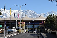
Himachal has three domestic airports in Kangra, Kullu and Shimla districts, respectively.[89] The air routes connect the state with New Delhi and Chandigarh.
- Kullu–Manali Airport is in Kullu district, around 10 kilometres (6 mi) from district headquarters Kullu.
- Kangra Airport is in Kangra district, around 15 kilometres (9 mi) from district headquarters at Dharamshala, which is around 10 kilometres from Kangra
- Shimla Airport is around 22 kilometres (14 mi) west of the Shimla city.
Railways edit


Broad-gauge lines edit
The only broad-gauge railway line in the whole state connects Amb Andaura–Una Himachal railway station to Nangal Dam in Punjab and runs all the way to Daulatpur, Himachal Pradesh.[90] It is an electrified track since 1999. While a tiny portion of line adjacent to Kandrori(KNDI) station on either side on Pathankot-Jalandhar Section, under Ferozepur Division of Northern Railway also crosses into Himachal Pradesh, before venturing out to Punjab again.
Future constructions:
- Una Himachal–Hamirpur rail project via Dhundla
- Bhanupali (Punjab)–Bilaspur, Himachal Pradesh
- Chandigarh–Baddi
Narrow-gauge lines edit
Himachal is known for its narrow-gauge railways. One is the Kalka-Shimla Railway, a UNESCO World Heritage Site, and another is the Kangra Valley Railway.[91] The total length of these two tracks is 259 kilometres (161 mi). The Kalka-Shimla Railway passes through many tunnels and bridges, while the Pathankot–Jogindernagar one meanders through a maze of hills and valleys. The total route length of the operational railway network in the state is 296.26 kilometres (184.09 mi).[92][93][94]
Roads edit
Roads are the major mode of transport in Himachal Pradesh due to its hilly terrain. The state has road network of 28,208 kilometres (17,528 mi),[95] including eight National Highways (NH) that constitute 1,234 kilometres (767 mi) and 19 State Highways with a total length of 1,625 kilometres (1,010 mi).[95] Hamirpur district has the highest road density in the country.[96] Some roads are closed during winter and monsoon seasons due to snow and landslides. The state-owned Himachal Road Transport Corporation with a fleet of over 3,100,[97] operates bus services connecting important cities and towns with villages within the state and also on various interstate routes. In addition, around 5,000 private buses ply in the state.[98]
Demographics edit
Population edit
| Year | Pop. | ±% |
|---|---|---|
| 1901 | 1,920,294 | — |
| 1911 | 1,896,944 | −1.2% |
| 1921 | 1,928,206 | +1.6% |
| 1931 | 2,029,113 | +5.2% |
| 1941 | 2,263,245 | +11.5% |
| 1951 | 2,385,981 | +5.4% |
| 1961 | 2,812,463 | +17.9% |
| 1971 | 3,460,434 | +23.0% |
| 1981 | 4,280,818 | +23.7% |
| 1991 | 5,170,877 | +20.8% |
| 2001 | 6,077,900 | +17.5% |
| 2011 | 6,864,602 | +12.9% |
| Source:[99] | ||
Himachal Pradesh has a total population of 6,864,602 including 3,481,873 males and 3,382,729 females according to the Census of India 2011. It has only 0.57 per cent of India's total population, recording a growth of 12.81 per cent.[5][100] The child sex ratio increased from 896 in 2001 to 909 in 2011.[101] The total fertility rate (TFR) per woman in 2015 stood at 1.7, one of the lowest in India.[102]
The scheduled castes and scheduled tribes account for 25.19 per cent and 5.71 per cent of the population, respectively.[103] The sex ratio stood at 972 females per 1,000 males, recording a marginal increase from 968 in 2001.[101] The main caste groups in Himachal Pradesh are Brahmins, Rajputs, Kanets, Kulindas, Girths, Raos, Rathis, Kolis, Hollis, Chamars, Drains, Rehars, Chanals, Lohars, Baris, Julahas, Dhakhis, Turis, Batwals[104]The Koli forms the largest caste-cluster, comprising 30% of the total population of Himachal Pradesh.[105]
| Year | % |
|---|---|
| 1971 | 31.96 |
| 1981 | 42.48 |
| 1991 | 63.86 |
| 2001 | 76.48 |
| 2011 | 83.78 |
In the census, the state is placed 21st on the population chart, followed by Tripura at 22nd place.[106] Kangra District was top-ranked with a population strength of 1,507,223 (21.98%), Mandi District 999,518 (14.58%), Shimla District 813,384 (11.86%), Solan District 576,670 (8.41%), Sirmaur District 530,164 (7.73%), Una District 521,057 (7.60%), Chamba District 518,844 (7.57%), Hamirpur district 454,293 (6.63%), Kullu District 437,474 (6.38%), Bilaspur district 382,056 (5.57%), Kinnaur District 84,298 (1.23%) and Lahaul Spiti 31,528 (0.46%).[107]
The life expectancy at birth in Himachal Pradesh increased significantly from 52.6 years in the period from 1970 to 1975 (above the national average of 49.7 years) to 72.0 years for the period 2011–15 (above the national average of 68.3 years).[108] The infant mortality rate stood at 40 in 2010, and the crude birth rate has declined from 37.3 in 1971 to 16.9 in 2010, below the national average of 26.5 in 1998. The crude death rate was 6.9 in 2010.[109] Himachal Pradesh's literacy rate has almost doubled between 1981 and 2011 (see table to right). The state is one of the most literate states of India with a literacy rate of 83.78% as of 2011.[7]: 114
Languages edit
Hindi is the de jure official language of Himachal Pradesh and is spoken by the majority of the population as a lingua franca.[110] Sanskrit is the additional official language of the state.[111] Although mostly encountered in academic and symbolic contexts, the government of Himachal Pradesh is encouraging its wider study and use.[112]
Most of the population, however, speaks natively one or another of the Western Pahari languages (locally also known as Himachali or just Pahari), a subgroup of the Indo-Aryan languages that includes Bhattiyali, Bilaspuri, Chambeali, Churahi, Gaddi, Hinduri, Kangri, Kullu, Mahasu Pahari, Mandeali, Pahari Kinnauri, Pangwali, and Sirmauri. Additional Indo-Aryan languages spoken include Punjabi (native to 4.4% of the population), Nepali (1.3%), Chinali, Lahul Lohar, and others. In parts of the state there are speakers of Tibeto-Burman languages like Kinnauri (1.2%), Tibetan (0.3%), Lahuli–Spiti languages (0.16%), Pattani (0.12%), Bhoti Kinnauri, Chitkuli Kinnauri, Bunan (or Gahri), Jangshung, Kanashi, Shumcho, Spiti Bhoti, Sunam, Tinani, and Tukpa.[113][114]
Religion edit
Hinduism is the major religion in Himachal Pradesh. More than 95% of the total population adheres to the Hindu faith and majorly follows Shaivism and Shaktism traditions,[116] the distribution of which is evenly spread throughout the state.[117] Himachal Pradesh has the highest proportion of Hindu population among all the states and union territories in India.[118]
Other religions that form a smaller percentage are Islam, Sikhism and Buddhism. Muslims are mainly concentrated in Sirmaur, Chamba, Una and Solan districts where they form 4.2-5.7% of the population.[117] Sikhs mostly live in towns and cities and constitute 1.16% of the state population. The Buddhists, who constitute 1.15%, are mainly natives and tribals from Lahaul and Spiti, where they form a majority of 62%, and Kinnaur, where they form 21.5%.[117]
Culture edit
Himachal Pradesh was one of the few states that had remained largely untouched by external customs, largely due to its difficult terrain. With remarkable economic and social advancements, the state has changed rapidly.[119] Himachal Pradesh is a multilingual state like other Indian states. Western Pahari languages also known as Himachali languages are widely spoken in the state. Some of the most commonly spoken Pahadi lects are Kangri, Mandyali, Kulvi, Chambeali, Bharmauri and Kinnauri.[120]

Himachal is well known for its handicrafts. The carpets, leather works, Kullu shawls, Kangra paintings, Chamba Rumals, stoles, embroidered grass footwear (Pullan chappal), silver jewellery, metal ware, knitted woolen socks, Pattoo, basketry of cane and bamboo (Wicker and Rattan) and woodwork are among the notable ones.[121][122][123] Of late, the demand for these handicrafts has increased within and outside the country.[122]
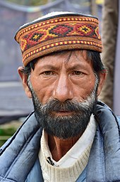
Himachali caps of various colour bands are also well-known local art work, and are often treated as a symbol of the Himachali identity.[124] The colour of the Himachali caps has been an indicator of political loyalties in the hill state for a long period of time with Congress party leaders like Virbhadra Singh donning caps with green band and the rival BJP leader Prem Kumar Dhumal wearing a cap with maroon band.[125][126] The former has served six terms as the Chief Minister of the state while the latter is a two-time Chief Minister.[127] Local music and dance also reflect the cultural identity of the state. Through their dance and music, the Himachali people entreat their gods during local festivals and other special occasions.[128]

There are national and regional fairs and festivals, including temple fairs in nearly every region.[128][129] The Kullu Dussehra, Minjar mela and Mahashivratri Mandi festival is nationally known.[130] The day-to-day cuisine of Himachalis is similar to the rest of northern India with Punjabi and Tibetan influences.[131] Lentils (Dāl), rice (chāwal or bhāț), vegetables (sabzī) and chapati (wheat flatbread) form the staple food of the local population.[131] Non-vegetarian food is more widely accepted in Himachal Pradesh than elsewhere in India, partly due to the scarcity of fresh vegetables on the hilly terrain of the state.[132]
Himachali specialities include Siddu, Babru, Khatta, Mhanee, Channa Madra, Patrode, Mah ki dal, Chamba-style fried fish, Kullu trout, Chha Gosht, Pahadi Chicken, Sepu Badi, Auriya Kaddu, Aloo palda, Pateer, Makki di roti, Sarson ka saag, Chamba Chukh (Chouck), Bhagjery, Chutney of Til, etc.
Notable people edit
Education edit
At the time of Independence, Himachal Pradesh had a literacy rate of 8% – one of the lowest in the country.[133] By 2011, the literacy rate surged to 82.8%,[5][134] making Himachal one of the most-literate states in the country. There are over 10,000 primary schools, 1,000 secondary schools and more than 1,300 high schools in the state.[135] In meeting the constitutional obligation to make primary education compulsory, Himachal became the first state in India to make elementary education accessible to every child.[136] Himachal Pradesh is an exception to the nationwide gender bias in education levels.[137] The state has a female literacy rate of around 76%.[138] In addition, school enrolment and participation rates for girls are almost universal at the primary level. While higher levels of education do reflect a gender-based disparity, Himachal is still significantly ahead of other states at bridging the gap.[139] The Hamirpur District in particular stands out for high literacy rates across all metrics of measurement.[140]
The state government has played an instrumental role in the rise of literacy in the state by spending a significant proportion of the state's GDP on education. During the first six five-year plans, most of the development expenditure in the education sector was utilised in quantitative expansion, but after the seventh five-year-plan the state government switched emphasis on qualitative improvement and modernisation of education.[133] To raise the number of the teaching staff at primary schools they appointed over 1000 teacher aids through the Vidya Upasak Yojna in 2001.[133] The Sarva Shiksha Abhiyan is another HP government initiative that not only aims for universal elementary education but also encourages communities to engage in the management of schools.[141] The Rashtriya Madhayamic Shiksha Abhiyan launched in 2009, is a similar scheme but focuses on improving access to quality secondary education.[141]

The standard of education in the state has reached a considerably high level as compared to other states in India[140] with several reputed educational institutes for higher studies. The Baddi University of Emerging Sciences and Technologies, Indian Institute of Technology Mandi, Indian Institute of Management Sirmaur, Himachal Pradesh University in Shimla, Central University of Himachal Pradesh, Dharamsala, National Institute of Technology, Hamirpur, Indian Institute of Information Technology Una, Alakh Prakash Goyal University, Maharaja Agrasen University, Himachal Pradesh National Law University are some of the notable universities in the state. Indira Gandhi Medical College and Hospital in Shimla, Dr. Rajendra Prasad Government Medical College in Kangra, Rajiv Gandhi Government Post Graduate Ayurvedic College in Paprola and Homoeopathic Medical College & Hospital in Kumarhatti are the prominent medical institutes in the state. Besides these, there is a Government Dental College in Shimla which is the state's first recognised dental institute.[142]
The state government has also decided to start three major nursing colleges to develop the healthcare system of the state.[143] CSK Himachal Pradesh Krishi Vishwavidyalya Palampur is one of the most renowned hill agriculture institutes in the world. Dr. Yashwant Singh Parmar University of Horticulture and Forestry has earned a unique distinction in India for imparting teaching, research and extension education in horticulture, forestry and allied disciplines. Further, state-run Jawaharlal Nehru Government Engineering College was inaugurated in 2006 at Sundernagar.[143] Himachal Pradesh also hosts a campus of the fashion college, National Institute of Fashion Technology (NIFT) in Kangra.
State profile edit
Source: Department of Information and Public Relations.[144]
| Area | 55,673 km2 |
| Total population | 7,781,244 |
| Males | 3,946,646 |
| Females | 3,834,598 |
| Population density | 123 |
| Sex ratio | 972[106] |
| Rural population | 6,176,050[101] |
| Urban population | 688,552[101] |
| Scheduled Caste population | 1,729,252 |
| Scheduled Tribe population | 392,126 |
| Literacy rate | 83.78%[101] |
| Male literacy | 90.83%[101] |
| Female literacy | 76.60%[101] |
| Capitals | 2 |
| Districts | 12 |
| Sub-divisions | 71 |
| Tehsils | 169 |
| Sub-tehsils | 38 |
| Developmental blocks | 78 |
| Towns | 59 |
| Panchayats | 3,243 |
| Panchayat smities | 77 |
| Zila parishad | 12 |
| Urban local bodies | 59 |
| Nagar nigams | 2 |
| Nagar parishads | 25 |
| Nagar panchayats | 23 |
| Census villages | 20,690 |
| Inhabited villages | 17,882 |
| Health institutions | 3,866 |
| Educational institutions | 17,000 |
| Motorable roads | 33,722 km |
| National highways | 8 |
| Identified hydroelectric potential | 23,000.43 MW in five rivers basins, i.e., Yamuna, Satluj, Beas, Ravi, Chenab and Himurja |
| Potential harnessed | 10,264 MW[50] |
| Food grain production | 15.28lakh MT |
| Vegetable production | 18.67 lakh MT |
| Fruit production | 1,027,000 tonnes |
| Per capita income | ₹2,01,854 (2021–22)[52] |
| Social Security pensions | 237,250 persons, annual expenditure: over ₹ 600 million |
| Investment in industrial areas | ₹ 273.80 billion, employment opportunities: Over 337,391 |
| Employment generated in government sector | 2,17,142 |
See also edit
References edit
- ^ "New Himachal governor Rajendra Arlekar is 1st Goan to occupy the post | Latest News India - Hindustan Times". 6 July 2021. Archived from the original on 11 December 2022. Retrieved 4 May 2023.
- ^ "Himachal Pradesh Vidhan Sabha". Hpvidhansabha.nic.in. 18 April 2011. Archived from the original on 20 July 2011. Retrieved 15 June 2011.
- ^ a b Statistical Facts about India, indianmirror.com, archived from the original on 26 October 2006, retrieved 26 October 2006
- ^ "Mountaineering & Rock Climbing - Himachal Tourism Official Website". Archived from the original on 25 April 2023. Retrieved 4 May 2023.
- ^ a b c "Himachal Pradesh Profile" (PDF). Census of India. Archived (PDF) from the original on 27 March 2016. Retrieved 27 May 2016.
- ^ "Sub-national HDI – Area Database". Global Data Lab. Institute for Management Research, Radboud University. Archived from the original on 23 September 2018. Retrieved 25 September 2018.
- ^ a b c Office of the Registrar General & Census Commissioner, India, Ministry of Home Affairs, "6. State of Literacy" (PDF), 2011 Census of India - Results, Government of India, archived (PDF) from the original on 6 July 2015, retrieved 13 February 2022,
[Statement 22(a)] Effective literacy rates – persons: 74.04%; males: 82.14%; females: 65.46%
- ^ ICAR-National Bureau of Fish Genetic Resources (ICAR-NBFGR), State Fishes of India (PDF), Lucknow, Uttar Pradesh: Indian Council of Agricultural Research (ICAR), archived (PDF) from the original on 14 June 2021, retrieved 1 June 2021
- ^ "Story of Himachal Pradesh". indiatoday.in. Archived from the original on 6 June 2021. Retrieved 6 June 2021.
- ^ "Himachal Pradesh known as 'Dev Bhoomi' or 'Land of Gods and Goddess'". Sankrit Magazine. 8 August 2014. Archived from the original on 18 August 2021. Retrieved 25 August 2021.
- ^ "Anurag Thakur pays tribute at Shaheed Sthal in Bilaspur, says Himachal Pradesh also known as 'Veerbhoomi'". ANI. 20 August 2021. Archived from the original on 25 August 2021. Retrieved 25 August 2021.
- ^ "Prehistory and Protohistory". Official Website of Panchayati Raj Department, Government of Himachal Pradesh. Archived from the original on 30 August 2018. Retrieved 29 December 2018.
- ^ Ashwani Sharma (28 October 2016). "Himachal becomes India's second 'Open Defecation Free' state, to get Rs 9,000 cr funding from World Bank". The Indian Express. Shimla. Archived from the original on 29 December 2018. Retrieved 29 December 2018.
- ^ "HP least corrupt state: CMS-India study". The Times of India. 30 April 2017. Archived from the original on 9 February 2018. Retrieved 7 February 2018.
- ^ "Corruption on decline in India; Karnataka ranked most corrupt, Himachal Pradesh least: Survey". Zee News. 28 March 2017. Archived from the original on 8 February 2018. Retrieved 7 February 2018.
- ^ "Himachal Pradesh turns 45 today: Some interesting facts about the state". India Today. 25 January 2016. Archived from the original on 27 September 2023. Retrieved 3 November 2023.
- ^ "हिमाचल प्रदेश का नामकरण और आचार्य दिवाकर दत्त शर्मा". Himalayilog.com. 11 April 2022. Archived from the original on 5 October 2023. Retrieved 3 November 2023.
- ^ Bhatt, SC; Bhargava, Gopal (2006). Land and People of Indian States and Union Territories Vol. X. Kalpaz publications. p. 2. ISBN 81-7835-366-0.
- ^ a b c d e f g h i j k l m n o p "History of Himachal Pradesh". National informatics center, Himachal Pradesh. Archived from the original on 21 November 2006. Retrieved 31 March 2008.
- ^ Verma 1995, pp. 28–35, Historical Perspective.
- ^ a b Verma 1995, pp. 239–254, Territorial Gains.
- ^ "Mountaineering & Rock Climbing". Himachal tourism. Archived from the original on 9 June 2021. Retrieved 9 June 2021.
- ^ a b "Rivers in Himachal Pradesh". Suni Systems (P). Archived from the original on 15 November 2005. Retrieved 28 April 2006.
- ^ "Climate of Himachal Pradesh". himachalpradesh.us. Archived from the original on 17 November 2006. Retrieved 26 October 2006.
- ^ PTI (2 July 2013). "Himachal Pradesh declared first smoke-free state in country". NDTV. Archived from the original on 3 March 2022. Retrieved 3 March 2022.
- ^ Aldam, C (10 October 2002). "Endangered medicinal plant species in Himachal Pradesh". Current Science Association. 83: 797.
- ^ Himachal Pradesh Forest Department. "The Forests". National Informatics Center, Himachal Pradesh. Archived from the original on 10 May 2013. Retrieved 3 April 2008.
- ^ Kala, C.P. (2002) Medicinal Plants of Indian Trans-Himalaya: Focus on Tibetan Use of Medicinal Resources. Bishen Singh Mahendra Pal Singh, Dehradun, India. 200 pp.
- ^ Kala, C.P. (2000) Status and conservation of rare and endangered medicinal plants in the Indian trans-Himalaya. Biological Conservation, 93 (3): 371–379.
- ^ Kala, C.P. (2005) Health traditions of Buddhist community and role of amchis in trans-Himalayan region of India. Current Science, 89 (8): 1331–1338.
- ^ Anand Bodh (10 August 2017). "Himachal initiates rs 1134 crore horticultural developmental project". The Times of India. Shimla. TNN. Archived from the original on 16 October 2018. Retrieved 16 April 2018.
- ^ "In Himachal Pradesh Striking gold with marigold". The Indian Express. 2 July 2004. Archived from the original on 26 January 2013. Retrieved 15 June 2011.
- ^ "About HPMC". HPMC. Archived from the original on 17 February 2018. Retrieved 16 April 2018.
- ^ Goutam Pal; Dipak K S. "Wild Life: Himachal Pradesh Forest Department". Archived from the original on 18 May 2015. Retrieved 10 May 2015.
- ^ a b "Wildlife in Himachal Pradesh". Tour my India. Archived from the original on 13 October 2016. Retrieved 19 July 2016.
- ^ "Beauty of Himachal Pradesh". Sulekha Holidays. Archived from the original on 13 October 2016. Retrieved 19 July 2016.
- ^ "Folk Songs of Himachal Pradesh". Top Lyrics Site. Archived from the original on 13 October 2016. Retrieved 19 July 2016.
- ^ a b "Protected Area Network". Himachal Pradesh Forest Department. Archived from the original on 19 August 2016. Retrieved 19 July 2016.
- ^ "Western tragopan is state bird". Tribune. 17 October 2016. Archived from the original on 1 August 2020. Retrieved 22 December 2020.
- ^ "Himachal to have new State Animal, Bird and Flower – Hill Post". hillpost.in. 10 August 2007. Archived from the original on 28 January 2021. Retrieved 22 December 2020.
- ^ "Himachal Pradesh (gov) Introduction". National informatics center. Computer Centre, Lok Sabha Secretariat. Archived from the original on 27 September 2007. Retrieved 3 May 2007.
- ^ "Legislative Assembly". Legislative Bodies in India. National Informatics Centre. Archived from the original on 18 October 2006. Retrieved 28 October 2006.
- ^ a b "Himachal Pradesh at a Glance". Official Website of Himachal Pradesh. Archived from the original on 8 June 2016. Retrieved 4 July 2016.
- ^ "DIVISIONAL COMMISSIONER, Kangra Division, Dharamshala". Archived from the original on 15 July 2016. Retrieved 4 July 2016.
- ^ "State of Himachal Pradesh at a Glance" (PDF). Department of Land Records, Government of Himachal Pradesh. Archived from the original (PDF) on 9 January 2017. Retrieved 4 July 2016.
- ^ "H.P. At A Glance". Information and Public Relations, Government of Himachal Pradesh. Archived from the original on 18 April 2018. Retrieved 17 April 2018.
- ^ "At a Glance". Government of Himachal Pradesh, india. 16 November 2019. Archived from the original on 5 May 2019. Retrieved 16 November 2019.
- ^ "Brief History of Himachal Pradesh Police" (PDF). p. 4. Archived (PDF) from the original on 16 October 2021. Retrieved 16 October 2021.
Today there are 138 Police Stations in the State..
- ^ a b "MAP (Parliamentary & Assembly Constituencies of HP)". Chief Electoral Officer, Himachal Pradesh. Archived from the original on 18 April 2018. Retrieved 17 April 2018.
- ^ a b c d "Economic Survey projects Himachal Pradesh's growth rate at 7.7%". The Times of India. Archived from the original on 29 April 2016. Retrieved 2 September 2016.
- ^ a b c "Growth rate for Himachal Pradesh estimated at 6.8%". The Times of India. 11 March 2017. Archived from the original on 15 July 2018. Retrieved 7 February 2018.
- ^ a b c "Final English Budget Speech for 2018–19" (PDF). Finance Department, Government of Himachal Pradesh. p. 7. Archived from the original (PDF) on 16 April 2018. Retrieved 16 April 2018.
- ^ "An Overview of Planning in Himachal Pradesh" (PDF). Planning Department, Himachal Pradesh. pp. 31–40. Archived (PDF) from the original on 1 May 2015. Retrieved 16 April 2018.
- ^ a b c "Himachal Pradesh: A Profile, Economic Development" (PDF). Planning Commission (India). p. 14. Archived (PDF) from the original on 26 October 2017. Retrieved 16 April 2018.
- ^ "Current GDP". H. K. Dua, The Tribune House. Archived from the original on 13 June 2007. Retrieved 23 May 2007.
- ^ "MOSPI Gross State Domestic Product". Ministry of Statistics and Programme Implementation. 3 August 2018. Archived from the original on 18 August 2018. Retrieved 29 December 2018.
- ^ Kundu, Tadit (17 December 2015). "Why Kerala is like Maldives and Uttar Pradesh, Pakistan". Live Mint. Archived from the original on 10 May 2017. Retrieved 2 May 2017.
- ^ Sudarshan.M, Ratna (January 2011). "India's National Rural Employment Guarantee Act: women's participation and impacts in Himachal Pradesh, Kerala and Rajasthan". Center for Social Protection Report. 6.
- ^ a b "Economic Survey: 2016–17" (PDF). Official Website of Irrigation and Public Health Department, Himachal Pradesh. Archived from the original (PDF) on 19 February 2018. Retrieved 16 April 2018.
- ^ a b Sharma, H. R. (2011). "Crop Diversification in Himachal Pradesh: Patterns, Determinants and Challenges" (PDF). Indian Journal of Agricultural Economics. 66 (1): 97–114.
- ^ "State specific files, Chapter 57: Himachal Pradesh". Indian Council of Agricultural Research. Archived from the original on 1 April 2018. Retrieved 16 April 2018.
- ^ Pinto, Aditi (13 May 2019). "Irrigation in Kangra valley: no longer kuhl". People's Archive of Rural India. Archived from the original on 28 April 2023. Retrieved 4 May 2023.
- ^ "HP 'Kulhs' bear the brunt of small hydro projects". The Statesman. 7 May 2018. Archived from the original on 27 July 2020. Retrieved 27 July 2020.
- ^ "$37 Million Additional Financing for Himachal Pradesh Mid Himalayan Watershed Development Project, India – 18000 Farmer Households to Benefit". Worldbank.org. 27 September 2012. Archived from the original on 11 November 2012. Retrieved 7 February 2014.
- ^ a b Kanwar Yogendra (3 August 2015). "Apple season begins in Himachal Pradesh". The Hindu. Archived from the original on 27 November 2016. Retrieved 1 June 2016.
- ^ "APPLE". National Horticulture Board. Archived from the original on 5 November 2015. Retrieved 1 June 2016.
- ^ a b "Himachal Pradesh headed for good Apple crop this year". Business Today. 19 October 2015. Archived from the original on 29 June 2016. Retrieved 1 June 2016.
- ^ "Production of Apple Increases by About 36% in 2015–16". Press Information Bureau. 29 July 2016. Archived from the original on 24 April 2018. Retrieved 23 April 2018.
- ^ "Tea, the Kangra way". The Hindu. 17 June 2014. ISSN 0971-751X. Archived from the original on 15 April 2022. Retrieved 4 May 2023.
- ^ "Plantations in Himachal Pradesh's Palampur: A tea that's not on the menu of any political party". Indian Express. 18 May 2019. Archived from the original on 28 September 2022. Retrieved 4 May 2023.
- ^ Bisht, Gaurav (22 November 2023). "Drug regulator flags quality issues, shoots off notices to 19 firms in HP". hindustan Times. Archived from the original on 30 January 2024. Retrieved 30 January 2024.
- ^ Sharma, Ambika (18 January 2024). "Solan: Pharma hub without State Drugs Controller since Jan 1". The Tribune. Archived from the original on 30 January 2024. Retrieved 30 January 2024.
- ^ "Independence Day-2013 Speech by Virbhadra Singh". shimlatimes.in. Archived from the original on 21 February 2014. Retrieved 18 August 2013.
- ^ a b "While others sweat, Himachal struggles to sell its surplus power". Hindustan Times. 5 August 2013. Archived from the original on 15 August 2016. Retrieved 31 May 2016.
- ^ a b Aggarwal, R.K.; Chandel, S.S. (1 May 2010). "Emerging energy scenario in Western Himalayan state of Himachal Pradesh". Energy Policy. 38 (5): 2545–2551. doi:10.1016/j.enpol.2010.01.002. ISSN 0301-4215.
- ^ a b "Himachal's mega 100 Mw hydro power project to be commissioned this month". The Economic Times. Shimla. IANS. 9 May 2017. Archived from the original on 27 April 2018. Retrieved 26 April 2018.
- ^ "Himachal Pradesh Tourism". India Tourism. Archived from the original on 3 May 2015. Retrieved 1 June 2016.
- ^ "Temples of Himachal Pradesh". Maps of India. Archived from the original on 7 August 2016. Retrieved 1 June 2016.
- ^ Gopal Puri (20 August 2017). "Historic pilgrimage trek to Himalayas concludes, five dead". The Times of India. Dharamshala. TNN. Archived from the original on 26 June 2018. Retrieved 7 May 2018.
- ^ "Himachal Pradesh: Dev Bhoomi, The Land of Gods". Sanskriti Magazine. 8 August 2014. Archived from the original on 23 June 2016. Retrieved 1 June 2016.
- ^ "Adventure Destinations". Department of Tourism and Civil Aviation, Government of Himachal Pradesh. Archived from the original on 18 April 2018. Retrieved 17 April 2018.
- ^ "Ice-skating rink completes 100 sessions again". The Tribune, Chandigarh, India. Archived from the original on 16 January 2002. Retrieved 11 February 2001.
- ^ "Top 15 Places To Visit in Himachal Pradesh". Tourpacx Dot Com. Archived from the original on 2 January 2020. Retrieved 12 January 2020.
- ^ a b "Paragliding World Cup 2015 will be held in India: All you need to know". India Today. 10 September 2015. Archived from the original on 7 August 2016. Retrieved 31 May 2016.
- ^ "India hosts the first ever Paragliding World Cup". Red Bull. 4 November 2015. Archived from the original on 13 May 2016. Retrieved 31 May 2016.
- ^ him_admin. "Himachal Tourism Official Website". Himachal Tourism Official Website. Archived from the original on 1 November 2019. Retrieved 16 October 2022.
- ^ Sengar, Resham. "At Bijli Mahadev temple in Himachal, lightning strikes the Shiva lingam every year". The Times of India. Archived from the original on 16 October 2022. Retrieved 16 October 2022.
- ^ "Narkanda: The gateway to apple country". Hindustan Times. 26 November 2014. Archived from the original on 16 October 2022. Retrieved 16 October 2022.
- ^ Lalit Mohan (1 April 2018). "Airfares to Dharamsala skyrocket this weekend". The Tribune. Dharamshala. Archived from the original on 17 April 2018. Retrieved 16 April 2018.
- ^ TNN (27 September 2017). "Complete Una-Hamirpur rail line survey within 6 months: Anurag". The Times of India. Shimla. Archived from the original on 14 June 2018. Retrieved 16 April 2018.
- ^ Mail Today (3 May 2016). "Kangra's narrow-gauge rail corridor is all set to get heritage status". India Today. Archived from the original on 16 April 2018. Retrieved 15 April 2018.
- ^ "Statewise Length of Railway Lines and Survey For New Railway Lines". Press Information Bureau, Ministry of Railways (India), Government of India. 7 December 2016. Archived from the original on 5 January 2018. Retrieved 16 April 2018.
- ^ "Work on Chandigarh–Baddi railway line to start soon". The Statesman. Shimla. Statesman News Service. 11 March 2018. Archived from the original on 29 April 2018. Retrieved 28 April 2018.
- ^ Siddharatha Tiwari (5 September 2016). "With eye on China, India begins work on Himachal-Ladakh rail link". India Today. New Delhi. Archived from the original on 21 September 2018. Retrieved 16 April 2018.
- ^ a b "Himachal Pradesh: Infrastructure". Public Private Partnerships in India. Ministry of Finance, Government of India. Archived from the original on 7 February 2010. Retrieved 6 April 2008.
- ^ "Hamirpur road density". Hari Jaisingh, Published from The Tribune House. Archived from the original on 8 April 2011. Retrieved 22 May 2007.
- ^ "White Paper on purchase of fleet of buses". The Tribune (Chandigarh). Shimla. Tribune News Service. 13 March 2018. Archived from the original on 26 April 2018. Retrieved 25 April 2018.
- ^ "Himachal private bus operators seek hike in fare". Business Standard. Shimla. IANS. 3 September 2013. Archived from the original on 26 April 2018. Retrieved 25 April 2018.
- ^ Office of the Registrar General & Census Commissioner, India, Ministry of Home Affairs, "A-2 Decadal Variation In Population Since 1901", 2011 Census of India, Government of India, archived from the original on 10 October 2021, retrieved 13 February 2022
- ^ "Census 2011:Population size and Decadal change" (PDF). Census of India. Archived (PDF) from the original on 24 June 2016. Retrieved 27 May 2016.
- ^ a b c d e f g Office of the Registrar General & Census Commissioner, India, Ministry of Home Affairs, "Himachal Pradesh Profile" (PDF), Census of India, Government of India, archived (PDF) from the original on 24 January 2022, retrieved 13 February 2022
- ^ "Himachal Pradesh Youth status report: Sex ratio up but total fertility rate declining". The Indian Express. Shimla. Express News Service. 5 January 2018. Archived from the original on 18 April 2018. Retrieved 17 April 2018.
- ^ "Statistical Abstract Of Himachal Pradesh 2015–16: I – Area And Population- Table 1.17 And 1.18, XIII – Education- Table 13.07" (PDF). Official site of Government of Himachal Pradesh. pp. 35, 36, 87, 88. Archived from the original (PDF) on 24 October 2017. Retrieved 23 April 2018.
- ^ Planning Commission, India (2005). Himachal Pradesh, Development Report. Academic Foundation. ISBN 9788171884452.
- ^ Minhas, Poonam (1998). Traditional Trade & Trading Centres in Himachal Pradesh: With Trade-routes and Trading Communities. Indus Publishing. ISBN 978-81-7387-080-4.
- ^ a b "States Census 2011". Census 2011. Archived from the original on 28 November 2018. Retrieved 15 April 2018.
- ^ "Indian Districts by Population, Sex Ratio, Literacy 2011 Census". Census 2011. Archived from the original on 11 April 2018. Retrieved 16 April 2018.
- ^ "ABRIDGED LIFE TABLES- 2011–15" (PDF). Census of India. p. 6. Archived (PDF) from the original on 19 February 2018. Retrieved 16 April 2018.
- ^ "Highlights of Himachal Pradesh HDR (2002)" (PDF). Government of Himachal Pradesh (2002), Himachal Pradesh Human Development Report 2002, Government of Himachal Pradesh. p. 40. Archived from the original (PDF) on 15 June 2007. Retrieved 26 May 2007.
- ^ "Report of the Commissioner for linguistic minorities: 52nd report (July 2014 to June 2015)" (PDF). Commissioner for Linguistic Minorities, Ministry of Minority Affairs, Government of India. pp. 33–34. Archived from the original (PDF) on 28 December 2017. Retrieved 16 February 2016.
- ^ Pratibha Chauhan (17 February 2019). "Bill to make Sanskrit second official language of HP passed". The Tribune. Shimla. Archived from the original on 18 February 2019. Retrieved 18 February 2019.
- ^ ED staff writer (29 April 2020). "Government committed to popularise Sanskrit language in State: Himachal Pradesh CM". India Education Diary. Archived from the original on 14 February 2022. Retrieved 13 February 2022.
- ^ a b C-16 Population By Mother Tongue – Himachal Pradesh (Report). Office of the Registrar General & Census Commissioner, India. Archived from the original on 27 October 2019. Retrieved 6 October 2019. The census returns also include 32% who identify their language as Pahari; this can include speakers of any of the above-listed varieties of Himachali.
- ^ Eberhard, David M.; Simons, Gary F.; Fennig, Charles D., eds. (2019). "India – Languages". Ethnologue (22nd ed.). SIL International. Archived from the original on 1 April 2019. Retrieved 7 October 2019.
- ^ "Population by religion community – 2011". Census of India, 2011. The Registrar General & Census Commissioner, India. Archived from the original on 25 August 2015.
- ^ "Shimla Name Change – The Quint". 30 October 2018. Archived from the original on 14 August 2020. Retrieved 1 August 2020.
- ^ a b c "Himachal Pradesh Districts – Religion 2011". Census2011. Archived from the original on 3 June 2016. Retrieved 31 May 2016.
- ^ "Hindu Religion Census 2011". Census2011. Archived from the original on 8 February 2018. Retrieved 7 February 2018.
- ^ "Himachal Pradesh: Secrets of Success". World Bank. 28 January 2015. Archived from the original on 19 April 2018. Retrieved 18 April 2018.
- ^ "The people and tribes". www.123himachal.com. Archived from the original on 25 July 2011. Retrieved 20 May 2007.
- ^ "Indian Crafts Map: Himachal Pradesh". Crafts Council of India. Archived from the original on 17 April 2018. Retrieved 16 April 2018.
- ^ a b Neetu Sharma; Promila Kanwar; Anju Rekha. "Traditional handicrafts and handloom of Kullu district, Himachal Pradesh" (PDF). NISCAIR Online Periodicals Repository. Archived (PDF) from the original on 10 October 2015. Retrieved 16 April 2018.
- ^ "Himcrafts: H.P State Handicrafts and Handloom Corp. Ltd, Shimla". Himcrafts. Archived from the original on 17 April 2018. Retrieved 16 April 2018.
- ^ Shruti Verma (3 February 2018). "The Himachali cap: Culture, legacy and heritage". Himvani. Archived from the original on 12 March 2018. Retrieved 12 March 2018.
- ^ Archana Phull (14 January 2018). "Cap likely on 'cap politics' in Himachal Pradesh". The Statesman. Archived from the original on 13 March 2018. Retrieved 12 March 2018.
- ^ Gaurav Bisht (6 July 2017). "PM Modi's cap in Israel takes political hue in Himachal". Hindustan Times. Archived from the original on 13 March 2018. Retrieved 12 March 2018.
- ^ PTI (18 December 2017). "Prem Kumar Dhumal, Virbhadra Singh: Tale of two captains, their wins and losses". The Economic Times. Archived from the original on 13 March 2018. Retrieved 12 March 2018.
- ^ a b "Fair Festivals and Events of Himachal Pradesh". Maps of India. Archived from the original on 17 April 2018. Retrieved 16 April 2018.
- ^ "Fairs & Festivals of Himachal". Himachal Tourism. Archived from the original on 17 April 2018. Retrieved 16 April 2018.
- ^ "Kullu Dussehra, Kullu". Himachal Tourism. Archived from the original on 17 April 2018. Retrieved 16 April 2018.
- ^ a b "Himachal Pradesh Food and Cuisine". Maps of India. Archived from the original on 17 April 2018. Retrieved 16 April 2018.
- ^ NDTV Food (10 August 2016). "Himachal Pradesh Food: 10 Best Recipes". NDTV. Archived from the original on 13 March 2018. Retrieved 12 March 2018.
- ^ a b c "Himachal Pradesh Development Report: Chapter 7 Education" (PDF). Planning Commission (India). p. 14. Archived (PDF) from the original on 15 February 2017. Retrieved 26 April 2018.
- ^ "In Himachal, where 90 per cent people live in villages, female literacy rate touches 80 per cent". India Today. 26 May 2013. Archived from the original on 7 August 2016. Retrieved 31 May 2016.
- ^ "Factual source on Education in Himachal". Government of India. Archived from the original on 30 April 2007. Retrieved 16 March 2007.
- ^ Dua, H.K. "Educational updates- Himachal". The Tribune Trust, 2006. The Tribune House. Archived from the original on 9 February 2007. Retrieved 16 March 2007.
- ^ De, Anuradha & Khera, Reetika & Samson, Meera & Shiva Kumar, A. K., 2011. "Probe Revisited: A Report on Elementary Education in India", OUP Catalogue, Oxford University Press, number 9780198071570.
- ^ Government of India. Census of India (2011)
- ^ Dreze, J. (May 1999). "A surprising exception. Himachal's success in promoting female education". Manushi (112): 12–17. ISSN 0257-7305. PMID 12295760.
- ^ a b "Educational Profile of Himachal Pradesh". General Overview of Education in Himachal. Archived from the original on 2 February 2008. Retrieved 16 March 2007.
- ^ a b "Himachal Sarva Shiksha Abhiyan & Rashtriya Madhyamik Shiksha Abhiyan". edumis.hp.gov.in. Archived from the original on 26 April 2018. Retrieved 26 April 2018.
- ^ "IGMC-home". Igmcshimla.org. Archived from the original on 22 February 2014. Retrieved 7 February 2014.
- ^ a b "Educational Profile of Himachal Pradesh". General Overview of Education in Himachal. Archived from the original on 2 February 2008. Retrieved 16 March 2007.
- ^ "Himachal at a Glance". Himachalpr.gov.in. Archived from the original on 16 August 2013. Retrieved 15 June 2011.
Further reading edit
- Ahluwalia, M.S. (1998). Social, Cultural and Economic History of Himachal Pradesh. Indus Publishing. ISBN 81-7387-089-6. Retrieved 31 March 2008.
- Batta, R.N. (2000). Tourism and the Environment: A Quest for Sustainability. Indus Publishing. ISBN 81-7387-110-8. Retrieved 31 March 2008.
- Singh, Mian Govardhan (2000). C.L. Gupta; Kulbhushan Chandel (eds.). Himachal Pradesh: History, Culture & Economy (extensively revised ed.). Shimla.: Minerva Publishers & Distributors.
- Singh, Sarina (2005). India. Lonely Planet. ISBN 1-74059-694-3. Retrieved 31 March 2008.
Himachal History.
- Tiwari, A.K. (2000). Infrastructure and Economic Development in Himachal Pradesh. Indus Publishing. ISBN 81-7387-105-1. Archived from the original on 28 March 2024. Retrieved 31 March 2008.
- Verma, V. (1995). The Emergence of Himachal Pradesh: A Survey of Constitutional Developments. Himachal Pradesh (India): Indus Publishing. ISBN 81-7387-035-7. Archived from the original on 28 March 2024. Retrieved 15 June 2011.
- United Nations Development Programme (UNDP) (2002). Himachal Pradesh Human Development Report 2002. Government of Himachal Pradesh. ISBN 0-19-521915-5. Retrieved 31 March 2008.
- Statistics and Data, Planning Department, Government of Himachal Pradesh Archived 29 August 2019 at the Wayback Machine
External links edit
 Definitions from Wiktionary
 Media from Commons
 News from Wikinews
 Quotations from Wikiquote
 Texts from Wikisource
 Textbooks from Wikibooks
 Resources from Wikiversity
 Travel information from Wikivoyage
- Government
- The official site of Himachal Pradesh
- The official tourism site of Himachal Pradesh, India
- General information
- Himachal Pradesh at the Encyclopædia Britannica
- Himachal Pradesh at Curlie
 Geographic data related to Himachal Pradesh at OpenStreetMap