


Summary
Hoboksar (Chinese: 和布克赛尔蒙古自治县; pinyin: Hébùkèsài'ěr Měnggǔ Zìzhìxiàn), sometimes referred with the historic name Hefeng County (和丰县; Héfēng Xiàn), is an autonomous county for Mongol people in the middle north of Xinjiang Uyghur Autonomous Region, Western China, it is under the administration of Tacheng Prefecture. The county has an area of 28,784 km2 (11,114 sq mi) with a population of 62,100 (as of 2010 Census).[2] It has eight towns and townships and seven farms, Hoboksar Town is its county seat.[3]
Hoboksar County
Qobuqsar, Hefeng | |
|---|---|
Hoboksar Mongol Autonomous County ᠬᠣᠪᠣᠭᠰᠠᠶᠢᠷ ᠮᠣᠩᠭᠣᠯ ᠥᠪᠡᠷᠲᠡᠭᠡᠨ ᠵᠠᠰᠠᠬᠤ ᠰᠢᠶᠠᠨ和布克赛尔蒙古自治县 قوبۇقسار موڭغۇل ئاپتونوم ناھىيىسى قوبىقسارى موڭعۇل اۆتونوميالىق اۋدانى | |
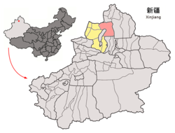 | |
 Hoboksar Location in Xinjiang  Hoboksar Hoboksar (Xinjiang)  Hoboksar Hoboksar (China) | |
| Coordinates: 46°47′N 85°43′E / 46.783°N 85.717°E | |
| Country | China |
| Autonomous region | Xinjiang |
| Prefecture | Tacheng |
| Township-level divisions | 2 towns and 5 townships |
| County seat | Hoboksar Town |
| Area | |
| • Total | 28,784 km2 (11,114 sq mi) |
| Population (2020)[1] | |
| • Total | 61,785 |
| • Density | 2.1/km2 (5.6/sq mi) |
| Time zone | UTC+8 (China Standard[a]) |
| Postal code | 834400 |
| Area code | 0901 |
| Website | www |
| Hoboksar Mongol Autonomous County | |||||||||
|---|---|---|---|---|---|---|---|---|---|
| Chinese name | |||||||||
| Simplified Chinese | 和布克赛尔蒙古自治县 | ||||||||
| Traditional Chinese | 和布克賽爾蒙古自治縣 | ||||||||
| |||||||||
| Alternative Chinese name | |||||||||
| Simplified Chinese | 和丰县 | ||||||||
| Traditional Chinese | 和豐縣 | ||||||||
| |||||||||
| Mongolian name | |||||||||
| Mongolian Cyrillic | Ховогсайр Монгол өөртөө засах шянь | ||||||||
| Mongolian script | ᠬᠣᠪᠣᠭᠰᠠᠶᠢᠷ ᠮᠣᠩᠭᠣᠯ ᠥᠪᠡᠷᠲᠡᠭᠡᠨ ᠵᠠᠰᠠᠬᠤ ᠰᠢᠶᠠᠨ | ||||||||
| |||||||||
| Uyghur name | |||||||||
| Uyghur | قوبۇقسار | ||||||||
| |||||||||
| Kazakh name | |||||||||
| Kazakh | قوبىقسارى موڭعۇل اۆتونوميالىق اۋدانى Qobyqsary Mońǵul avtonomıaly aýdany Қобықсары Моңғұл автономйалы ауданы | ||||||||
| Oirat name | |||||||||
| Oirat | ᡍᡆᡋᡆᡎᠰᠠᡅᠷᡅ ᡏᡆᡊᡎᡆᠯ ᡄᡋᡄᠷᡄᡃᠨ ᠴᠠᠰᠠᡍᡇ ᠱᡅᡕᠠᠨ Qoboγsairi mongγol ebereen zasaqu šiyan | ||||||||
Name edit
The name of Hoboksar (Ховогсайр) was individually referred to as "Hobok" (ховог) and "Sar" (сайр) from the Mongolian language. Hobok is Hobok River, it means "sika deer", the river was named after its river basin within huge amount of sika deer in the past. Sar is the Salair Mountains and it means horseback, the mountain was named after its shape like a horseback.[2]
History edit
At the latest starting from the Qin dynasty, the Saka people appeared in the place of present Hoboksar area. This was followed by the Usans and Xiongnu people.
The place was part of Usan Sate in the Western Han period. It was merged to the Rear Jushi Kingdom (車師後國) in the Eastern Han and Three Kingdoms periods. It was part of Xianbei during the Jin period, part of Rouran Khaganate, followed by the First Turkic Khaganate, Western Turkic Khaganate in the period of Northern and Southern dynasties. It was under the administration of Kunling Protectorate (崑陵都護府) of the Tang dynasty in 657, ruled by Karluks in 789, Uyghur Khaganate in 808, Kyrgyz Khaganate in 840 and Qara Khitai in 1127, it was merged to the Yuan dynasty in 1218, became the dominion of Ögedei Khan in 1225, then after that, the territory of Beshbalik Province (Beiting) and Almaliq Province in 1280, it was merged to Chagatai Khanate during 1324 - 1328.
It was part of Eastern Chagatai Khanate (Beshbalik Khaganate) in 1370, the herd land of the Oirats tribe in the 5th century. After Batur's succession to Khong Tayiji in 1636, he quickly unified the Oirats tribes in the North Xinjiang, with Hoboksar as the base camp. Batur built a castle five kilometers away southeast of the present county seat of Hoboksar Town between 1639 - 1643.[4]
The place of Hoboksar was under jurisdiction of Tarbaghatay Ministerial Attache (塔爾巴哈臺參贊大臣, under leadship of the General of Ili; "Tarbaghatay", the prensent Tacheng Prefecture) in 1758. The Torghut Tribe back far away from the south side of Russian Volga River, immigrated to Hoboksar in 1771.[2]
Hoxtolgay Xianzuo (和什托洛蓋縣佐, similar to a division under vice county magistrate; in the present Hoxtolgay Town) under jurisdiction of Shawan County, was formed in 1915 and it was transferred to Tacheng Circuit (塔城道) in 1916. Hoxtolgay Xianzuo was changed to Hoxtolgay Division (和什托洛蓋設治局) and the Hefeng Division (和豐設治局) was formed in 1941. Hefeng County (和豐縣) was organized in 1944 and its county seat is in the present Hoboksar Town. Hefeng County was renamed to Hoboksar Mongol Autonomous County on September 10, 1954.[5]
Geography edit
Hoboksar County is located south of the Tarbagatai-Saur mountain range and its northern part, where most of the county's population lives, receives some water from streams (such as the Baiyang River) flowing from the snow-capped mountains. The southeastern part of the county is in Gurbantünggüt Desert.
Historically, the large Alan Nur and Manas Lake were located in the desert southwestern part of the county; they received water, at least intermittently, both from the streams flowing across the desert from the north and from the south (via the Manas River). Due to the increasing water diversion for irrigation and other human needs, as well as geological processes, the Alan Nur has fully dried out, and the Manas Lake is in a fairly precarious situation as well.[6]
The Irtysh–Karamay Canal, constructed around the turn of the 21st century, crosses the county's southeastern part; the canal's Fengcheng Reservoir is located on the county's border with Karamay City's Urho District.
A point situated some 30 miles ESE of Hoxtolgay Town is listed as the farthest point from the sea (at 46°16.8′N 86°40.2′E / 46.2800°N 86.6700°E) by the Guinness Book of World Records. It is roughly 2646 kilometres away from the Arctic Ocean and a similar distance from the Bay of Bengal and the Arabian Sea (see Continental Pole of Inaccessibility for other candidates).
The "record-setting" location of the county attracted the attention of advertisers for the Corona beer brand, who staged and documented a trip of a few residents of the village of Bulin (布林), 46°43′13″N 86°7′59″E / 46.72028°N 86.13306°E), in Hoboksar County's Qagankol Township to the sea coast in Hainan Island.[7]
Administrative divisions edit
Hoboksar administered 2 towns, 6 townships.[8]
| Name | Simplified Chinese | Hanyu Pinyin | Mongolian (Traditional) | Mongolian (Cyrillic) | Uyghur (UEY) | Uyghur Latin (ULY) | Kazakh (Arabic script) | Kazakh (Cyrillic script) | Administrative division code |
|---|---|---|---|---|---|---|---|---|---|
| Towns | |||||||||
| Hoboksar Town | 和布克赛尔镇 | Hébùkèsài'ěr Zhèn | ᠬᠣᠪᠣᠭᠰᠠᠶᠢᠷ ᠬᠣᠲᠠ | Хувсайр балгас | قوبۇقسار بازىرى | qobuqsar baziri | قوبىقسارى قالاشىعى | 654226100 | |
| Hoxtolgay Town | 和什托洛盖镇 | Héshítuōluògài Zhèn | ᠬᠣᠣᠰᠲᠣᠯᠣᠭᠠᠢ ᠪᠠᠯᠭᠠᠰᠤᠨ | Хостолгой балгас | قوشتولغاي بازىرى | qoshtolghay baziri | قوستولعاي قالاشىعى | 654226101 | |
| Townships | |||||||||
| Xazgat Township | 夏孜盖乡 | Xiàzīgài Xiāng | ᠱᠠᠭᠠᠵᠠᠭᠠᠢᠲᠤ ᠰᠤᠮᠤᠨ | Шаазгайт суман | شازغەت يېزىسى | shazghet yëzisi | شازعەت اۋىلى | 654226200 | |
| Tebkinusan Township | 铁布肯乌散乡 | Tiěbùkěnwūsàn Xiāng | ᠲᠡᠪᠬᠡᠨ᠋ᠤᠰᠤᠨ ᠰᠤᠮᠤᠨ | Дэвхөнөөсөн суман | تېبكىن ئۇسان يېزىسى | tëbkin Usan yëzisi | تەبىكىنۇسان اۋىلى | 654226201 | |
| Qagankol Township | 查干库勒乡 | Chágànkùlè Xiāng | ᠴᠠᠭᠠᠨ ᠭᠣᠤᠯ ᠰᠤᠮᠤᠨ | Цагаан гол суман | چاغانكۆل يېزىسى | chaghanköl yëzisi | شاعانكول اۋىلى | 654226202 | |
| Bayan Obo Township | 巴音傲瓦乡 | Bāyīn'àowǎ Xiāng | ᠪᠠᠶᠠᠨ᠋ᠣ᠋ᠪᠣᠭᠠ ᠰᠤᠮᠤᠨ | Баянөваа суман | بايىن ئاۋۋا يېزىسى | bayin Awwa yëzisi | بايىنوبا اۋىلى | 654226203 | |
| Motge Township | 莫特格乡 | Mòtègé Xiāng | ᠮᠥᠲᠥᠭᠡᠢ ᠰᠤᠮᠤᠨ | Мөтүгэй суман | مۆتگې يېزىسى | mötgë yëzisi | موتكە اۋىلى | 654226204 | |
| Qaht Township | 查和特乡 | Cháhétè Xiāng | ᠴᠠᠬᠠᠲᠤ ᠰᠤᠮᠤᠨ | Цахад суман | 654226205 | ||||
Others
Climate edit
| Climate data for Hoboksar (1991–2020 normals) | |||||||||||||
|---|---|---|---|---|---|---|---|---|---|---|---|---|---|
| Month | Jan | Feb | Mar | Apr | May | Jun | Jul | Aug | Sep | Oct | Nov | Dec | Year |
| Record high °C (°F) | 6.2 (43.2) |
8.8 (47.8) |
19.7 (67.5) |
28.9 (84.0) |
31.3 (88.3) |
33.9 (93.0) |
36.8 (98.2) |
34.7 (94.5) |
31.7 (89.1) |
26.4 (79.5) |
16.1 (61.0) |
10.8 (51.4) |
36.8 (98.2) |
| Mean daily maximum °C (°F) | −6.7 (19.9) |
−3.4 (25.9) |
3.8 (38.8) |
13.3 (55.9) |
19.4 (66.9) |
24.4 (75.9) |
25.9 (78.6) |
24.6 (76.3) |
18.6 (65.5) |
10.5 (50.9) |
1.1 (34.0) |
−5.1 (22.8) |
10.5 (50.9) |
| Daily mean °C (°F) | −12.8 (9.0) |
−9.5 (14.9) |
−2.3 (27.9) |
6.8 (44.2) |
12.8 (55.0) |
18.1 (64.6) |
19.7 (67.5) |
18.1 (64.6) |
12.1 (53.8) |
4.3 (39.7) |
−4.3 (24.3) |
−10.7 (12.7) |
4.4 (39.9) |
| Mean daily minimum °C (°F) | −16.9 (1.6) |
−14.1 (6.6) |
−7.1 (19.2) |
1.2 (34.2) |
6.8 (44.2) |
12.2 (54.0) |
14.1 (57.4) |
12.3 (54.1) |
6.5 (43.7) |
−0.5 (31.1) |
−8.2 (17.2) |
−14.6 (5.7) |
−0.7 (30.8) |
| Record low °C (°F) | −29.1 (−20.4) |
−28.5 (−19.3) |
−24.1 (−11.4) |
−17.3 (0.9) |
−6.5 (20.3) |
1.4 (34.5) |
5.3 (41.5) |
−0.7 (30.7) |
−7.7 (18.1) |
−16.7 (1.9) |
−31.1 (−24.0) |
−32.0 (−25.6) |
−32.0 (−25.6) |
| Average precipitation mm (inches) | 4.4 (0.17) |
2.9 (0.11) |
6.1 (0.24) |
8.4 (0.33) |
15.8 (0.62) |
24.7 (0.97) |
42.1 (1.66) |
27.8 (1.09) |
11.5 (0.45) |
5.5 (0.22) |
6.2 (0.24) |
4.6 (0.18) |
160 (6.28) |
| Average precipitation days (≥ 0.1 mm) | 5.0 | 4.1 | 4.6 | 5.3 | 7.3 | 10.0 | 12.0 | 9.1 | 5.2 | 3.5 | 5.2 | 5.4 | 76.7 |
| Average snowy days | 8.1 | 7.1 | 7.1 | 2.5 | 0.4 | 0 | 0 | 0 | 0.3 | 2.8 | 7.6 | 9.2 | 45.1 |
| Average relative humidity (%) | 65 | 63 | 57 | 46 | 42 | 45 | 49 | 47 | 47 | 54 | 64 | 67 | 54 |
| Mean monthly sunshine hours | 172.6 | 188.7 | 245.1 | 265.5 | 307.5 | 290.9 | 291.5 | 292.2 | 267.2 | 227.7 | 156.3 | 144.8 | 2,850 |
| Percent possible sunshine | 61 | 63 | 65 | 64 | 65 | 62 | 62 | 68 | 73 | 69 | 57 | 55 | 64 |
| Source: China Meteorological Administration[9][10][11] | |||||||||||||
Demographics edit
The Chinese Mongols that live in Bayingolin and Hoboksar come from varied origins. A majority are Torghuts, who speak the Oirat language. Chahar Mongols who immigrated from Inner Mongolia also live in Hoboksar and Bayingolin, and there are also Uriankhai Mongols, who are considered Mongols in China but Tuvans to some outside observers. A fair number of Daur people and Dongxiang people live in Hoboksar especially and they speak Mongolic languages.[12]
Culture edit
Hoboksar is traditionally considered the place of origin of the Epic of Jangar. The Jangar Culture and Art Palace (江格尔文化艺术宫) was opened in the county in 2014.[13][14]
Transportation edit
China National Highway 217 and the new Kuytun–Beitun Railway both cross Hoboksar county along the same north–south corridor. There is daily passenger service at the Hoxtolgay station.
Notes edit
- ^ Locals in Xinjiang frequently observe UTC+6 (Xinjiang Time), 2 hours behind Beijing.
References edit
- ^ Xinjiang: Prefectures, Cities, Districts and Counties
- ^ a b c 和布克赛尔县历史沿革. xzqh.org. 2014-12-04. Retrieved 2019-08-27.
- ^ 和布克赛尔县概况. xzqh.org. 2014-12-04. Retrieved 2019-08-27.
- ^ Haines, R Spencer (2016). "The Physical Remains of the Zunghar Legacy in Central Eurasia: Some Notes from the Field". Paper Presented at the Social and Environmental Changes on the Mongolian Plateau Workshop, Canberra, ACT, Australia. The Australian National University.
- ^ 和布克赛尔概况. Hoboksar.gov.cn. Retrieved 2019-08-27.
- ^ Yao, Yonghui; Li, Huiguo (2010), "Tectonic geomorphological characteristics for evolution of the Manas Lake", Journal of Arid Land, 2 (3): 167–173, doi:10.3724/SP.J.1227.2010.00167
- ^ Daniel Gilroy, Corona Extra: A Journey From ‘The Pole Of naccessibility’. Here's the campaign's web site: http://www.coronaextra.eu/china/#/
- ^ 2022年统计用区划代码和城乡划分代码:和布克赛尔蒙古自治县. National Bureau of Statistics of China.
- ^ 中国气象数据网 – WeatherBk Data (in Simplified Chinese). China Meteorological Administration. Retrieved 10 October 2023.
- ^ 中国气象数据网 (in Simplified Chinese). China Meteorological Administration. Retrieved 10 October 2023.
- ^ 中国地面国际交换站气候标准值月值数据集(1971-2000年). China Meteorological Administration. Archived from the original on 2013-09-21. Retrieved 2010-05-25.
- ^ Benson, Linda K.; Svanberg, Ingvar (1998). China's Last Nomads: The History and Culture of China's Kazaks. M.E. Sharpe. p. 25.
- ^ Jangar Palace Opens in Xinjiang’s Hoboksar Archived 2014-02-04 at the Wayback Machine
- ^ 世界最大的江格尔文化艺术宫建成投用
External links edit
- County government - official site (in Chinese)