


Summary
Hockley Valley Provincial Nature Reserve is a nature reserve located on the Niagara Escarpment within the township of Mono, Ontario, Canada. It is managed by Ontario Parks. Approximately 80% of the Cannings Falls Area of Natural and Scientific Interest is within the borders of the park; land acquisitions are planned to encompass it entirely.[1][2] The Bruce Trail links the reserve to other protected areas of the Niagara Escarpment.
| Hockley Valley Provincial Nature Reserve | |
|---|---|
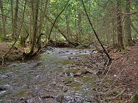 A Nottawasaga River tributary within the reserve. | |
 | |
| Location | Ontario, Canada |
| Nearest city | Mono |
| Coordinates | 43°59′6″N 80°3′44″W / 43.98500°N 80.06222°W |
| Area | 3.78 km2 (1.46 sq mi) |
| Established | 1989 |
| Governing body | Ontario Parks |
| www | |
Landform edit
The topography of the area was greatly influenced by glacial processes, followed by fluvial erosion. The reserve is characterized by a till moraine and other glacial features, such as kames and kettles.[3][4] A deeply cut tributary valley to the Nottawasaga River bisects the reserve through its centre. The Niagara Escarpment's dolomite caprock (the Amabel Formation) can be seen in the upper parts of the gorge; rapids and waterfalls expose stratigraphic succession down to the Queenston Shale.[1]
Flora and fauna edit
Within the reserve, 417 species of vascular plants, many of which are rare, have been identified. This includes the regionally rare cuckoo flower and the sand violet, as well as the nationally endangered butternut, population of which has dwindled due to the butternut canker disease.[2][5] Fauna includes the locally rare northern long-eared bat, the nationally vulnerable Louisiana waterthrush and the northern brook lamprey, as well as the nationally threatened Jefferson salamander.[2]
Activities edit
Recreation in the park is limited. Due to the park's designation as a nature reserve, permitted activities are limited to hiking, and snowshoeing; no visitor facilities are present or planned.[2]
References edit
- ^ a b "Natural Areas Report: CANNINGS FALLS". Ontario Ministry of Natural Resources. 2008-06-27. Archived from the original on 2009-06-08. Retrieved 2009-06-07.
- ^ a b c d "Hockley Valley Park Management Plan" (PDF). Ontario Parks. 2005-01-28. Archived from the original (PDF) on 2011-06-06. Retrieved 2009-06-07.
- ^ Wake, Winifred Cairns; Cartwright, John; Champagne, Anne; Parker, Kathy; Parker, Martin (1997). A Nature Guide to Ontario. University of Toronto Press. ISBN 0-8020-2755-5.
- ^ "Parks in Dufferin County". Niagara Escarpment Commission. 2007-01-03. Archived from the original on 2009-07-01. Retrieved 2009-06-12.
- ^ "Species Profile - Butternut". Species at Risk Public Registry. 2009-05-13. Archived from the original on 2013-06-10. Retrieved 2009-06-13.
External links edit
- Official website
