


Summary
Holland Park West is a suburb in the City of Brisbane, Queensland, Australia.[2] In the 2016 census, Holland Park West had a population of 6,376 people.[1]
| Holland Park West Brisbane, Queensland | |||||||||||||||
|---|---|---|---|---|---|---|---|---|---|---|---|---|---|---|---|
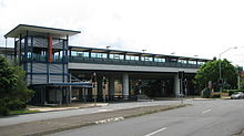
 View along Logan Road at Holland Park West, 2017 | |||||||||||||||
 Holland Park West | |||||||||||||||
| Coordinates | 27°31′24″S 153°03′34″E / 27.5233°S 153.0594°E | ||||||||||||||
| Population | 6,376 (2016 census)[1] | ||||||||||||||
| • Density | 2,280/km2 (5,900/sq mi) | ||||||||||||||
| Postcode(s) | 4121 | ||||||||||||||
| Area | 2.8 km2 (1.1 sq mi) | ||||||||||||||
| Time zone | AEST (UTC+10:00) | ||||||||||||||
| Location | 8.4 km (5 mi) SSE of Brisbane GPO | ||||||||||||||
| LGA(s) | City of Brisbane | ||||||||||||||
| State electorate(s) | Greenslopes | ||||||||||||||
| Federal division(s) | |||||||||||||||
| |||||||||||||||
Geography edit
Holland Park West is located to the south-east of the Brisbane central business district between the Pacific Motorway and Logan Road.
The South East Busway passes through the suburb which is served by the Holland Park West busway station (27°31′43″S 153°03′27″E / 27.5286°S 153.0574°E).[3]
History edit
The suburb takes its name from the adjacent suburb of Holland Park, which in turn takes its name from the subdivision of land owned by Julius Holland.[4]
In May 1914, on what is now known as Holland Park West, 62 subdivided allotments of 'Hill Farm Estate' were auctioned by G.T. Bell and Chandler and Russell. A map advertising the auction states the Estate was 12 minutes' walk from the Logan Road tram.[5][6]
In 1926 the Logan Road tramway was extended to a new terminus at Holland Park.[7] Trams commenced operation on the route on Sunday 1 August 1926.[8]
Holland Park Baptist Church opened on Saturday 15 December 1928 by the President of the Baptist Union, Reverend Alfred George Weller. The new church was 30 by 18 feet (9.1 by 5.5 m) and was an old building that they had acquired and removed from another site and reconstructed at 10 Yuletide Street off Logan Road (27°31′11″S 153°03′39″E / 27.5198°S 153.0609°E).[9][10][11][12] In 1970 a new church building was constructed on the site, with the former church relocated to the rear of the site.[13] The Grace Bible Church which now occupies the site is not affiliated with the Baptist Union.[14]
Marshall Road State School opened on 25 January 1960.[4][15][16]
Holland Park State High School opened on 25 January 1971.[15]
Mount Gravatt West Special School was opened on 28 July 1986. On 1 January 2010, it was renamed Nursery Road State Special School.[4] In 2010, the Xavier Special Education Unit of Whites Hill State College in Camp Hill was transferred to Nursery Road Special School. Originally established in 1970 as the Xavier Special School in Coorparoo, the unit was officially merged into Whites Hill State College in 2002, but was never relocated to the college's site in Camp Hill but remained in Coorparoo until its lease expired in 2009, triggering the move to Mount Gravatt West Special School as being better equipped to accommodate Xavier's conductive education methods for children with multiple impairments.[17][18] As at 2022, Xavier's conductive education methods continue to be an important program at Nursery Road Special School.[19][20]
Demographics edit
In the 2011 census, Holland Park West recorded a population of 5,965 people, 50.2% female and 49.8% male. The median age of the Holland Park West population was 35 years of age, 2 years below the Australian median. 73.2% of people living in Holland Park West were born in Australia, compared to the national average of 69.8%; the next most common countries of birth were England 3.1%, New Zealand 3.1%, India 2.1%, China 0.9%, Philippines 0.8%. 81.3% of people spoke only English at home; the next most common languages were 1.6% Greek, 1% Cantonese, 0.8% Punjabi, 0.7% Spanish, 0.5% Italian.[21]
In the 2016 census, Holland Park West had a population of 6,376 people.[1]
Heritage listings edit
There are a number of heritage-listed sites, including:
- Holland Park Hotel (also known as Mountain View Hotel), 935 Logan Road[22]
- Glindemann Farmhouse (also known as Glindemann's Highfield Dairy), 1118 Logan Road[23]
- former Tram Shelter No. 3 (also known as Bus shelter shed), outside 1167 Logan Road (27°31′42″S 153°04′15″E / 27.5284°S 153.0707°E)[24]
- St Joachim's Catholic Church, 41 Yuletide Street[25]
Education edit

Marshall Road State School is a government primary (Prep–6) school for boys and girls at Kurts Street (27°31′31″S 153°03′30″E / 27.5252°S 153.0584°E).[26][27] In 2018, the school had an enrolment of 492 students with 40 teachers (33 full-time equivalent) and 19 non-teaching staff (14 full-time equivalent).[28] It includes a special education program.[26]
Holland Park State High School is a government secondary (7–12) school for boys and girls at Bapaume Road (27°31′51″S 153°03′34″E / 27.5309°S 153.0594°E).[26][29] In 2018, the school had an enrolment of 607 students with 60 teachers (52 full-time equivalent) and 32 non-teaching staff (18 full-time equivalent).[28] It includes a special education program.[26]
Nursery Road State Special School is a special school primary and secondary (Early Childhood to Year 12) school for boys and girls at 49 Nursery Road (27°32′03″S 153°03′51″E / 27.5341°S 153.0641°E).[26][30] In 2018, the school had an enrolment of 150 students with 53 teachers (46 full-time equivalent) and 76 non-teaching staff (47 full-time equivalent).[28] It provides special education including an early childhood development program.[26]
References edit
- ^ a b c Australian Bureau of Statistics (27 June 2017). "Holland Park West (SSC)". 2016 Census QuickStats. Retrieved 20 October 2018.
- ^ "Holland Park West – suburb in City of Brisbane (entry 47599)". Queensland Place Names. Queensland Government. Retrieved 18 July 2021.
- ^ "Busway stations – Queensland". Queensland Open Data. Queensland Government. 22 October 2020. Archived from the original on 15 November 2020. Retrieved 3 November 2020.
- ^ a b c "Opening and closing dates of Queensland Schools". Queensland Government. Retrieved 18 April 2019.
- ^ "The Hill Farm Estate, Logan Road sale on the ground Saturday 16th May, 1914" (1914) [Map]. Collections. State Library of Queensland.
- ^ "Advertising". The Brisbane Courier. No. 17, 576. Queensland, Australia. 15 May 1914. p. 12. Archived from the original on 25 April 2022. Retrieved 25 February 2019 – via National Library of Australia.
- ^ "A brief history of Brisbane's Tramways". Brisbane Tramway Museum. Archived from the original on 25 July 2019. Retrieved 25 July 2019.
- ^ "NEW TRAM-LINE". Daily Mail. No. 7620. Brisbane. 2 August 1926. p. 6. Archived from the original on 18 December 2021. Retrieved 25 July 2019 – via National Library of Australia.
- ^ "Queensland Baptist churches by date of erection/opening". Baptist Church Archives Queensland. Archived from the original on 26 November 2021. Retrieved 29 November 2021.
- ^ "1928 Holland Park". Baptist Church Archives Queensland. Retrieved 29 November 2021.
- ^ "OPENING CEREMONY". The Brisbane Courier. No. 22, 119. Queensland, Australia. 17 December 1928. p. 3. Archived from the original on 18 December 2021. Retrieved 2 December 2021 – via National Library of Australia.
- ^ "NEW CHURCH". Sunday Mail. No. 290. Queensland, Australia. 16 December 1928. p. 17. Archived from the original on 18 December 2021. Retrieved 2 December 2021 – via National Library of Australia.
- ^ Blake, Thom. "Holland Park Baptist Church". Queensland religious places database. Archived from the original on 2 December 2021. Retrieved 2 December 2021.
- ^ "Grace Bible Church". Churches Australia. Archived from the original on 2 December 2021. Retrieved 2 December 2021.
- ^ a b Queensland schools past and present. Version 1.01. Queensland Family History Society. 2010. ISBN 978-1-921171-26-0.
- ^ "History". Marshall Road State School. 25 March 2019. Archived from the original on 9 March 2021. Retrieved 18 December 2021.
- ^ "Our school". Nursery Road State Special School. 6 November 2019. Archived from the original on 10 March 2021. Retrieved 18 December 2021.
- ^ Welford, Rod (13 January 2009). "Response to "Petition number 1182-08 received by the Queensland Legislative Assembly relating to the relocation of Xavier Special Education Unit to Mount Gravatt West Special School"". Queensland Parliament. Archived from the original on 25 April 2022. Retrieved 25 April 2022.
- ^ "Our school". Nursery Road State Special School. 6 November 2019. Archived from the original on 18 March 2019. Retrieved 25 April 2022.
- ^ "Conductive Education Program" (PDF). Nursery Road State Special School. Archived (PDF) from the original on 25 April 2022. Retrieved 25 April 2022.
- ^ Australian Bureau of Statistics (31 October 2012). "Holland Park West (SSC)". 2011 Census QuickStats. Retrieved 18 December 2021.
- ^ "Holland Park Hotel". Brisbane Heritage Register. Brisbane City Council. Retrieved 9 March 2020.
- ^ "Glindemann Farmhouse". Brisbane Heritage Register. Brisbane City Council. Retrieved 9 March 2020.
- ^ "Tram Shelter No. 3 (former)". Brisbane Heritage Register. Brisbane City Council. Retrieved 9 March 2020.
- ^ "St Joachim's Catholic Church". Brisbane Heritage Register. Brisbane City Council. Retrieved 9 March 2020.
- ^ a b c d e f "State and non-state school details". Queensland Government. 9 July 2018. Archived from the original on 21 November 2018. Retrieved 21 November 2018.
- ^ "Marshall Road State School". Marshall Road State School. 15 March 2019. Archived from the original on 9 March 2021. Retrieved 18 December 2021.
- ^ a b c "ACARA School Profile 2018". Australian Curriculum, Assessment and Reporting Authority. Archived from the original on 27 August 2020. Retrieved 28 January 2020.
- ^ "Holland Park State High School". Holland Park State High School. 25 March 2020. Archived from the original on 8 March 2021. Retrieved 18 December 2021.
- ^ "Nursery Road State Special School". Nursery Road State Special School. 6 November 2019. Archived from the original on 10 March 2021. Retrieved 18 December 2021.
External links edit
- "Holland Park and Holland Park West". Queensland Places. University of Queensland.