


Summary
39°53′42″N 22°37′43″E / 39.89498°N 22.62858°E
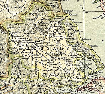

Homolium or Homolion (Ancient Greek: Ὁμόλιον) or Homole (Ὁμόλη)[1] was a town and polis (city-state)[2] of Magnesia in ancient Thessaly, situated at the foot of Mount Homole, and near the edge of the vale of Tempe. Mt. Homole was the part of the chain of Ossa lying between Tempe and the modern village of Karitsa. Mt. Homole is sometimes used as synonymous with Ossa. It was celebrated as a favourite haunt of Pan, and as the abode of the Centaurs and the Lapithae.[3] Pausanias describes it as the most fertile mountain in Thessaly, and well supplied with fountains.[4]
Ancient authors differed in their descriptions of the town's location. Both Pseudo-Scylax and Strabo seem to place it on the right bank of the Peneius near the exit of the vale of Tempe, and consequently at some distance from the sea;[5][6] but in Apollonius Rhodius and in the Orphic poems Homolium is described as situated near the sea-shore, and in Apollonius even another town, Eurymenae, is placed between Homolium and Tempe.[7][8] Eurymenae, however, stood upon the coast more to the south.
Homolium minted coins dated to the 4th century BCE.[9]
Homolium's site is at the modern village of Laspochori, in the municipal unit of Evrymenes.[10][11]
References edit
- ^ Stephanus of Byzantium. Ethnica. Vol. s.v. Ὀμόλη.
- ^ Mogens Herman Hansen & Thomas Heine Nielsen (2004). "Thessaly and Adjacent Regions". An inventory of archaic and classical poleis. New York: Oxford University Press. pp. 718-719. ISBN 0-19-814099-1.
- ^ Eurip. Here. Fur. 371; Theocr. Idyll. 7.104; Virgil. Aeneid. Vol. 7.675.
- ^ Pausanias (1918). "8.6". Description of Greece. Vol. 9. Translated by W. H. S. Jones; H. A. Ormerod. Cambridge, Massachusetts; London: Harvard University Press; William Heinemann – via Perseus Digital Library.
- ^ Periplus of Pseudo-Scylax, p. 12
- ^ Strabo. Geographica. Vol. ix. p.445. Page numbers refer to those of Isaac Casaubon's edition.
- ^ Apollonius of Rhodes. Argonautica. Vol. 1.594.
- ^ Orpheus, Argon. 460.
- ^ Coins from Homolium
- ^ Richard Talbert, ed. (2000). Barrington Atlas of the Greek and Roman World. Princeton University Press. p. 55, and directory notes accompanying. ISBN 978-0-691-03169-9.
- ^ Lund University. Digital Atlas of the Roman Empire.
![]() This article incorporates text from a publication now in the public domain: Smith, William, ed. (1854–1857). "Homole". Dictionary of Greek and Roman Geography. London: John Murray.
This article incorporates text from a publication now in the public domain: Smith, William, ed. (1854–1857). "Homole". Dictionary of Greek and Roman Geography. London: John Murray.
External links edit
- Archaeological Atlas of the Aegean
- The Geography of Strabo
- Herakles Numismatics
- Ancient Thessaly
- NumisWiki
- Strabo: Geography
- Ancient Greek Coins
- Strabon: Geografia