


Summary
Hope Island is a suburb in the City of Gold Coast, Queensland, Australia.[2] In the 2016 census, Hope Island had a population of 11,186 people.[1]
| Hope Island Gold Coast, Queensland | |||||||||||||||
|---|---|---|---|---|---|---|---|---|---|---|---|---|---|---|---|
 The Palms Golf Course, 2013 | |||||||||||||||
 Hope Island | |||||||||||||||
 | |||||||||||||||
| Coordinates | 27°52′01″S 153°21′43″E / 27.8669°S 153.3619°E | ||||||||||||||
| Population | 11,186 (2016 census)[1] | ||||||||||||||
| • Density | 787.7/km2 (2,040/sq mi) | ||||||||||||||
| Postcode(s) | 4212 | ||||||||||||||
| Area | 14.2 km2 (5.5 sq mi) | ||||||||||||||
| Time zone | AEST (UTC+10:00) | ||||||||||||||
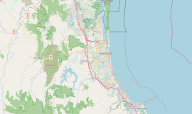
| Location |
| ||||||||||||||
| LGA(s) | City of Gold Coast | ||||||||||||||
| State electorate(s) | Broadwater | ||||||||||||||
| Federal division(s) | Fadden | ||||||||||||||
| |||||||||||||||
There are three towns within the suburb, each established around a real estate development:[3]
- Sanctuary Cove, a gated community in the north of the suburb (27°51′20″S 153°21′12″E / 27.85562°S 153.35330°E)[4]
- Boykambil in the east of the suburb (27°52′18″S 153°22′02″E / 27.8716°S 153.3672°E)[5][6]
- Santa Barbara in the west of the suburb (27°51′50″S 153°20′45″E / 27.8638°S 153.3458°E)[7]
Geography edit

Hope Island is positioned on the northern Gold Coast. It is bounded by the Coomera River to the west, north-west, and north. The river then splits into a northern and southern branch around Coomera Island to east. the southern branch bounds Hope Island to the east. Hope Island is bounded to the south-west and south by Saltwater Creek. The undeveloped Coomera Island lies to the east of the Hope Island preventing direct access to Moreton Bay.[6]
Hope Harbour is in the east of the suburb providing boat access to the southern branch of the Coomera River (27°52′24″S 153°22′34″E / 27.8734°S 153.3760°E).[8]
The Pacific Motorway is to the west passing through the neighbouring suburb of Helensvale.[6]
History edit
The Indigenous name for the area was Boykambil.[2]
The area was named after colonial aristocrat Captain Louis Hope, who in 1867 was granted the island then known as Boykambil near the mouth of the Coomera River in recognition of his contribution in developing the sugar industry in Queensland.[9][10][11]
After arriving in Moreton Bay in 1848, Hope spent the next 20 years building sugar plantations on the edge of Moreton Bay. The development of a sugar plantation called ‘Rockholm’ on the Island was largely undertaken by the Grimes Family. By the twentieth century, the sugar and arrowroot plantation had passed into the hands of the Sheehan and Davidson families. Hope himself never actually lived in the suburb of Hope Island, preferring to live in Ormiston on the edge of Moreton Bay.[citation needed]
In the 2016 census, Hope Island had a population of 11,186 people.[1]
Education edit
There are no schools in Hope Island. The nearest government primary schools are Coomera State School in neighbouring Coomera to the west and Coombabah State School in Coombabah to the south-east. The nearest government secondary school is Helensvale State High School in neighbouring Helensvale to the south-west.[6]
Amenities edit

There are a number of marinas in the suburb, including:
- Hope Harbour Marina in the east of the suburb accessed from the south branch of the Coomera River (27°52′07″S 153°22′31″E / 27.8687°S 153.3754°E)[12]
- Hope Island Resort Marina, in the west of the suburb accessed from Saltwater Creek (27°52′01″S 153°20′54″E / 27.8670°S 153.3484°E)[12]
- Sanctuary Cove Marina, in the north of the suburb where Coomer River splits into two branches (27°51′07″S 153°21′46″E / 27.8520°S 153.3627°E)[12]
There is also a boat ramp and jetty at Boykambil Esplanade South in the south-east of the suburb on the north bank of Coombabah Creek (27°52′24″S 153°22′41″E / 27.8732°S 153.3780°E). It is managed by the Gold Coast City Council.[13]
Hope Island has shops, restaurants and three golf courses within close proximity. Hope Island is home to the upmarket Hope Island Resort and Sanctuary Cove. Community facilities include a harbour front dining/shopping precinct, deep water mooring facilities and luxury housing.[citation needed]
Hope Island is currently[when?] undergoing major strategic planning by developers, together with the Gold Coast City Council, who advocate mixed use (that is, parallel commercial and residential development).[citation needed]
Transport edit
Hope Island is serviced by many transport options for both local and inter-city commuting. It is located adjacent to the M1 motorway connecting it with the rest of the Gold Coast and Brisbane, as well as 20 minutes from the Coomera railway station with regular direct services to Brisbane city and airport.[citation needed]
Golf buggies are a popular form of transport within Hope Island Resort and the neighbouring Sanctuary Cove Resort. A buggy path linking the two resorts has recently been completed by Gold Coast City Council, allowing Sanctuary Cove and Hope Island Resort residents to access each other's resorts.[citation needed]
Hope Island is also serviced by bus services 711 & 718 which are operated by Surfside Buslines, The 711 bus service route is from Sanctuary Cove to Southport running hourly, the 718 bus route from Santa Barbara to Helensvale Station runs on a less frequent basis.[citation needed]
Sport and recreation edit
Recreation areas include Robert Dalley Park, and the Pat Cash Tennis Academy.[citation needed]
There are three golf courses:
- Palms Golf Course in the north of the suburb (27°51′26″S 153°21′40″E / 27.8571°S 153.3612°E)[14][15]
- Sanctuary Cove Golf & Country Club in the centre of the suburb (27°51′53″S 153°21′49″E / 27.8648°S 153.3637°E)[14][16][failed verification]
- Hope Island Golf Course in the south-west of the suburb (27°52′31″S 153°20′59″E / 27.8752°S 153.3496°E)[14][17]
The Pat Cash International Tennis Academy is a sports centre (27°52′16″S 153°21′01″E / 27.8712°S 153.3504°E).[citation needed]
Commercial areas edit
Hope Island Marina Shopping Village is a tropical style, waterfront, open-air shopping and dining centre located on the Hope Island Resort Marina. Its major tenant is Coles, along with a number of specialty stores as well as waterfront cafes and restaurants. There is a large medical centre (Hope Island Medical Centre), optometrist practice (Hope Island Optical, next to coles) and pharmacy. There are smaller shopping areas at Hope Island Central and along Hope Island Road including veterinary clinics, child care facilities, shopping, and services.[citation needed]
A recently completed buggy path allows Hope Island Resort residents easy access to the commercial area and dining precinct within Sanctuary Cove, as well as the Intercontinental Hotel and other facilities.[citation needed]
Hope Island Resort edit
A large portion of Hope Island is home to the Hope Island Resort, a gated community with facilities such as marina, half-Olympic pool, golf course, tennis and 24-hour security.[citation needed]
Links Hope Island (part of Hope Island Resort) is home to an 18-hole championship course designed by five-time British Open champion Peter Thomson.[citation needed]
Hope Island Resort has its own private broadband network. A modern Hybrid Fibre Coax (HFC) network which is used for cable television delivery, the gate intercom, community telephony, security and super-fast Internet delivery to all residents. Newer parts of the resort have a full fibre-to-the-premises (FTTP) connection.[citation needed]
References edit
- ^ a b c Australian Bureau of Statistics (27 June 2017). "Hope Island (SSC)". 2016 Census QuickStats. Retrieved 20 October 2018.
- ^ a b "Hope Island – suburb in City of Gold Coast (entry 46054)". Queensland Place Names. Queensland Government. Retrieved 20 July 2021.
- ^ "Hope Island". Queensland Places. University of Queensland. Retrieved 5 February 2023.
- ^ "Sanctuary Cove – population centre in Gold Coast City (entry 29566)". Queensland Place Names. Queensland Government. Retrieved 13 November 2019.
- ^ "Boykambil – town in City of Gold Coast (entry 4218)". Queensland Place Names. Queensland Government. Retrieved 29 November 2019.
- ^ a b c d "Queensland Globe". State of Queensland. Retrieved 5 February 2023.
- ^ "Santa Barbara – town in City of Gold Coast (entry 29936)". Queensland Place Names. Queensland Government. Retrieved 29 November 2019.
- ^ "Hope Harbour – harbour in City of Gold Coast (entry 16110)". Queensland Place Names. Queensland Government. Retrieved 14 August 2022.
- ^ "THE LOGAN". The Brisbane Courier. Vol. XXII, no. 3, 151. Queensland, Australia. 16 November 1867. p. 6. Retrieved 21 December 2021 – via National Library of Australia.
- ^ "THE COOMERA RIVER". The Brisbane Courier. Vol. XXII, no. 3, 244. Queensland, Australia. 21 February 1868. p. 3. Retrieved 21 December 2021 – via National Library of Australia.
- ^ "THE GRANT TO CAPTAIN HOPE". The Brisbane Courier. Vol. XXII, no. 3, 135. Queensland, Australia. 29 October 1867. p. 3. Retrieved 21 December 2021 – via National Library of Australia.
- ^ a b c "Marinas - Queensland". Queensland Open Data. Queensland Government. 18 November 2020. Archived from the original on 24 November 2020. Retrieved 24 October 2020.
- ^ "Recreational Boating Facilities Queensland". Queensland Open Data. Queensland Government. 12 November 2020. Archived from the original on 22 November 2020. Retrieved 22 November 2020.
- ^ a b c "Building points - Queensland". Queensland Open Data. Queensland Government. 17 November 2020. Archived from the original on 25 November 2020. Retrieved 25 November 2020.
- ^ "The Palms Golf Course at Sanctuary Cove Golf & Country Club". Sanctuary Cove Golf and Country Club. Retrieved 5 February 2023.
- ^ "The Pines". Sanctuary Cove Golf and Country Club. Retrieved 5 February 2023.
- ^ "Course Tour". Links Hope Island. Retrieved 5 February 2023.
External links edit
- "Hope Island". Queensland Places. Centre for the Government of Queensland, University of Queensland.