


Summary
Hovin is a former municipality in Telemark county, Norway. The 302.5-square-kilometre (116.8 sq mi)[3] municipality existed from 1886 until its dissolution in 1964. The area is now divided between Tinn Municipality and Notodden Municipality. The administrative centre was the village of Hovin. The other main village in the municipality was Rudsgrendi on the opposite side of the lake Tinnsjå.
Hovin Municipality
Hovin herred | |
|---|---|
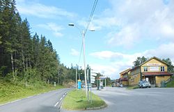 View of Hovin | |
 Telemark within Norway | |
 Hovin within Telemark | |
| Coordinates: 59°51′09″N 9°01′43″E / 59.85245°N 9.02861°E | |
| Country | Norway |
| County | Telemark |
| District | Aust-Telemark |
| Established | 1 Jan 1886 |
| • Preceded by | Gransherad |
| Disestablished | 1 Jan 1964 |
| • Succeeded by | Tinn and Notodden |
| Administrative centre | Hovin |
| Demonym | Hoværing[1] |
| Time zone | UTC+01:00 (CET) |
| • Summer (DST) | UTC+02:00 (CEST) |
| ISO 3166 code | NO-0825[2] |
Data from Statistics Norway | |
History edit
The municipality was established on 1 January 1886 when the municipality of Gransherad was divided into two: Hovin in the north (population: 885) and Gransherad in the south (population: 1,393). On 24 March 1903, an unpopulated part of Tinn Municipality was transferred to Hovin. During the 1960s, there were many municipal mergers across Norway due to the work of the Schei Committee. On 1 January 1964, the municipality of Hovin was dissolved and its lands were split in two:[4]
- The Rudsgrendi area of Hovin on the west side of the lake Tinnsjå (population: 21) was merged with the municipality of Heddal (population: 4,844), most of the municipality of Gransherad (population: 1,115), and the town of Notodden (population: 7,523).
- The rest of Hovin on the east side of the lake Tinnsjå (population: 461) was merged with Tinn Municipality (population: 9,449).
Name edit
The municipality (originally the parish) is named after the old Hovin farm (Old Norse: Hofvin) since the first Hovin Church was built there. The first element is identical to the word hof which means "heathen hof" or a "temple for the Norse gods". The last element is vin which means "meadow" or "pasture". In this context, "Hovin" likely refers to a meadow location that was associated with a pagan temple or a religious site in the past.[5]
Government edit
During its existence, this municipality was governed by a municipal council of directly elected representatives. The mayor was indirectly elected by a vote of the municipal council.[6]
Municipal council edit
The municipal council (Herredsstyre) of Hovin was made up of representatives that were elected to four year terms. The tables below show the historical composition of the council by political party.
| Party name (in Norwegian) | Number of representatives | |
|---|---|---|
| Labour Party (Arbeiderpartiet) | 9 | |
| Centre Party (Senterpartiet) | 6 | |
| Liberal Party (Venstre) | 2 | |
| Total number of members: | 17 | |
| Party name (in Norwegian) | Number of representatives | |
|---|---|---|
| Labour Party (Arbeiderpartiet) | 9 | |
| Farmers' Party (Bondepartiet) | 6 | |
| Liberal Party (Venstre) | 2 | |
| Total number of members: | 17 | |
| Party name (in Norwegian) | Number of representatives | |
|---|---|---|
| Labour Party (Arbeiderpartiet) | 8 | |
| Joint List(s) of Non-Socialist Parties (Borgerlige Felleslister) | 8 | |
| Total number of members: | 16 | |
| Party name (in Norwegian) | Number of representatives | |
|---|---|---|
| Labour Party (Arbeiderpartiet) | 9 | |
| Farmers' Party (Bondepartiet) | 4 | |
| Joint list of the Liberal Party (Venstre) and the Radical People's Party (Radikale Folkepartiet) | 3 | |
| Total number of members: | 16 | |
| Party name (in Norwegian) | Number of representatives | |
|---|---|---|
| Labour Party (Arbeiderpartiet) | 8 | |
| Farmers' Party (Bondepartiet) | 4 | |
| Joint list of the Liberal Party (Venstre) and the Radical People's Party (Radikale Folkepartiet) | 4 | |
| Total number of members: | 16 | |
| Party name (in Norwegian) | Number of representatives | |
|---|---|---|
| Labour Party (Arbeiderpartiet) | 7 | |
| Farmers' Party (Bondepartiet) | 5 | |
| Liberal Party (Venstre) | 4 | |
| Total number of members: | 16 | |
| Note: Due to the German occupation of Norway during World War II, no elections were held for new municipal councils until after the war ended in 1945. | ||
See also edit
References edit
- ^ "Navn på steder og personer: Innbyggjarnamn" (in Norwegian). Språkrådet.
- ^ Bolstad, Erik; Thorsnæs, Geir, eds. (26 January 2023). "Kommunenummer". Store norske leksikon (in Norwegian). Kunnskapsforlaget.
- ^ Helland, Amund (1900). "Tinn herred". VIII. Bratsberg Amt. Anden del. Norges land og folk (in Norwegian). Kristiania, Norway: H. Aschehoug & Company. p. 446. Retrieved 21 August 2023.
- ^ Jukvam, Dag (1999). Historisk oversikt over endringer i kommune- og fylkesinndelingen (PDF) (in Norwegian). Statistisk sentralbyrå. ISBN 9788253746845.
- ^ Rygh, Oluf (1914). Norske gaardnavne: Bratsbergs amt (in Norwegian) (7 ed.). Kristiania, Norge: W. C. Fabritius & sønners bogtrikkeri. p. 279.
- ^ Hansen, Tore; Vabo, Signy Irene, eds. (20 September 2022). "kommunestyre". Store norske leksikon (in Norwegian). Kunnskapsforlaget. Retrieved 3 August 2023.
- ^ "Kommunevalgene og Ordførervalgene 1959" (PDF) (in Norwegian). Oslo, Norge: Statistisk sentralbyrå. 1960.
- ^ "Kommunevalgene og Ordførervalgene 1955" (PDF) (in Norwegian). Oslo, Norge: Statistisk sentralbyrå. 1957.
- ^ "Kommunevalgene og Ordførervalgene 1951" (PDF) (in Norwegian). Oslo: Statistisk sentralbyrå. 1952.
- ^ "Kommunevalgene og Ordførervalgene 1947" (PDF) (in Norwegian). Oslo: Statistisk sentralbyrå. 1948.
- ^ "Kommunevalgene og Ordførervalgene 1945" (PDF) (in Norwegian). Oslo: Statistisk sentralbyrå. 1947.
- ^ "Kommunevalgene og Ordførervalgene 1937" (PDF) (in Norwegian). Oslo: Statistisk sentralbyrå. 1938.