


Summary
Hundorp is the administrative centre of Sør-Fron Municipality in Innlandet county, Norway. The village is located in the Gudbrandsdal valley along the north shore of the Gudbrandsdalslågen river, about 10 kilometres (6.2 mi) west of the village of Ringebu. The European route E6 highway and the Dovrebanen railway line both pass through the village. The 0.85-square-kilometre (210-acre) village has a population (2021) of 583 and a population density of 689 inhabitants per square kilometre (1,780/sq mi).[1]
Hundorp | |
|---|---|
Village | |
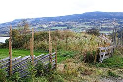 View of the village in the distance | |
 Hundorp Location of the village  Hundorp Hundorp (Norway) | |
| Coordinates: 61°33′19″N 9°56′27″E / 61.55527°N 9.94072°E | |
| Country | Norway |
| Region | Eastern Norway |
| County | Innlandet |
| District | Gudbrandsdalen |
| Municipality | Sør-Fron Municipality |
| Area | |
| • Total | 0.85 km2 (0.33 sq mi) |
| Elevation | 262 m (860 ft) |
| Population (2021)[1] | |
| • Total | 583 |
| • Density | 689/km2 (1,780/sq mi) |
| Time zone | UTC+01:00 (CET) |
| • Summer (DST) | UTC+02:00 (CEST) |
| Post Code | 2647 Sør-Fron |
Hundorp was also the centre of the petty kingdom of Gudbrandsdalen and as such, it was an important place for religion and politics. Dale-Gudbrand's farm, the farm once populated by the ancient ruler Dale-Gudbrand, was chosen as the millennium site of Oppland county.
Name edit
The village is named after the old Hundorp farm (Old Norse: Hundþorp). The first element is hundr which means 'dog' or 'hound'. The last element is þorp which means 'village'. The name is probably reflecting the fact that at one time this was a village of dog-breeding.
References edit