


Summary
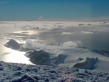
Hurd Peninsula lies between South Bay and False Bay on the south coast of Livingston Island in the South Shetland Islands, Antarctica. The Spanish Juan Carlos I Antarctic Base and the Bulgarian St. Kliment Ohridski Base are situated on its west coast.


The peninsula was named by the UK Antarctic Place-Names Committee in 1961 for Captain Thomas Hurd, Royal Navy, the second Hydrographer to the British Admiralty, 1808–23, who instituted a regular system of nautical surveys, and under whose authority Lieutenant Edward Bransfield's 1820 survey of the Bransfield Strait area was published in November 1822.[1]
Location edit
The midpoint of the peninsula is located at 62°40′33″S 60°21′59″W / 62.67583°S 60.36639°W (Detailed Spanish mapping in 1991, and Bulgarian in 2005 and 2009).
Maps edit
- Chart of South Shetland including Coronation Island, &c. from the exploration of the sloop Dove in the years 1821 and 1822 by George Powell Commander of the same. Scale ca. 1:200000. London: Laurie, 1822.
- South Shetland Islands. Scale 1:200000 topographic map. DOS 610 Sheet W 62 60. Tolworth, UK, 1968.
- Islas Livingston y Decepción. Mapa topográfico a escala 1:100000. Madrid: Servicio Geográfico del Ejército, 1991.
- Isla Livingston: Península Hurd. Mapa topográfico de escala 1:25000. Madrid: Servicio Geográfico del Ejército, 1991. (The map is reproduced on p. 16 of the linked work)
- L.L. Ivanov et al. Antarctica: Livingston Island and Greenwich Island, South Shetland Islands. Scale 1:100000 topographic map. Sofia: Antarctic Place-names Commission of Bulgaria, 2005.
- L.L. Ivanov. Antarctica: Livingston Island and Greenwich, Robert, Snow and Smith Islands. Scale 1:120000 topographic map. Troyan: Manfred Wörner Foundation, 2010. ISBN 978-954-92032-9-5 (First edition 2009. ISBN 978-954-92032-6-4)
- Antarctic Digital Database (ADD). Scale 1:250000 topographic map of Antarctica. Scientific Committee on Antarctic Research (SCAR). Since 1993, regularly updated.
- L.L. Ivanov. Antarctica: Livingston Island and Smith Island. Scale 1:100000 topographic map. Manfred Wörner Foundation, 2017. ISBN 978-619-90008-3-0
References edit
- ^ "Hurd Peninsula". Geographic Names Information System. United States Geological Survey, United States Department of the Interior. Retrieved 2012-07-04.
External links edit
- Hurd Peninsula. SCAR Composite Antarctic Gazetteer
- Ivanov, L. General Geography and History of Livingston Island. In: Bulgarian Antarctic Research: A Synthesis. Eds. C. Pimpirev and N. Chipev. Sofia: St. Kliment Ohridski University Press, 2015. pp. 17–28. ISBN 978-954-07-3939-7
![]() This article incorporates public domain material from "Hurd Peninsula". Geographic Names Information System. United States Geological Survey.
This article incorporates public domain material from "Hurd Peninsula". Geographic Names Information System. United States Geological Survey.