


Summary
Imari (伊万里市, Imari-shi) is a city located in Saga Prefecture on the island of Kyushu, Japan. Imari is most notable because of Imari porcelain, which is the European collectors' name for Japanese porcelain wares made in the town of Arita, Saga Prefecture. The porcelain was exported from the port of Imari specifically for the European export trade. As of October 1, 2016, the city has an estimated population of 54,907 and a population density of 220 persons per km2. The total area is 254.99 km2.
Imari
伊万里市 | |
|---|---|
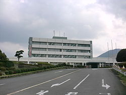 Imari City Hall | |
 Flag  Emblem | |
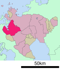 Location of Imari in Saga Prefecture | |
 Imari Location in Japan | |
| Coordinates: 33°16′N 129°53′E / 33.267°N 129.883°E | |
| Country | Japan |
| Region | Kyushu |
| Prefecture | Saga Prefecture |
| Government | |
| • Mayor | Hironobu Fukaura <深浦 弘信> (from April 2018) |
| Area | |
| • Total | 254.99 km2 (98.45 sq mi) |
| Population (October 1, 2016) | |
| • Total | 54,907 |
| • Density | 220/km2 (560/sq mi) |
| Time zone | UTC+09:00 (JST) |
| City hall address | 1355-1 Tachibana-chō, Imari-shi, Saga-ken 848-8501 |
| Climate | Cfa |
| Website | www |
| Symbols | |
| Flower | Azalea |
| Tree | Podocarpaceae |
Geography edit
Imari is located in the western part of Saga Prefecture. The city center is located around the mouth of the Imari River.
- Mountains: Mt. Hachiman (764 m), Mt. Seira (599 m), Mt. Eboshi (597 m)
- Rivers: Matsuura River, Imari River, Hata River, Kurōtake River, Arita River
Adjoining municipalities edit
Climate edit
| Climate data for Imari (1991−2020 normals, extremes 1977−present) | |||||||||||||
|---|---|---|---|---|---|---|---|---|---|---|---|---|---|
| Month | Jan | Feb | Mar | Apr | May | Jun | Jul | Aug | Sep | Oct | Nov | Dec | Year |
| Record high °C (°F) | 19.8 (67.6) |
22.4 (72.3) |
24.4 (75.9) |
29.9 (85.8) |
32.1 (89.8) |
36.0 (96.8) |
36.8 (98.2) |
37.8 (100.0) |
36.7 (98.1) |
32.6 (90.7) |
28.3 (82.9) |
24.0 (75.2) |
37.8 (100.0) |
| Mean daily maximum °C (°F) | 9.8 (49.6) |
11.2 (52.2) |
14.6 (58.3) |
19.7 (67.5) |
24.1 (75.4) |
26.7 (80.1) |
30.5 (86.9) |
31.8 (89.2) |
28.0 (82.4) |
23.3 (73.9) |
17.7 (63.9) |
12.2 (54.0) |
20.8 (69.5) |
| Daily mean °C (°F) | 5.4 (41.7) |
6.4 (43.5) |
9.5 (49.1) |
14.2 (57.6) |
18.6 (65.5) |
22.2 (72.0) |
26.4 (79.5) |
27.2 (81.0) |
23.3 (73.9) |
17.9 (64.2) |
12.4 (54.3) |
7.3 (45.1) |
15.9 (60.6) |
| Mean daily minimum °C (°F) | 1.2 (34.2) |
1.7 (35.1) |
4.5 (40.1) |
8.9 (48.0) |
13.6 (56.5) |
18.6 (65.5) |
23.3 (73.9) |
23.7 (74.7) |
19.6 (67.3) |
13.3 (55.9) |
7.6 (45.7) |
2.9 (37.2) |
11.6 (52.8) |
| Record low °C (°F) | −5.4 (22.3) |
−5.3 (22.5) |
−3.6 (25.5) |
−1.0 (30.2) |
4.0 (39.2) |
8.7 (47.7) |
15.6 (60.1) |
16.7 (62.1) |
8.6 (47.5) |
2.1 (35.8) |
−1.6 (29.1) |
−4.5 (23.9) |
−5.4 (22.3) |
| Average precipitation mm (inches) | 78.6 (3.09) |
93.8 (3.69) |
148.6 (5.85) |
188.2 (7.41) |
197.2 (7.76) |
355.6 (14.00) |
367.9 (14.48) |
272.0 (10.71) |
224.1 (8.82) |
105.0 (4.13) |
107.4 (4.23) |
83.6 (3.29) |
2,221.8 (87.47) |
| Average precipitation days (≥ 1.0 mm) | 9.4 | 9.0 | 10.9 | 10.0 | 9.4 | 13.4 | 13.1 | 11.0 | 10.0 | 7.2 | 9.1 | 9.2 | 121.7 |
| Mean monthly sunshine hours | 98.6 | 118.9 | 157.9 | 182.7 | 193.2 | 122.0 | 159.0 | 188.5 | 155.3 | 178.7 | 135.4 | 108.6 | 1,798.8 |
| Source: JMA[1][2] | |||||||||||||
History edit

During the Edo period this region flourished due to the export of ceramics and porcelain. High quality goods to be presented to Shōgun and the Imperial Court were produced in what is now called Ōkawachiyama. From the Meiji period to 1955 coal was also a major export.
- August 15, 1281 - The 2nd Mongol invasion fleet retreated into Imari Bay and was destroyed here by Kamikaze typhoon.
- April 1, 1889 - The modern municipal system was established. The current city region was occupied by one town (Imari), and 11 villages (Higashiyamashiro, Kurokawa, Makishima, Matsuura, Minamihata, Niri, Nishiyamashiro, Ōdake, Ōkawa, Ōkawachi and Ōtsubo).
- February 16, 1901 - Ōdake Village was renamed Hatatsu Village.
- December 10, 1928 - Makishima Village was incorporated into Imari Town.
- April 1, 1936 - Nishiyamashiro Village became Yamashiro Town.
- December 8, 1943 - The villages of Ōkawachi and Ōtsubo were incorporated into Imari Town.
- April 1, 1954 - The towns of Imari and Yamashiro, and the villages of Higashiyamashiro, Kurokawa, Hatatsu, Minamihata, Ōkawa, Matsuura, and Niri were merged to create Imari City.
Education edit
Vocational schools edit
- Imari College of Nursing
High schools edit
- Saga Prefectural Imari High School (佐賀県立伊万里高等学校)
- Saga Prefectural Imari Agriculture and Forestry High School (佐賀県立伊万里農林高等学校)
- Saga Prefectural Imari Business High School (佐賀県立伊万里商業高等学校)
- Keitoku High School (敬徳高等学校)
Transportation edit
Air edit
The nearest airports are Saga Airport, Fukuoka Airport, and Nagasaki Airport.
Rail edit
- JR Kyushu
- Matsuura Railway
- Nishi-Kyūshū Line
- Kanatake Station - Kawahigashi Station - Imari Station - Higashiyamashiro Station - Sato Station - Kusuku Station - Naruishi Station - Kubara Station - Haze Station - Uranosaki Station - Fukushimaguchi Station
- Nishi-Kyūshū Line
The main station is Imari Station.
Road edit
- Expressways:
- There are no expressway interchanges in Imari. The closest is the Nagasaki Expressway Takeo-Kitagata Interchange.
- National highways:
- Prefectural roads:
- Saga Prefectural Route 5 (Imari-Matsuura)
- Saga Prefectural Route 32 (Hatagawachi-Chikushino)
- Saga Prefectural Route 321 (Kurokawa-Matsushima)
Sea edit
The port of Imari is a medium size port which receives ocean ships of various types, including container ships, dry bulk ships, cruise ships...etc. [1] .
The port of Imari is also the location of the main shipyard of Namura Shipbuilding Co. Ltd., a large Osaka based shipbuilding and repair company [2] which also owns another large ship repair firm further southwest in Sasebo, i.e. Sasebo Heavy Industries.
Pottery edit
- Imari porcelain
- Ōkawachiyama, 'The Village of the Secret Kilns', used to be the home of the Nabeshima clan kilns, with masters such as Hatase Buemon and Sakaida Kakiemon.
The Imari Pear edit
Imari is the largest Japanese pear producing center in western Japan. The cultivation of the Japanese pear from Imari (Imari pears (伊万里梨, Imari nashi)), which originated in the Ōkawa area 100 years ago, has spread out to the Minamihata area and other areas of the city. Today, they are produced over about 350 hectares of land, and their quantity of production was about 4800 tons per year as of 2007.
Ōkawa originally had little rice fields, but in 1906 this led the chairman of the Ōkawa Junior Chamber of Commerce, Takeji Fujita and 11 other people to spearhead the reclamation of forest lands and the cultivation of Japanese pears as a cash crop in Ōkawa. Since then the production and the crop acreage of Imari nashi have increased. According to the latest municipal statistics, the production is the fifth and the acreage is the third in the nation.
The characteristics of Imari nashi are juiciness and crispness. Thanks to the adoption of light sensor systems for fruit sorting, only those which are of excellent quality can be selected and are shipped to Kantō, Kansai, and Kyūshū districts. Recently export to China has started and been promoted.
The main brands of Imari nashi are Kosui, Hosui, and Niitaka. The most produced is Kosui, but Hosui is the most popular brand of the three.[3][4]
Festivals edit
The Imari Ton-Ten-Ton Festival is held annually for three days from October 22 to 24, beginning at the Imari Shrine in Imari City. The festival is well known as one of the three great fighting festivals of Japan.
People from Imari edit
- Fujiko (actress)
- Tatsuo Ikeda - avant-garde artist
- Sayuri Katayama - singer
- Kyohei Maeyama - Footballer for Blaublitz Akita[5]
- Ryosuke Mizumachi - Basketball player for Akita Northern Happinets[6][7][8]
- Taichiro Morinaga - Morinaga & Co founder
- Yōsuke Takasu - baseball player
- Masayuki Tanaka - singer
References edit
- ^ 観測史上1~10位の値(年間を通じての値). JMA. Retrieved February 27, 2022.
- ^ 気象庁 / 平年値(年・月ごとの値). JMA. Retrieved February 27, 2022.
- ^ "JA Imari". 2006. Retrieved 2008-10-14.[permanent dead link]
- ^ "Cultivation of the Japanese pear". 2008-06-27. Retrieved 2008-10-16.
- ^ "Login • Instagram".
{{cite web}}: Cite uses generic title (help) - ^ Happinets halftime show vs.SunRockers Shibuya on December 12, 2018
- ^ "『M ~もう一度の新潟ストーリー~』". まっちょのブログ.
- ^ 水町嘉宏 (19 May 2010). "トンテントン". Retrieved 15 March 2021.
External links edit
- Imari City official website (in Japanese)