


Summary
The Indian River is a river in Yukon, Canada.[1][2][3] It is in the Bering Sea drainage basin and is a right tributary of the Yukon River.
| Indian River | |
|---|---|
 Panning for gold on the Indian River, 1904; photo by Joseph Tyrrell, Thomas Fisher Rare Book Library | |
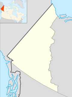 Location of the mouth in Yukon | |
| Location | |
| Country | Canada |
| Territory | Yukon |
| Physical characteristics | |
| Source confluence | Australia Creek, Dominion Creek, Scribner Creek and Wounded Moose Creek |
| • coordinates | 63°37′08″N 138°42′16″W / 63.61889°N 138.70444°W |
| • elevation | 487 m (1,598 ft) |
| Mouth | Yukon River |
• coordinates | 63°47′08″N 139°43′39″W / 63.78556°N 139.72750°W |
• elevation | 333 m (1,093 ft) |
| Basin features | |
| River system | Bering Sea drainage basin |
Course edit
The river begins at the confluence of Australia Creek, Dominion Creek, Scribner Creek and Wounded Moose Creek, about 5 kilometres (3.1 mi) southwest of the settlement of Dominion. It flows northwest, then turns west to reach its mouth at the Yukon River.[3]
Geology edit
The river is a gravel-bed stream located south of Dawson City. It lies on the Klondike Plateau, and forms the southern boundary of the Yukon placer gold district.[4] Indian River and its tributaries are the largest gold producers in the Yukon. In 2001, the river produced 119,999 grams (4,232.8 oz) of gold.[4] In 2008, Klondike Star Mineral Corporation announced plans to further develop the gold resources of the river.[5]
Tributaries edit
- Bertha Creek (right)
- Nine Mile Creek (right)
- Ophir Creek (right)
- Ruby Creek (left)
- Quartz Creek (right)
- McKinnon Creek (left)
- New Zealand Creek (right)
- Montana Creek (left)
- Eureka Creek (left)
Further reading edit
- Unrau, Jason (2012-02-23). "How a novice miner survived a summer in the Klondike". Report on Business Magazine. The Globe and Mail. Retrieved 2012-03-02. An account of working a season at a placer gold mining camp in the Indian River valley; mentions Quartz Creek and Ruby Creek tributaries, and Little Blanche Creek sub-tributary.
See also edit
References edit
- ^ "Indian River". Geographical Names Data Base. Natural Resources Canada. Retrieved 2012-01-23.
- ^ "Gazetteer of Yukon" (PDF). Yukon Tourism and Culture - Cultural Services Branch - Heritage Resources Unit - Geographical Names Program. March 2011. p. 32. Archived from the original (PDF) on 2011-08-27. Retrieved 2012-01-23.
- ^ a b "Indian River". Atlas of Canada. Natural Resources Canada. 2010-02-04. Retrieved 2012-01-23. Shows the course of the river highlighted on a map.
- ^ a b Nelson, Faye EN; Jackson, Lionel E Jr (2003). "High-level terraces, Indian River valley, Yukon" (PDF). In Emond, DS; Lewis, LL (eds.). Yukon Exploration and Geology 2004. Yukon Geological Survey. pp. 177–190. Retrieved 2012-01-23.
- ^ "Klondike Star greenlights Indian River gold project". Klondike Star Mineral Corporation. July 29, 2008. Retrieved May 13, 2009.