


Summary
Indianola Municipal Airport (ICAO: KIDL, FAA LID: IDL) is a public use airport in Sunflower County, Mississippi, United States.[1] The airport is owned by the City of Indianola[1][2] and located two nautical miles (4 km) northwest of the central business district.[1]
Indianola Municipal Airport (former Indianola Auxiliary Field) | |||||||||||
|---|---|---|---|---|---|---|---|---|---|---|---|
 USGS 2006 orthophoto | |||||||||||
| Summary | |||||||||||
| Airport type | Public | ||||||||||
| Owner | City of Indianola | ||||||||||
| Serves | Indianola, Mississippi | ||||||||||
| Elevation AMSL | 126 ft / 38 m | ||||||||||
| Coordinates | 33°29′09″N 090°40′44″W / 33.48583°N 90.67889°W | ||||||||||
| Map | |||||||||||
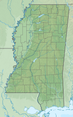 IDL Location of airport in Mississippi  IDL IDL (the United States) | |||||||||||
| Runways | |||||||||||
| |||||||||||
| Statistics (2012) | |||||||||||
| |||||||||||
This airport is included in the National Plan of Integrated Airport Systems for 2011–2015, which categorized it as a general aviation facility.[3] In 2010 the airport received a $88,997 Federal Aviation Administration Airport Improvement Program grant to rehabilitate the airport beacon and to fund the installation of a water system.[2]
Although many U.S. airports use the same three-letter location identifier for the FAA and IATA, this airport is assigned IDL by the FAA[1] but has no designation from the IATA.[4][5]
History edit
The airport was opened during World War II, and was designated as Indianola Auxiliary Field and was used as an auxiliary training airfield supporting the Army pilot training school at Greenwood Army Airfield. It was turned over for civil use in January 1947. [6]
Facilities and aircraft edit
Indianola Municipal Airport covers an area of 600 acres (243 ha) at an elevation of 126 feet (38 m) above mean sea level. It has one runway designated 18/36 with a concrete surface measuring 7,004 by 150 feet (2,135 x 46 m).[1]
For the 12-month period ending February 8, 2012, the airport had 21,500 general aviation aircraft operations, an average of 58 per day. At that time there were 21 aircraft based at this airport: 86% single-engine and 14% multi-engine.[1]
See also edit
References edit
- ^ a b c d e f g FAA Airport Form 5010 for IDL PDF. Federal Aviation Administration. Effective November 15, 2012.
- ^ a b "Poplarville, Hattiesburg among airports receiving grants Archived 2012-02-28 at the Wayback Machine." WDAM. March 12, 2010. Retrieved on September 23, 2010.
- ^ "Appendix A: List of NPIAS Airports with 5-Year Forecast Activity and Development Cost". National Plan of Integrated Airport Systems (NPIAS) Reports. Federal Aviation Administration. October 4, 2010. Archived from the original on 2012-10-27.
- ^ "IATA Airport Code Search (IDL)". International Air Transport Association. Retrieved August 14, 2013.
- ^ "Indianola Municipal Airport (IATA: none, ICAO: KIDL, FAA: IDL)". Great Circle Mapper. Retrieved August 14, 2013.
- ^
 This article incorporates public domain material from the Air Force Historical Research Agency
External links edit
- Aerial image as of March 1992[permanent dead link] from USGS The National Map
- FAA Terminal Procedures for IDL, effective April 18, 2024
- Resources for this airport:
- FAA airport information for IDL
- AirNav airport information for KIDL
- FlightAware airport information and live flight tracker
- SkyVector aeronautical chart for KIDL