
KNOWPIA
WELCOME TO KNOWPIA

Iraquara 
Summary
Iraquara is a municipality in the state of Bahia in the North-East region of Brazil.
Iraquara
City of Caves | |
|---|---|
| Nickname: City of Caves | |
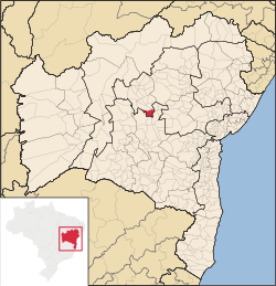 morro do chapeu localization map of the state ahia | |
| Country | |
| Region | Nordeste |
| State | Bahia |
| Mesoregion | Centro Norte Baiano |
| Area | |
| • Total | 309.010 sq mi (800.332 km2) |
| Population (2020 [1]) | |
| • Total | 25,478 |
| Time zone | UTC−3 (BRT) |
| Website | iraquara |
Geography edit
Its estimated in 2020 population was 25,478 inhabitants. It lies in the center of Bahia, in the Chapada Diamantina. Tourists visit to see the caves such as: Pratinha, Lapa Doce, Torrinha, Gruta Azul, Gruta da Fumaça, among others.[2][3][4][5]
See also edit
References edit
- ^ IBGE 2020
- ^ "Divisão Territorial do Brasil" (in Portuguese). Divisão Territorial do Brasil e Limites Territoriais, Instituto Brasileiro de Geografia e Estatística (IBGE). 1 July 2008. Retrieved 17 December 2009.
- ^ "Estimativas da população para 1º de julho de 2009" (PDF) (in Portuguese). Estimativas de População, Instituto Brasileiro de Geografia e Estatística (IBGE). 14 August 2009. Retrieved 17 December 2009.
- ^ "Ranking decrescente do IDH-M dos municípios do Brasil" (in Portuguese). Atlas do Desenvolvimento Humano, Programa das Nações Unidas para o Desenvolvimento (PNUD). 2000. Archived from the original on 3 October 2009. Retrieved 17 December 2009.
- ^ "Produto Interno Bruto dos Municípios 2002–2005" (PDF) (in Portuguese). Instituto Brasileiro de Geografia e Estatística (IBGE). 19 December 2007. Archived from the original (PDF) on 2 October 2008. Retrieved 17 December 2009.
12°14′56″S 41°37′08″W / 12.24889°S 41.61889°W