
KNOWPIA
WELCOME TO KNOWPIA

Irles 
Summary
Irles (French pronunciation: [iʁl]) is a commune in the Somme department in Hauts-de-France in northern France.
Irles | |
|---|---|
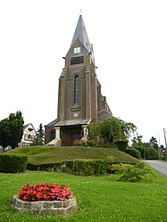 The church in Irles | |
Location of Irles .mw-parser-output .locmap .od{position:absolute}.mw-parser-output .locmap .id{position:absolute;line-height:0}.mw-parser-output .locmap .l0{font-size:0;position:absolute}.mw-parser-output .locmap .pv{line-height:110%;position:absolute;text-align:center}.mw-parser-output .locmap .pl{line-height:110%;position:absolute;top:-0.75em;text-align:right}.mw-parser-output .locmap .pr{line-height:110%;position:absolute;top:-0.75em;text-align:left}.mw-parser-output .locmap .pv>div{display:inline;padding:1px}.mw-parser-output .locmap .pl>div{display:inline;padding:1px;float:right}.mw-parser-output .locmap .pr>div{display:inline;padding:1px;float:left}html.skin-theme-clientpref-night .mw-parser-output .od,html.skin-theme-clientpref-night .mw-parser-output .od .pv>div,html.skin-theme-clientpref-night .mw-parser-output .od .pl>div,html.skin-theme-clientpref-night .mw-parser-output .od .pr>div{background:#fff;color:#000}html.skin-theme-clientpref-night .mw-parser-output .locmap{filter:grayscale(0.6)}@media(prefers-color-scheme:dark){html.skin-theme-clientpref-os .mw-parser-output .locmap{filter:grayscale(0.6)}html.skin-theme-clientpref-os .mw-parser-output .od,html.skin-theme-clientpref-os .mw-parser-output .od .pv>div,html.skin-theme-clientpref-os .mw-parser-output .od .pl>div,html.skin-theme-clientpref-os .mw-parser-output .od .pr>div{background:white;color:#000}}  Irles  Irles | |
| Coordinates: 50°06′01″N 2°45′16″E / 50.1003°N 2.7544°E | |
| Country | France |
| Region | Hauts-de-France |
| Department | Somme |
| Arrondissement | Péronne |
| Canton | Albert |
| Intercommunality | Pays du Coquelicot |
| Government | |
| • Mayor (2020–2026) | Régis Philippe[1] |
| Area 1 | 5.38 km2 (2.08 sq mi) |
| Population (2021)[2] | 130 |
| • Density | 24/km2 (63/sq mi) |
| Time zone | UTC+01:00 (CET) |
| • Summer (DST) | UTC+02:00 (CEST) |
| INSEE/Postal code | 80451 /80300 |
| Elevation | 82–132 m (269–433 ft) (avg. 101 m or 331 ft) |
| 1 French Land Register data, which excludes lakes, ponds, glaciers > 1 km2 (0.386 sq mi or 247 acres) and river estuaries. | |
Geography edit
Irles is situated on the D163 road, some 10 miles (16 km) south of Arras, near the border with the département of the Pas-de-Calais.
History edit
Irles was the site of an action by the 1st Royal West Kent Regiment and the 12th Gloucestershire Regiment on 23 August 1918 during the Second Battle of Bapaume.
Population edit
| Year | Pop. | ±% p.a. |
|---|---|---|
| 1968 | 135 | — |
| 1975 | 129 | −0.65% |
| 1982 | 120 | −1.03% |
| 1990 | 113 | −0.75% |
| 1999 | 104 | −0.92% |
| 2007 | 115 | +1.26% |
| 2012 | 108 | −1.25% |
| 2017 | 113 | +0.91% |
| Source: INSEE[3] | ||
See also edit
References edit
- Major CV Maloney, '"Invicta": with the 1st Battalion the Queen's Own Royal West Kent Regiment in the Great War', London: Nisbet & Co, 1923. ISBN 978-1-84342-541-0
- ^ "Répertoire national des élus: les maires" (in French). data.gouv.fr, Plateforme ouverte des données publiques françaises. 13 September 2022.
- ^ "Populations légales 2021". The National Institute of Statistics and Economic Studies. 28 December 2023.
- ^ Population en historique depuis 1968, INSEE
Wikimedia Commons has media related to Irles.