


Summary
Ishkoshim District or Nohiya-i Ishkoshim (Russian: Ишкашимский район, Tajik: Ноҳияи Ишкошим) is a district in eastern Tajikistan, in the extreme south-west of the Gorno-Badakhshan Autonomous Region (GBAO). It borders Afghanistan along the river Panj to the south and to the west.[3] The population of Ishkoshim district is 32,900 (1 January 2020 estimate).[1]
Ishkoshim District
ناحیه اشکاشم | |
|---|---|
| Russian: Ишкашимский район Tajik: Ноҳияи Ишкошим | |
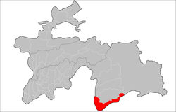 Location of Ishkoshim District in Tajikistan | |
| Coordinates: 36°45′N 71°40′E / 36.750°N 71.667°E | |
| Country | |
| Region | Gorno-Badakhshan Autonomous Region |
| Capital | Ishkoshim |
| Area | |
| • Total | 3,656 km2 (1,412 sq mi) |
| Population (2020)[1] | |
| • Total | 32,900 |
| • Density | 9.0/km2 (23/sq mi) |
| Time zone | UTC+5 (TJT) |
| Postal code | 736500 |
| Area code | +992 3553 |
| Official languages | |
| Website | ishkoshim |
The district is roughly V-shaped and lies northeast of the Panj River where its course turns from west to north. It is bordered on the south and west Afghanistan across the Panj River and the lower Pamir River and on the north by Roshtqal'a District. There are short borders with Shughnon District to the north and Murghab District to the east. The Shakhdara Range is along the northern border with Roshtqal'a District and the north–south Ishkoshim Range is along the district's eastern border.[3]
The district capital is Ishkoshim, a town at the bend of the Panj, opposite the Ishkashim District in Afghanistan. There is an ancient balas ruby (technically spinel) mine at Kuh-i-Lal. Ishkoshim District is a particularly attractive destination in Gorno-Badakhshan for its archaeological sites and spectacular scenery.[4]
Administrative divisions edit
The district has an area of about 3,700 km2 (1,000 sq mi) and is divided administratively into seven jamoats.[5] They are as follows:[6]
| Jamoat | Population (Jan. 2015)[6] |
|---|---|
| Ishkoshim (Rustambek Yusufbekov) | 7,673 |
| Ptup | |
| Qozideh | 1,880 |
| Shitkharv | 2,223 |
| Vrang | 6,541 |
| Askar Zamirov | 2,770 |
| Zong | 6,355 |
References edit
- ^ a b "Population of the Republic of Tajikistan as of 1 January 2020" (PDF) (in Russian). Statistics office of Tajikistan. Archived from the original (PDF) on 1 June 2021. Retrieved 3 October 2020.
- ^ "КОНСТИТУЦИЯ РЕСПУБЛИКИ ТАДЖИКИСТАН". prokuratura.tj. Parliament of Tajikistan. Retrieved 9 January 2020.
- ^ a b Republic of Tajikistan, map showing administrative division as of January 1, 2004, "Tojikkoinot" Cartographic Press, Dushanbe
- ^ Robert Middleton and Huw Thomas, Tajikistan and the High Pamirs, 2008
- ^ "Regions of the Republic of Tajikistan 2017" (PDF) (in Russian). Statistics office of Tajikistan. pp. 15–21. Archived from the original (PDF) on 28 March 2022. Retrieved 12 October 2020.
- ^ a b Jamoat-level basic indicators, United Nations Development Programme in Tajikistan, accessed 3 October 2020