


Summary
Jagtial district is a district located in the northern region of the Indian state of Telangana.[1] Its headquarters is Jagtial. The district shares boundaries with Nirmal, Mancherial, Karimnagar, Peddapalli, Sircilla and Nizamabad districts.[2][3]
Jagtial district | |
|---|---|
 Lakshmi Narasimha Swami temple, Dharmapuri | |
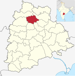 Location in Telangana | |
Jagtial districtCoordinates (Jagtial): .mw-parser-output .geo-default,.mw-parser-output .geo-dms,.mw-parser-output .geo-dec{display:inline}.mw-parser-output .geo-nondefault,.mw-parser-output .geo-multi-punct,.mw-parser-output .geo-inline-hidden{display:none}.mw-parser-output .longitude,.mw-parser-output .latitude{white-space:nowrap}18°42′N 78°54′E / 18.7°N 78.9°E | |
| Country | |
| State | Telangana |
| Headquarters | Jagtial |
| Mandalas | 18 |
| Government | |
| • District Collector | Shaik Yasmeen Basha |
| • Parliament constituencies | Nizamabad |
| • Assembly constituencies | Jagtial, Korutla, Dharmapuri |
| Area | |
| • Total | 2,419.00 km2 (933.98 sq mi) |
| Population (2011) | |
| • Total | 988,913 |
| • Density | 410/km2 (1,100/sq mi) |
| Time zone | UTC+05:30 (IST) |
| Website | jagtial |
Geography edit
The district is spread over an area of 2,419.00 square kilometres (933.98 sq mi).[4] Jagtial district shares it boundaries with Nirmal district and Mancherial district on North and North East respectively, it is bounded on South and South West by Karimnagar district and Peddapalli district respectively and on the West by Nizamabad district
Demographics edit
As of 2011[update] Census of India, the district has a population of 985,417, of which 221,336 (22.46%) live in urban areas. Jagtial district has a sex ratio of 1036 females per 1000 males and a literacy rate of 60.26%.[6] 93,272 (9.47%) were under 10 years of age. Scheduled Castes and Scheduled Tribes make up 164,596 (16.70%) and 23,351 (2.37%) of the population respectively.[7][8]
At the time of the 2011 census, 90.90% of the population spoke Telugu, 7.17% Urdu and 0.91% Lambadi as their first language.[9]
Administrative divisions edit
The district has three revenue divisions of Jagtial, Korutla and Metpally, which are sub-divided into 18 mandals.[10]
Mandals edit
The below table categorizes mandals into their respective revenue divisions in the district:
| Sr No. | Jagital revenue division | Korutla revenue division | Metpalli revenue division |
|---|---|---|---|
| 1 | Jagtial | Korutla | Metpalli |
| 2 | Jagtial Rural | Medipalle | Mallapur |
| 3 | Raikal | Kathlapur | Ibrahimpatnam |
| 4 | Sarangapur | ||
| 5 | Beerpur | ||
| 6 | Dharmapuri | ||
| 7 | Buggaram | ||
| 8 | Pegadapalli | ||
| 9 | Gollapalli | ||
| 10 | Mallial | ||
| 11 | Kodimial | ||
| 12 | Velgatoor |
Notable People edit
- Duvvasi Mohan Actor and comedian in Telugu cinema
- Venu Sriram Film director in Tollywood
- Harish Shankar Film director in Tollywood
- Alishetti Prabhakar, writer and painter
- Milkuri Gangavva, YouTuber Comedian Actress in Telugu Cinema
- Rohith Vakrala, Socio-Political Activist, Analyst, Policy Enthusiast
- T Jeevan Reddy politician, MLC, Ex R&B Minister
- Vamshi Paidipally Film Director in Tollywood
- Dr M Sanjay Kumar, politician Member of Legislative Assembly from 2018
National Highways edit
NH563 Jagtial - Karimnagar - Warangal - Khammam
NH63 Latur- Nizamabad - Jagtial - Mancherial - Bijapur Jagdalpur
NH61 Bhiwandi - Ahmadnagar - Nanded - Nirmal - Jagtial
See also edit
References edit
- ^ "Jagtial district" (PDF). Official website of Jagtial district. Archived from the original (PDF) on 10 January 2017. Retrieved 29 June 2017.
- ^ "Jagtial district" (PDF). Chief Commissioner of Land Administration. Archived from the original (PDF) on 9 September 2016. Retrieved 22 August 2016.
- ^ "New districts map". newdistrictsformation.telangana.gov.in. Retrieved 22 August 2016.[permanent dead link]
- ^ "New districts". Andhra Jyothy.com. 8 October 2016. Archived from the original on 25 December 2018. Retrieved 8 October 2016.
- ^ "Population by Religion - Andhra Pradesh". censusindia.gov.in. Registrar General and Census Commissioner of India. 2011.
- ^ "About District | District Jagtial, Government of Telangana | India". Retrieved 13 May 2023.
- ^ "District Census Handbook: Karimnagar" (PDF). censusindia.gov.in. Registrar General and Census Commissioner of India. 2011.
- ^ "Know your district Plan your district - Jagtial" (PDF). trac.telangana.gov.in. Telangana State Remote Sensing Applications Centre.
- ^ a b "Table C-16 Population by Mother Tongue: Andhra Pradesh". Census of India. Registrar General and Census Commissioner of India.
- ^ "Revenue divisions and mandals in Jagtial district" (PDF). The official website of Jagtial District. p. 3. Retrieved 29 June 2017.
External links edit
- Official website