


Summary
National Route 466 (国道466号, Kokudō Yonhyaku roku-jurokugō) is a national highway in Japan connecting Setagaya and Hodogaya-ku, Yokohama, with a total length of 18.4 kilometers (11.4 mi).
 | ||||
|---|---|---|---|---|
| 国道466号 | ||||
 | ||||
| Route information | ||||
| Length | 18.4 km[1] (11.4 mi) | |||
| Existed | 6 May 1993–present | |||
| Major junctions | ||||
| North end | ||||
| South end | ||||
| Location | ||||
| Country | Japan | |||
| Highway system | ||||
| ||||
List of interchanges and features edit
| Name | Connections | Dist. from origin (km) |
Notes | Location | |||
|---|---|---|---|---|---|---|---|
| Seta Intersection | 0.0 | From here to Tamagawa Interchange is commonly known (and signed) as Kanpachi-Dori | Setagaya | Tokyo | |||
| Tamagawa Interchange | Met. Route 311 (Kanjō Hachigō Route) | 1.8 | Northern terminus of the Daisan Keihin Road | Setagaya | Tokyo | ||
| Keihin-Kawasaki | 4.0 | Kanagawa | |||||
| Tsuzuki | 9.5 | Kanagawa | |||||
| Kohoku | 12.5 | Tsuzuki-ku, Shin Yokohama | Kanagawa | ||||
| Hodogaya | 17.0 | Kanagawa | |||||
| Through to | |||||||
Daisan Keihin Road edit
 | |
|---|---|
 | |
| Route information | |
| Maintained by East Nippon Expressway Company | |
| Length | 16.6 km (10.3 mi) |
| Existed | 1964–present |
| Component highways | |
| Major junctions | |
| North end | Setagaya |
| South end | Kanagawa-ku, Yokohama |
| Location | |
| Country | Japan |
| Highway system | |
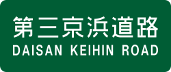
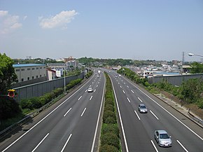
A major part of the National Route 466 is known as the Daisan Keihin Road (第三京浜道路, Daisan Keihin Dōro), a limited access toll road connecting Tokyo and Yokohama. It is managed by the East Nippon Expressway Company. In addition to its designation as National Route 466, the Daisan Keihin Road is signed as a part of E83 under the "2016 Proposal for Realization of Expressway Numbering".[2]
Route description edit
The toll road has three lanes traveling in each direction along the entire 16.6-kilometer (10.3 mi) route. The speed limit is set at 80 km/h along most of the toll road, the only exceptions to this limit is at the termini of the route where the limit is set at 60 km/h.
Tolls edit
In short, the tolls average at a cost of 50 to 100 yen per exit. To drive the entire route costs ¥390 for standard-sized cars.[3]
References edit
- ^ "一般国道の路線別、都道府県別道路現況" [Road statistics by General National Highway route and prefecture] (PDF) (in Japanese). Ministry of Land, Infrastructure, Transport and Tourism. Retrieved 11 February 2020.
- ^ "Japan's Expressway Numbering System". www.mlit.go.jp.
- ^ "東日本エリアの料金表:第三京浜道路・横浜新道・横浜横須賀道路" (PDF). NEXCO East (in Japanese). 1 April 2019. Retrieved 12 June 2019.
35°36′01″N 139°38′00″E / 35.60025°N 139.633285°E