


Summary
The Judith Mountains are located in central Montana[1] in the Central Montana Alkalic Province in Fergus County, just to the northeast of Lewistown, Montana.
| Judith Mountains | |
|---|---|
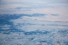 The Judith Mountains in winter | |
| Highest point | |
| Peak | Judith Peak |
| Elevation | 6,428 ft (1,959 m) |
| Coordinates | 47°13′08″N 109°13′43″W / 47.21889°N 109.22861°W |
| Geography | |
| Country | United States |
| State | Montana |
| Parent range | Rocky Mountains |
Judith Peak is the highest summit of this range, with an elevation of 6,428 feet (1,959 m).
History edit
To the southeast of Judith Peak lies the remains of Fort Maginnis. Fort Maginnis was built in 1880 to protect the cattle ranches, the gold mining camps in and around the Judith Mountains and the Carroll Trail. The fort was constructed following the battle of the Little Bighorn.[2][3][4]
In 1879, Granville Stuart and his friend Samuel T. Hauser along with Helena banker Andrew J. Davis established the Davis, Hauser and Stuart (DHS) cattle company. Stuart was made the general manager of the DHS brand and Stuart located the ranch headquarters on 800 acres (320 ha) on the southern slopes of the Judith Mountains near Flat Willow Creek.[5][6] The DHS Ranch was one of the largest open range cattle operations in the Central Montana prairie in the 1880s.[7]
Mining and geology edit

The geology the range includes limestone, sandstone, and siltstone of Cambrian to Cretaceous age which were intruded by alkaline intrusives of monzonite, syenite to tinguaite composition of Cretaceous to Tertiary age. Epithermal gold and silver veins are found along the intrusive contacts.[8]
The mountains were the center of gold and silver mining in the 1800s and current exploration continues.[4][9] The old mining camps of Maiden and Gilt Edge were built during the mining boom in the 1880s and 1890s.[4]

See also edit
References edit
- ^ U.S. Geological Survey Geographic Names Information System: Judith Mountains
- ^ The Building of Fort Maginnis, Lewistown News-Argus, Sunday, December 14, 1997 Archived April 25, 2012, at the Wayback Machine
- ^ Fort MaGinnis on Wikimapia
- ^ a b c "Judith/Moccasin Mountain Collaboration Cultural Resource Management Zane Fulbright February 21, 2008" (PDF). Archived from the original (PDF) on June 2, 2013. Retrieved December 5, 2011.
- ^ Reese, William S. (July 1981). "Granville Stuart of the DHS Ranch, 1879-1887". Montana The Magazine of Western History. XXXI (3).
- ^ MacMillan, D. (Spring 1970). "The Gilded Age and Montana's DHS Ranch". Montana: The Magazine of Western History. 20 (2). Montana Historical Society: 50–57. JSTOR 4517454.
- ^ Remley, David (Summer 1981). "Granville Stuart, Cowman: "To Struggle against an Adverse Fate"". Montana: The Magazine of Western History. 31 (3). Montana Historical Society: 28–41. JSTOR 4518584.
- ^ Bindi, Luca, Lenaite from the Gies Gold–Silver Telluride Deposit, Judith Mountains, Montana, USA; The Canadian Mineralogist, Vol. 44, pp. 207-212 (2006)
- ^ Gies Mine (Red Metal Claim group; Gies Mine; Elk Peak project; Bertha claim group), Cone Butte Sub District, Warm Spring District (Gilt Edge District; Gold Hill District; Maiden District), Fergus Co., Montana, USA
External links edit
- Judith Mountains