


Summary
Jugsalai is a township and business center adjacent to Tatanagar Railway Station, Jamshedpur and a municipality in the Dhalbhum subdivision of the Purbi Singhbhum district in the Indian state of Jharkhand. It is often referred as a wholesale market of Jamshedpur.
Jugsalai | |
|---|---|
Township | |
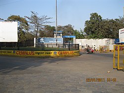 The Tata Pigments | |
 Jugsalai Location in Jharkhand, India  Jugsalai Jugsalai (India) | |
| Coordinates: 22°46′10″N 86°10′49″E / 22.76944°N 86.18028°E | |
| Country | |
| State | Jharkhand |
| District | Purbi Singhbhum |
| Government | |
| • Type | Municipality |
| Area | |
| • Total | 1.25 km2 (0.48 sq mi) |
| Population (2011) | |
| • Total | 49,660 |
| • Density | 40,000/km2 (100,000/sq mi) |
| Time zone | GMT +5:30 |
| PIN | 831006 |
| Telephone/STD code | 0657 |
| Vehicle registration | JH 05 |
| Literacy | 84.36% |
| Lok Sabha constituency | Jamshedpur |
| Vidhan Sabha constituency | Jugsalai |
| Website | jamshedpur |
Geography edit


3miles
Wildlife
Sanctuary
River
River
Location edit
Jugsalai is located at 22°46′10″N 86°10′49″E / 22.76944°N 86.18028°E.
Jugsalai has an average elevation of 140 metres (459 feet).[1]
Jamshedpur Urban Agglomeration edit
With its recognition as an industrial town as early as the 1911 census, Jamshedpur was set on the road of steady population growth, as large number of emigrants flocked in for work opportunities. While in the earlier decades the central nucleus grew, in the later decades towns around Jamshedpur grew rapidly. In 2011, Jamshedpur Urban Agglomeration included 13 urban centres, with a total population of 1.3 million people. However, in more recent years, Jamshedpur UA “has lacked the growth and development observed around other similar industrial towns in western and southern India.”[2]
Note: The map alongside presents the Jamshedpur Urban Agglomeration. All places marked in the map are linked in the larger full screen map.
Civic administration edit
The first police station in the area was opened in 1912 at Jugsalai.[3]
Demographics edit
According to the 2011 Census of India, Jugsalai had a total population of 49,660, of which 26,036 (52%) were males and 23,624 (48%) were females. Population in the age range 0-6 years was 6,115. The total number of literate persons in Jugsalai was 36,773 (84.36% of the population over 6 years).[4]
(*For language details see Golmuri-cum-Jugsalai block#Language and religion)
Jamshedpur Urban Agglomeration includes: Jamshedpur (Industrial Town), Jamshedpur (NAC), Tata Nagar Railway Colony (OG), Mango (NAC), Jugsalai (M), Bagbera (CT), Chhota Gobindpur (CT), Haludbani (CT), Sarjamda (CT), Gadhra (CT), Ghorabandha (CT), Purihasa (CT), Adityapur (M Corp.), Chota Gamahria (CT) and Kapali (CT).[5]
As of 2001[update] India census,[6] Jugsalai had a population of 46,061. Males constitute 52% of the population and females 48%. Jugsalai has an average literacy rate of 72%, higher than the national average of 59.5%: male literacy is 77%, and female literacy is 67%. In Jugsalai, 13% of the population is under 6 years of age.
Major festivals celebrations in the Jugsalai area include in Chhath Puja Durga Puja, Makar Sankranti, Deepavali, Kali Puja, Holi, Christmas, Easter, Shab-e-baraat, Ramadan, Eid-al-fitr, Eid al-adha, Mawlid, Muharram. Hindu is the Majority Religion in Jugsalai.
Infrastructure edit
According to the District Census Handbook 2011, Purbi Singhbhum, Jugsalai covered an area of 1.25 km2 (0.48 sq mi). It has an annual rainfall of 1,030.2 mm (40.56 in). Among the civic amenities, it had 17.47 km (10.86 mi) of roads with both closed and open drains, the protected water supply involved tap water from treated sources, tube well/ borewell, overhead tank. It had 8,366 domestic electric connections, 386 road lighting points. Among the medical facilities, it had 1 hospital (with 30 beds), 2 dispensaries, 2 health centres, 1 family welfare centre, 6 maternity and child welfare centres,1 maternity home, 1 nursing home, 2 charitable hospitals/ nursing homes, 1 veterinary hospital, 17 medicine shops. Among the educational facilities it had 5 primary schools, 5 middle schools, 4 secondary schools, the nearest senior secondary school at Bishtupur, 3 km (1.9 mi) away, the nearest general degree college at Jamshedpur, 4 km (2.5 mi) away. Among social, cultural and recreational facilities, it had 1 cinema theatre, 2 public library, 2 reading room. It had flour mill, oil mill and produced steel almirahs. It had the branch offices of 5 nationalised banks, 1 cooperative bank, 1 agricultural credit society, 2 non-agricultural credit societies.[7]
Main areas edit
.* Dispensary Road Bhogendra * Mishra Niwas * Ghoda Chowk * Chowk Bazaar * Gouri Shankar Road * Shahid Thakurji Pathak House * Saffi Gang Muhalla * Goushala Nala Road * Bengali Para * R.P Patel School Road * Gouri Shankar Road * Marwari Para * Panchhi Mohallah * Gwala Para * Chaparia Mohallah * Millatnagar * Islamnagar * Chuna Shah Colony * Rahbar Lane * Habibnagar * Gharib Nawaz Colony * Station Road * Mahato Para Road * Kali Asthan Road * Huma Lane * Ram Tekri Road * Nagar Palika Chowk * M.E. School Road * Safihganj Mohallah * Gadhabasa * Girls School Road * Rahmat Lane * Fish Lane * Ghausia Lane * Harijan Basti .* Patnaiya Colony * D.B. Road * Sachchidanand Mishra coal Industry * Hussaini Lane * Chuna Bhatta * Shiv Ghat R* Hill View Area * Raja Ram Badi * Dhobi Lane * Dry Fish Godwon * M.E. School road * River View Colony * P.B.Road * Pareek Bhawan.
Notable people edit
- Thakur Ji Pathak ठाकुर जी पाठक Indian Activist, Politician From Jamshedpur Jharkhand, Born at Uttar Pradesh.
- Ram Chandra Sahis Politician, Ex-MLA Jugsalai Vidhansabha Constituency.
- Mangal Kalindi Politician, Jugsalai Vidhansabha Constituency.
References edit
- ^ Falling Rain Genomics, Inc - Jugsalai
- ^ "Growth of Industrial Cities in India: A Case Study of Jamshedpur" (PDF). Amaresh Dubey. The Third Conference: GIS-based Global History from Asian Perspectives, 5 June 2015. Retrieved 25 December 2021.
- ^ "District Police Profile – East Singhbhum". Brief Summary of the District. Jharkhand Police. Archived from the original on 22 June 2022. Retrieved 30 December 2021.
- ^ "District Census Handbook, Purbi Singhbhum, Series 21, Part XII B" (PDF). Location code: 801782, Pages 358-359: District primary census abstract, 2011 census. Directorate of Census Operations Jharkhand. Retrieved 15 December 2021.
- ^ "Constituents of Urban Agglomerations Having Population 1 Lakh & above" (PDF). Provisional Population Totals, Census of India 2011. Retrieved 15 December 2021.
- ^ "Census of India 2001: Data from the 2001 Census, including cities, villages and towns (Provisional)". Census Commission of India. Archived from the original on 16 June 2004. Retrieved 1 November 2008.
- ^ "District Census Handbook, Purbi Singhbhum, Series 21, Part XII A" (PDF). Pages 863-871. Directorate of Census Operations Jharkhand. Retrieved 14 December 2021.
- जुगसलाई पिगमेंट पार्क में शहीद ठाकुर जी पाठक सोसाइटी के द्वारा वृक्षारोपण किया गया।. pathaknetwork.com (in Hindi). Retrieved 8 November 2019.