
KNOWPIA
WELCOME TO KNOWPIA

Julu County 
Summary
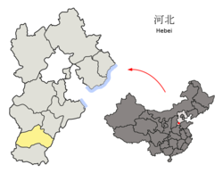
Julu (simplified Chinese: 巨鹿; traditional Chinese: 鉅鹿; pinyin: Jùlù) is a county of Xingtai City, in the south of Hebei province, China. Prior to the Sui Dynasty, Julu had been known as Nanyi County (南亦县; Nányì Xiàn). The name was changed and became Julu, with the Chinese for Ju being written either as either "巨" or "钜". In 1980, the name was standardized as "巨鹿". The county has a population of 370,000[when?] residing in an area of 623 km2 (241 sq mi).
Julu County
巨鹿县 Kulu | |
|---|---|
 | |
 Baixiang in Xingtai | |
 Xingtai in Hebei | |
| Coordinates: 37°13′16″N 115°02′13″E / 37.221°N 115.037°E | |
| Country | People's Republic of China |
| Province | Hebei |
| Prefecture-level city | Xingtai |
| County seat | Julu (巨鹿镇) |
| Area | |
| • Total | 623 km2 (241 sq mi) |
| Elevation | 31 m (102 ft) |
| Population | |
| • Total | 370,000 |
| • Density | 590/km2 (1,500/sq mi) |
| Time zone | UTC+8 (China Standard) |
| Postal code | 055250 |
Administrative divisions edit
The county administers 6 towns and 4 townships.[1]
Towns:
- Julu (巨鹿镇), Wanghuzhai (王虎寨镇), Xiguocheng (西郭城镇), Guanting (官亭镇), Yantuan (阎疃镇), Xiaolüzhai (小吕寨镇)
Townships:
- Ticun Township (堤村乡), Zhangwangtuan Township (张王疃乡), Guanzhai Township (观寨乡), Sujiaying Township (苏家营乡)
Climate edit
| Climate data for Julu (1991–2020 normals, extremes 1981–2010) | |||||||||||||
|---|---|---|---|---|---|---|---|---|---|---|---|---|---|
| Month | Jan | Feb | Mar | Apr | May | Jun | Jul | Aug | Sep | Oct | Nov | Dec | Year |
| Record high °C (°F) | 18.3 (64.9) |
24.8 (76.6) |
28.6 (83.5) |
35.6 (96.1) |
41.6 (106.9) |
40.9 (105.6) |
41.1 (106.0) |
37.6 (99.7) |
38.0 (100.4) |
32.7 (90.9) |
27.3 (81.1) |
22.5 (72.5) |
41.6 (106.9) |
| Mean daily maximum °C (°F) | 3.6 (38.5) |
8.0 (46.4) |
15.0 (59.0) |
22.1 (71.8) |
27.8 (82.0) |
32.3 (90.1) |
32.4 (90.3) |
30.6 (87.1) |
27.0 (80.6) |
21.1 (70.0) |
12.1 (53.8) |
5.1 (41.2) |
19.8 (67.6) |
| Daily mean °C (°F) | −2.2 (28.0) |
1.8 (35.2) |
8.5 (47.3) |
15.5 (59.9) |
21.4 (70.5) |
26.1 (79.0) |
27.4 (81.3) |
25.8 (78.4) |
21.1 (70.0) |
14.5 (58.1) |
6.0 (42.8) |
−0.4 (31.3) |
13.8 (56.8) |
| Mean daily minimum °C (°F) | −6.6 (20.1) |
−3.0 (26.6) |
3.0 (37.4) |
9.6 (49.3) |
15.5 (59.9) |
20.5 (68.9) |
23.2 (73.8) |
21.8 (71.2) |
16.4 (61.5) |
9.3 (48.7) |
1.4 (34.5) |
−4.5 (23.9) |
8.9 (48.0) |
| Record low °C (°F) | −23.0 (−9.4) |
−17.4 (0.7) |
−10.0 (14.0) |
−1.5 (29.3) |
4.1 (39.4) |
11.2 (52.2) |
17.0 (62.6) |
14.1 (57.4) |
4.0 (39.2) |
−3.7 (25.3) |
−13.2 (8.2) |
−20.6 (−5.1) |
−23.0 (−9.4) |
| Average precipitation mm (inches) | 2.5 (0.10) |
7.4 (0.29) |
9.2 (0.36) |
25.8 (1.02) |
39.6 (1.56) |
61.2 (2.41) |
141.3 (5.56) |
116.8 (4.60) |
50.1 (1.97) |
25.7 (1.01) |
15.7 (0.62) |
3.4 (0.13) |
498.7 (19.63) |
| Average precipitation days (≥ 0.1 mm) | 1.9 | 3.1 | 2.6 | 5.3 | 6.8 | 7.9 | 10.9 | 9.5 | 6.7 | 5.5 | 3.9 | 2.3 | 66.4 |
| Average snowy days | 3.5 | 3.1 | 1.0 | 0.2 | 0 | 0 | 0 | 0 | 0 | 0 | 1.2 | 3.1 | 12.1 |
| Average relative humidity (%) | 61 | 56 | 52 | 56 | 59 | 60 | 75 | 80 | 74 | 68 | 68 | 65 | 65 |
| Mean monthly sunshine hours | 148.6 | 156.2 | 207.9 | 232.6 | 259.1 | 227.2 | 197.5 | 193.7 | 186.5 | 180.7 | 151.6 | 145.4 | 2,287 |
| Percent possible sunshine | 48 | 51 | 56 | 59 | 59 | 52 | 44 | 47 | 51 | 53 | 50 | 49 | 52 |
| Source: China Meteorological Administration[2][3] | |||||||||||||
References edit
- ^ 2011年统计用区划代码和城乡划分代码:巨鹿县 (in Chinese). National Bureau of Statistics of the People's Republic of China. Retrieved 2012-07-21.
- ^ 中国气象数据网 – WeatherBk Data (in Simplified Chinese). China Meteorological Administration. Retrieved 25 August 2023.
- ^ 中国气象数据网 (in Simplified Chinese). China Meteorological Administration. Retrieved 25 August 2023.
External links edit
- http://www.0319xt.cn/renwen/xiangxi.asp?id=272