
KNOWPIA
WELCOME TO KNOWPIA

Jumencourt 
Summary
Jumencourt (French pronunciation: [ʒymɑ̃kuʁ]) is a commune in the Aisne department in Hauts-de-France in northern France.
Jumencourt | |
|---|---|
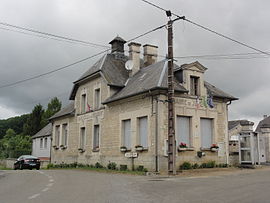 The town hall and school of Jumencourt | |
 Coat of arms | |
Location of Jumencourt .mw-parser-output .locmap .od{position:absolute}.mw-parser-output .locmap .id{position:absolute;line-height:0}.mw-parser-output .locmap .l0{font-size:0;position:absolute}.mw-parser-output .locmap .pv{line-height:110%;position:absolute;text-align:center}.mw-parser-output .locmap .pl{line-height:110%;position:absolute;top:-0.75em;text-align:right}.mw-parser-output .locmap .pr{line-height:110%;position:absolute;top:-0.75em;text-align:left}.mw-parser-output .locmap .pv>div{display:inline;padding:1px}.mw-parser-output .locmap .pl>div{display:inline;padding:1px;float:right}.mw-parser-output .locmap .pr>div{display:inline;padding:1px;float:left}html.skin-theme-clientpref-night .mw-parser-output .od,html.skin-theme-clientpref-night .mw-parser-output .od .pv>div,html.skin-theme-clientpref-night .mw-parser-output .od .pl>div,html.skin-theme-clientpref-night .mw-parser-output .od .pr>div{background:#000;color:#fff}html.skin-theme-clientpref-night .mw-parser-output .locmap{filter:grayscale(0.6)}@media(prefers-color-scheme:dark){html.skin-theme-clientpref-os .mw-parser-output .locmap{filter:grayscale(0.6)}html.skin-theme-clientpref-os .mw-parser-output .od,html.skin-theme-clientpref-os .mw-parser-output .od .pv>div,html.skin-theme-clientpref-os .mw-parser-output .od .pl>div,html.skin-theme-clientpref-os .mw-parser-output .od .pr>div{background:#000;color:#fff}}  Jumencourt  Jumencourt | |
| Coordinates: 49°30′34″N 3°21′17″E / 49.5094°N 3.3547°E | |
| Country | France |
| Region | Hauts-de-France |
| Department | Aisne |
| Arrondissement | Laon |
| Canton | Vic-sur-Aisne |
| Intercommunality | Picardie des Châteaux |
| Government | |
| • Mayor (2020–2026) | Rodrigue Marouze[1] |
| Area 1 | 6.2 km2 (2.4 sq mi) |
| Population (2021)[2] | 132 |
| • Density | 21/km2 (55/sq mi) |
| Time zone | UTC+01:00 (CET) |
| • Summer (DST) | UTC+02:00 (CEST) |
| INSEE/Postal code | 02395 /02380 |
| Elevation | 51–168 m (167–551 ft) (avg. 68 m or 223 ft) |
| 1 French Land Register data, which excludes lakes, ponds, glaciers > 1 km2 (0.386 sq mi or 247 acres) and river estuaries. | |
Geography edit
The river Ailette forms all of the commune's southern border.
Population edit
| Year | Pop. | ±% |
|---|---|---|
| 1962 | 108 | — |
| 1968 | 109 | +0.9% |
| 1975 | 98 | −10.1% |
| 1982 | 94 | −4.1% |
| 1990 | 111 | +18.1% |
| 1999 | 119 | +7.2% |
| 2008 | 155 | +30.3% |
See also edit
References edit
- ^ "Répertoire national des élus: les maires". data.gouv.fr, Plateforme ouverte des données publiques françaises (in French). 9 August 2021.
- ^ "Populations légales 2021". The National Institute of Statistics and Economic Studies. 28 December 2023.
Wikimedia Commons has media related to Jumencourt.