


Summary
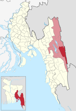
Juraichhari (Bengali: জুরাছড়ি) is an upazila of Rangamati District[1] in the Division of Chittagong, Bangladesh.
Juraichhari
জুরাছড়ি | |
|---|---|
 | |
| Coordinates: 22°40′N 92°23′E / 22.667°N 92.383°E | |
| Country | |
| Division | Chittagong |
| District | Rangamati |
| Area | |
| • Total | 606.05 km2 (234.00 sq mi) |
| Population (2011) | |
| • Total | 27,786 |
| • Density | 46/km2 (120/sq mi) |
| Time zone | UTC+6 (BST) |
| Website | Official Map of Juraichhari |
Geography edit
Juraichhari is located at 22°40′00″N 92°23′00″E / 22.6667°N 92.3833°E. It has 6,136 households and total area 606.05 km2. Juraichhari is bordered by Barkal upazila to the north, Rangamati Sadar and Belaichhari upazilas to the west and the Indian state of Mizoram to the east.
Demographics edit
As of the 2011 Bangladeshi census, Juraichhari upazila had 6,136 households and a population of 27,786. 6,841 (24.62%) were under 10 years of age. Juraichhari had an average literacy rate of 46.8%, compared to the national average of 51.8%, and a sex ratio of 872 females per 1000 males. 5,895 (21.22%) of the population lived in urban areas.[2] The ethnic population was 26,331 (94.76%), of which Chakma were 25,199 and Tanchangya 928.[3]
As of the 1991 Bangladesh census, Juraichhari had a population of 11621. Males constituted 52.16% of the population, while females 47.84%. This Upazila's eighteen up population is 6158. Juraichhari has an average literacy rate of 23.4% (7+ years), and the national average of 32.4% literate.[4]
Administration edit
Juraichhari Upazila is divided into four union parishads: Banjugichhara, Dumdumya, Juraichhari, and Maidang. The union parishads are subdivided into 11 mauzas and 105 villages.[5]
See also edit
References edit
- ^ Gautam Chandra Modak (2012), "Juraichhari Upazila", in Sirajul Islam and Ahmed A. Jamal (ed.), Banglapedia: National Encyclopedia of Bangladesh (Second ed.), Asiatic Society of Bangladesh
- ^ a b "Bangladesh Population and Housing Census 2011 Zila Report – Rangamati" (PDF). bbs.gov.bd. Bangladesh Bureau of Statistics.
- ^ "Community Tables: Rangamati district" (PDF). bbs.gov.bd. Bangladesh Bureau of Statistics. 2011.
- ^ "Population Census Wing, BBS". Archived from the original on 2005-03-27. Retrieved November 10, 2006.
- ^ "District Statistics 2011: Rangamati" (PDF). Bangladesh Bureau of Statistics. Archived from the original (PDF) on 13 November 2014. Retrieved 14 July 2014.