


Summary
Juybar County (Persian: شهرستان جویبار) is in Mazandaran province, Iran. Its capital is the city of Juybar. The county was separated from Qaem Shahr County in 1997.[4]
Juybar County
Persian: شهرستان جویبار | |
|---|---|
County | |
 Wrestling Square, Juybar | |
 Location of Juybar County in Mazandaran province (top right center, yellow) | |
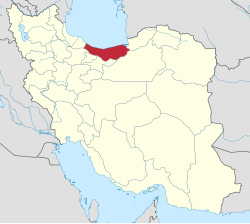 Location of Mazandaran province in Iran | |
| Coordinates: 36°40′N 52°53′E / 36.667°N 52.883°E[1] | |
| Country | |
| Province | Mazandaran |
| Capital | Juybar |
| Districts | Central, Gil Khuran, Larim |
| Area | |
| • Total | 285.50 km2 (110.23 sq mi) |
| Population (2016)[3] | |
| • Total | 77,576 |
| • Density | 270/km2 (700/sq mi) |
| Time zone | UTC+3:30 (IRST) |
| Juybar County can be found at GEOnet Names Server, at this link, by opening the Advanced Search box, entering "9207243" in the "Unique Feature Id" form, and clicking on "Search Database". | |
At the 2006 census, the county's population was 70,204 in 18,276 households.[5] The following census in 2011 counted 73,554 people in 21,697 households.[6] At the 2016 census, the county's population was 77,576 in 25,278 households.[3] Despite its small population, this county is the most prolific in terms of having national champions in wrestling, the national sport of Iran.[citation needed]
Administrative divisions edit
The population history of Juybar County's administrative divisions over three consecutive censuses is shown in the following table. The latest census shows two districts, four rural districts, and two cities.[3]
In 2023, Larim Rural District was separated from Gil Khuran District in the establishment of Larim District. Chapakrud-e Gharbi and Chapakrud-e Sharqi Rural Districts were established in Gil Khuran District.[7]
| Administrative Divisions | 2006[5] | 2011[6] | 2016[3] |
|---|---|---|---|
| Central District | 49,329 | 51,865 | 54,819 |
| Hasan Reza RD | 8,292 | 8,024 | 8,181 |
| Siyahrud RD | 13,920 | 14,719 | 13,714 |
| Juybar (city) | 27,117 | 29,122 | 32,924 |
| Gil Khuran District | 20,875 | 21,689 | 22,757 |
| Chapakrud RD | 9,465 | 9,697 | 9,968 |
| Chapakrud-e Gharbi RD1 | |||
| Chapakrud-e Sharqi RD1 | |||
| Larim RD | 9,471 | 9,931 | 10,547 |
| Kuhi Kheyl (city) | 1,939 | 2,061 | 2,242 |
| Larim District1 | |||
| Larim-e Jonubi RD1 | |||
| Larim-e Shomali RD1 | |||
| Total | 70,204 | 73,554 | 77,576 |
| RD: Rural District 1Established after the 2016 census[7] | |||
References edit
- ^ OpenStreetMap contributors (24 May 2023). "Juybar County" (Map). OpenStreetMap. Retrieved 24 May 2023.
- ^ Management and Planning Organization of Mazandaran, 2006 Archived November 16, 2013, at the Wayback Machine
- ^ a b c d "Census of the Islamic Republic of Iran, 1395 (2016)". AMAR (in Persian). The Statistical Center of Iran. p. 02. Archived from the original (Excel) on 7 October 2021. Retrieved 19 December 2022.
- ^ Habibi, Hassan (7 February 1376). "Approval letter regarding divisional reforms in Mazandaran province". Laws and Regulations Portal of the Islamic Republic of Iran (in Persian). Ministry of Interior, Political-Defense Commission of the Government Council. Archived from the original on 11 May 2023. Retrieved 24 May 2023.
- ^ a b "Census of the Islamic Republic of Iran, 1385 (2006)". AMAR (in Persian). The Statistical Center of Iran. p. 02. Archived from the original (Excel) on 20 September 2011. Retrieved 25 September 2022.
- ^ a b "Census of the Islamic Republic of Iran, 1390 (2011)". Syracuse University (in Persian). The Statistical Center of Iran. p. 02. Archived from the original (Excel) on 19 January 2023. Retrieved 19 December 2022.
- ^ a b "Approval letter regarding country divisions of Juybar County of Mazandaran province". RRK (in Persian). Ministry of Interior, Board of Ministers. 17 May 1402. Archived from the original on 24 May 2023. Retrieved 24 May 2023.