


Summary
Kaitaia Airport (IATA: KAT, ICAO: NZKT) is an airport located 5km Northeast of Kaitaia, in the Far North District of New Zealand. The land the airport is situated on is owned by Crown and leased to the Far North District Council (FNDC), who contracts Far North Holdings Limited (FNHL) to manage the aerodrome.
Kaitaia Airport | |||||||||||||||
|---|---|---|---|---|---|---|---|---|---|---|---|---|---|---|---|
| Summary | |||||||||||||||
| Airport type | Public | ||||||||||||||
| Operator | Far North Holdings Ltd. | ||||||||||||||
| Location | Kaitaia | ||||||||||||||
| Elevation AMSL | 270 ft / 82 m | ||||||||||||||
| Coordinates | 35°04′12″S 173°17′07″E / 35.07000°S 173.28528°E | ||||||||||||||
| Website | https://kaitaiaairport.co.nz/ | ||||||||||||||
| Map | |||||||||||||||
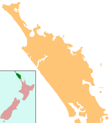 KAT Location of airport in Northland | |||||||||||||||
| Runways | |||||||||||||||
| |||||||||||||||
History edit
Kaitāia Aerodrome was originally built for American long-range bombers around the time of the second world war so that the aircraft could reach parts of the South Pacific from their base in the Far North.
On 13 June 2005, Kaitaia Airport received an injection of $333,850 to upgrade its runway facilities so that it could accommodate larger aircraft. The Far North District Council approved loan funding for Kaitaia Airport's project to allow it to accommodate aircraft with a pavement classification number PCN 15. This upgrade would allow Air New Zealand to fly into Kaitaia with its Bombardier and ATR 72-500 aircraft. During the project, $1.4 million invested into the airport was to provide larger hardstand areas and better terminal facilities.[citation needed]
At the end of April 2015, Air New Zealand discontinued its service between Kaitaia and Auckland. Barrier Air began operating the route with a Cessna Caravan from 28 April 2015.[1]
Aircraft transit edit
Kaitaia Airport is the most northern airfield in New Zealand that has fuel available. It has a long and smooth runway, the longest in Northland, and is used by light aircraft, as well as private aircraft such as the Gulfstream V.[citation needed]
852 km to the north-west of Kaitaia is Norfolk Island Airport, from which it is 754 km to Nouméa in New Caledonia, or 900 km to Lord Howe Island, which can be used as a stepping stone to the Australian mainland. These distances are within the range of many light aircraft fitted with long range tanks, while the direct distances are usually used with the larger private aircraft which are able to land at Kaitaia Airport. From New Caledonia other Pacific Islands such as Vanuatu and Fiji are within range and can be used as further 'stepping stones' to the other South Pacific and North Pacific destinations.[citation needed]
Airlines and destinations edit
| Airlines | Destinations |
|---|---|
| Barrier Air | Auckland[2] |
Kaitaia Airport previously received Beechcraft 1900Ds, operated by Eagle Air on behalf of Air New Zealand, twice daily Monday–Friday and daily Saturday–Sunday. This route was taken over by Barrier Air from 28 April 2015. Other airlines also expressed interest in operating the route, including Tauranga-based Sunair.[3]
The airport is home to the Kaitaia Aero Club, which operates a small flight school from its hangar.[4]
See also edit
References edit
- ^ L, Steve (16 August 2015). "3rd Level New Zealand: Barrier Air - The new name to the Barrier and Kaitaia". 3rd Level New Zealand. Retrieved 3 January 2020.
- ^ "Small Kiwi airline comes to Kaitaia's rescue". TVNZ.
- ^ "Sunair looks at abandoned Air NZ routes, blames airports for high fares". 17 November 2014.
- ^ "Home". kac.co.nz. Retrieved 3 January 2020.
External links edit
- Far North Holdings Ltd.
- About Far North Holdings Ltd.