


Summary
Kalat County (Persian: شهرستان کلات) is in Razavi Khorasan province, Iran. Its capital is the city of Kalat.[3] Around half of the people of Kalat County are Tekke Turkmen; 35% are Kurdish and 15% are Persian.[4]
Kalat County
Persian: شهرستان کلات | |
|---|---|
County | |
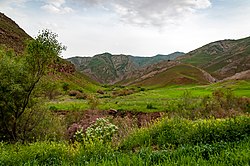 Landscape near Spa Waterfall | |
 Location of Kalat County in Razavi Khorasan province (top right, purple) | |
 Location of Razavi Khorasan province in Iran | |
| Coordinates: 36°51′N 59°52′E / 36.850°N 59.867°E[1] | |
| Country | |
| Province | Razavi Khorasan |
| Capital | Kalat |
| Districts | Central, Hezarmasjed, Zavin |
| Area | |
| • Total | 3,503 km2 (1,353 sq mi) |
| Population (2016)[2] | |
| • Total | 36,237 |
| • Density | 10/km2 (27/sq mi) |
| Time zone | UTC+3:30 (IRST) |
| Kalat County at GEOnet Names Server | |
At the 2006 census, the county's population was 39,560 in 9,489 households.[5] The following census in 2011 counted 38,232 people in 10,298 households.[6] At the 2016 census the county's population was 36,237, in 10,708 households.[2]
Administrative divisions edit
The population history of Kalat County's administrative divisions over three consecutive censuses is shown in the following table. The latest census shows two districts, four rural districts, and two cities.[2]
After the census, Charam Rural District was established in the Central District, and Hezarmasjed Rural District was separated from the district in the establishment of Hezarmasjed District.[7] In addition, the villages of Chenar[8] and Hasanabad-e Layen-e Now[9] were elevated to city status.
| Administrative Divisions | 2006[5] | 2011[6] | 2016[2] |
|---|---|---|---|
| Central District | 22,928 | 22,421 | 21,820 |
| Charam RD1 | |||
| Hezarmasjed RD | 6,010 | 5,772 | 6,075 |
| Kabud Gonbad RD | 10,389 | 9,117 | 8,058 |
| Kalat (city) | 6,529 | 7,532 | 7,687 |
| Hezarmasjed District1 | |||
| Hezarmasjed RD | |||
| Layen RD1 | |||
| Hasanabad-e Layen-e Now (city)2 | |||
| Zavin District | 16,632 | 15,811 | 14,417 |
| Pasakuh RD | 3,647 | 3,314 | 3,046 |
| Zavin RD | 8,932 | 8,408 | 7,626 |
| Chenar (city)2 | |||
| Shahr-e Zow (city) | 4,053 | 4,089 | 3,745 |
| Total | 39,560 | 38,232 | 36,237 |
| RD: Rural District 1Established after the 2016 census[7] 2Became a city after the 2016 census[8][9] | |||
References edit
- ^ OpenStreetMap contributors (30 April 2023). "Kalat County" (Map). OpenStreetMap. Retrieved 30 April 2023.
- ^ a b c d "Census of the Islamic Republic of Iran, 1395 (2016)". AMAR (in Persian). The Statistical Center of Iran. p. 09. Archived from the original (Excel) on 2 April 2022. Retrieved 19 December 2022.
- ^ Aref, Mohammad Reza (18 December 1381). "Letter of approval regarding divisional reforms in Khorasan province (Zavin District, Kalat County, Central District)". Laws and Regulations Portal of the Islamic Republic of Iran (in Persian). Ministry of Interior, Political-Defense Commission of the Cabinet of Ministers. Archived from the original on 7 January 2024. Retrieved 7 January 2024.
- ^ Khosravi, Mohammad Reza (1367). Kalat Naderi (in Persian). Astan Quds Razavi Publishing House.
- ^ a b "Census of the Islamic Republic of Iran, 1385 (2006)". AMAR (in Persian). The Statistical Center of Iran. p. 09. Archived from the original (Excel) on 20 September 2011. Retrieved 25 September 2022.
- ^ a b "Census of the Islamic Republic of Iran, 1390 (2011)". Syracuse University (in Persian). The Statistical Center of Iran. p. 09. Archived from the original (Excel) on 20 January 2023. Retrieved 19 December 2022.
- ^ a b Jahangiri, Ishaq (15 February 1400). "Letter of approval regarding country divisions in Kalat County, Razavi Khorasan province". Laws and Regulations Portal of the Islamic Republic of Iran (in Persian). Ministry of Interior, Council of Ministers. Archived from the original on 30 April 2023. Retrieved 30 April 2023.
- ^ a b "Approval regarding the conversion of Chenar village, Zavin Rural District, Zavin District, Kalat County, Razavi Khorasan province, into a city". RRK (in Persian). Ministry of Interior. Archived from the original on 30 April 2021. Retrieved 30 April 2023.
- ^ a b "The approval of the Minister of Interior to establish municipalities in 5 cities". Khabar Online (in Persian). Ministry of Interior. Archived from the original on 6 November 2021. Retrieved 30 April 2023.