


Summary
Kaleen (/keɪˈliːn/ kay-LEEN or /kəˈliːn/ kə-LEEN) is a suburb in the Belconnen district of Canberra, located within the Australian Capital Territory, Australia. The suburb's name is derived from the word for 'water' in the language of the Wiradjuri Aboriginal tribe of the central west region of New South Wales. Kaleen was gazetted as a suburb on 15 January 1974. The streets are named after Australian rivers.[2]
| Kaleen Canberra, Australian Capital Territory | |||||||||||||||
|---|---|---|---|---|---|---|---|---|---|---|---|---|---|---|---|
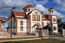 All Saints Greek Orthodox Church | |||||||||||||||
 Kaleen | |||||||||||||||
| Coordinates | 35°13′13″S 149°06′09″E / 35.22028°S 149.10250°E | ||||||||||||||
| Population | 7,672 (SAL 2021)[1] | ||||||||||||||
| Established | 1974 | ||||||||||||||
| Postcode(s) | 2617 | ||||||||||||||
| Elevation | 601 m (1,972 ft) | ||||||||||||||
| Area | 6.0 km2 (2.3 sq mi) | ||||||||||||||
| Location |
| ||||||||||||||
| District | Belconnen | ||||||||||||||
| Territory electorate(s) | Yerrabi | ||||||||||||||
| Federal division(s) | Canberra | ||||||||||||||
| |||||||||||||||
The suburb is next to Lyneham, Giralang, Lawson and Bruce. It is bordered by Baldwin Drive and Ginninderra Drive. It has several ovals; Kaleen North oval, Kaleen Enclosed oval, Kaleen District Playing Fields and Kaleen South oval, which play host to a number of sports, including soccer, cricket, and rugby. Unusually for a suburb, there are two small shopping centres in Kaleen, both bordering the main street of Maribyrnong Avenue. There is also a larger shopping centre near Kaleen's border with Giralang on Georgina Crescent.
The 2XX transmitting station is also located in Kaleen, near the Barton Highway. On the east side of the suburb is the Lyneham Ridge eucalypt plantation and a horse holding paddock. Kaleen, like most of Canberra, is located on a network of well-maintained bicycle paths. The main track in Kaleen passes under Ginninderra Drive, and runs through the middle of the suburb in a generally north–south direction, exiting the other side to the neighbouring suburb of Giralang.
Political representation edit
For the purposes of Australian federal elections for the House of Representatives, Kaleen is in the Division of Canberra.[3]
For the purposes of Australian Capital Territory elections for the ACT Legislative Assembly, Kaleen is in the Yerrabi electorate.[4]
Geology edit

Silurian age Canberra Formation calcareous shale is found in the east of Kaleen. Ordovician age Pittman Formation greywacke is in the west of the suburb. The Gungahlin Fault separates the two kinds of sediments, with the older greywacke being uplifted. Also to the east is the Winslade Fault roughly parallel and aligned north east.[5]
Churches and schools edit
Georgina Crescent is surrounded on three sides by several religious structures, including a Greek Orthodox church, a Coptic Orthodox church, and an Anglican church, St. Simon's Kaleen. St. Michael's Catholic Church and school are located nearby in Tyrrell Circuit. The suburb also has two government run primary schools: Maribyrnong Primary School (located in Alberga Street, Kaleen) and Kaleen Primary School. Kaleen High School is located off Baldwin drive.
- All Saints (Old Calendar) Greek Orthodox Church, Canberra.
- St Mark Coptic Orthodox Church, Canberra – Australia
- Anglican Church Canberra & Goulburn Diocese
References edit
- ^ Australian Bureau of Statistics (28 June 2022). "Kaleen (suburb and locality)". Australian Census 2021 QuickStats. Retrieved 28 June 2022.
- ^ "Suburb Name search results". ACT Environment and Sustainable Development. Retrieved 11 February 2014.
- ^ "Profile of the electoral division of Canberra (ACT)". Current federal electoral divisions. Australian Electoral Commission. 17 August 2018. Retrieved 21 June 2019.
- ^ "Electorates 2012 election". Electorates. ACT Electoral Commission. 5 July 2012. Retrieved 17 December 2013.
- ^ Henderson G A M and Matveev G, Geology of Canberra, Queanbeyan and Environs 1:50000 1980.