


Summary
Kamensk-Shakhtinsky (Russian: Ка́менск-Ша́хтинский, IPA: [ˈkamʲɪnsk ˈʂaxtʲɪnskʲɪj]) is a town in Rostov Oblast, located on the Seversky Donets River. Population: 95,296 (2010 Russian census);[2] 75,632 (2002 Census);[7] 72,379 (1989 Soviet census).[8]
Kamensk-Shakhtinsky
Каменск-Шахтинский | |
|---|---|
 Flag  Coat of arms | |
Location of Kamensk-Shakhtinsky .mw-parser-output .locmap .od{position:absolute}.mw-parser-output .locmap .id{position:absolute;line-height:0}.mw-parser-output .locmap .l0{font-size:0;position:absolute}.mw-parser-output .locmap .pv{line-height:110%;position:absolute;text-align:center}.mw-parser-output .locmap .pl{line-height:110%;position:absolute;top:-0.75em;text-align:right}.mw-parser-output .locmap .pr{line-height:110%;position:absolute;top:-0.75em;text-align:left}.mw-parser-output .locmap .pv>div{display:inline;padding:1px}.mw-parser-output .locmap .pl>div{display:inline;padding:1px;float:right}.mw-parser-output .locmap .pr>div{display:inline;padding:1px;float:left}html.skin-theme-clientpref-night .mw-parser-output .od,html.skin-theme-clientpref-night .mw-parser-output .od .pv>div,html.skin-theme-clientpref-night .mw-parser-output .od .pl>div,html.skin-theme-clientpref-night .mw-parser-output .od .pr>div{background:#000;color:#fff}html.skin-theme-clientpref-night .mw-parser-output .locmap{filter:grayscale(0.6)}@media(prefers-color-scheme:dark){html.skin-theme-clientpref-os .mw-parser-output .locmap{filter:grayscale(0.6)}html.skin-theme-clientpref-os .mw-parser-output .od,html.skin-theme-clientpref-os .mw-parser-output .od .pv>div,html.skin-theme-clientpref-os .mw-parser-output .od .pl>div,html.skin-theme-clientpref-os .mw-parser-output .od .pr>div{background:#000;color:#fff}}  Kamensk-Shakhtinsky Location of Kamensk-Shakhtinsky 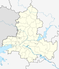 Kamensk-Shakhtinsky Kamensk-Shakhtinsky (Rostov Oblast) | |
| Coordinates: 48°19′14″N 40°15′40″E / 48.32056°N 40.26111°E | |
| Country | Russia |
| Federal subject | Rostov Oblast[1] |
| Founded | 1686 |
| Town status since | 1927 |
| Elevation | 60 m (200 ft) |
| Population | |
| • Total | 95,296 |
| • Estimate (2018)[3] | 88,997 (−6.6%) |
| • Rank | 180th in 2010 |
| • Subordinated to | Kamensk-Shakhtinsky Urban Okrug[1] |
| • Capital of | Kamensk-Shakhtinsky Urban Okrug[1] |
| • Urban okrug | Kamensk-Shakhtinsky Urban Okrug[4] |
| • Capital of | Kamensk-Shakhtinsky Urban Okrug[4] |
| Time zone | UTC+3 (MSK |
| Postal code(s)[6] | 347800 |
| OKTMO ID | 60719000001 |
History edit
It was founded by Cossack settlers in 1686 and was granted town status in 1927.[citation needed]
Administrative and municipal status edit
Within the framework of administrative divisions, it is incorporated as Kamensk-Shakhtinsky Urban Okrug—an administrative unit with the status equal to that of the districts.[1] As a municipal division, this administrative unit also has urban okrug status.[4]
Economy edit
Once a major coal-mining center of the eastern Donets coal basin, it now an important producer of artificial fibers and mining machinery as well as glass. European route E40 passes through Kamensk-Shakhtinsky. The Kamensky chemical plant is located at the city.
Climate edit
| Climate data for Kamensk-Shakhtinsky (1991–2020) | |||||||||||||
|---|---|---|---|---|---|---|---|---|---|---|---|---|---|
| Month | Jan | Feb | Mar | Apr | May | Jun | Jul | Aug | Sep | Oct | Nov | Dec | Year |
| Mean daily maximum °C (°F) | −0.9 (30.4) |
0.1 (32.2) |
7.0 (44.6) |
16.7 (62.1) |
23.5 (74.3) |
28.5 (83.3) |
30.5 (86.9) |
30.1 (86.2) |
23.2 (73.8) |
14.9 (58.8) |
5.9 (42.6) |
0.8 (33.4) |
15.0 (59.0) |
| Daily mean °C (°F) | −3.9 (25.0) |
−3.4 (25.9) |
2.4 (36.3) |
10.4 (50.7) |
16.8 (62.2) |
21.8 (71.2) |
23.8 (74.8) |
23.0 (73.4) |
16.5 (61.7) |
9.5 (49.1) |
2.4 (36.3) |
−1.9 (28.6) |
9.8 (49.6) |
| Mean daily minimum °C (°F) | −6.6 (20.1) |
−6.2 (20.8) |
−1.1 (30.0) |
5.0 (41.0) |
10.7 (51.3) |
15.5 (59.9) |
17.4 (63.3) |
16.0 (60.8) |
10.5 (50.9) |
5.1 (41.2) |
−0.4 (31.3) |
−4.3 (24.3) |
5.1 (41.2) |
| Average precipitation mm (inches) | 34.5 (1.36) |
30.5 (1.20) |
31.1 (1.22) |
29.8 (1.17) |
45.4 (1.79) |
42.1 (1.66) |
58.2 (2.29) |
28.7 (1.13) |
32.3 (1.27) |
36.0 (1.42) |
31.8 (1.25) |
39.7 (1.56) |
440.1 (17.33) |
| Average precipitation days (≥ 1.0 mm) | 7 | 6 | 7 | 5 | 6 | 6 | 6 | 4 | 5 | 6 | 6 | 7 | 71 |
| Average relative humidity (%) | 84 | 81 | 75 | 63 | 61 | 56 | 55 | 53 | 62 | 73 | 81 | 85 | 69 |
| Source: NOAA[9] | |||||||||||||
Gallery edit

See also edit
References edit
Notes edit
- ^ a b c d e Law #340-ZS
- ^ a b Russian Federal State Statistics Service (2011). Всероссийская перепись населения 2010 года. Том 1 [2010 All-Russian Population Census, vol. 1]. Всероссийская перепись населения 2010 года [2010 All-Russia Population Census] (in Russian). Federal State Statistics Service.
- ^ "26. Численность постоянного населения Российской Федерации по муниципальным образованиям на 1 января 2018 года". Federal State Statistics Service. Retrieved January 23, 2019.
- ^ a b c Law #236-ZS
- ^ "Об исчислении времени". Официальный интернет-портал правовой информации (in Russian). June 3, 2011. Retrieved January 19, 2019.
- ^ Почта России. Информационно-вычислительный центр ОАСУ РПО. (Russian Post). Поиск объектов почтовой связи (Postal Objects Search) (in Russian)
- ^ Federal State Statistics Service (May 21, 2004). Численность населения России, субъектов Российской Федерации в составе федеральных округов, районов, городских поселений, сельских населённых пунктов – районных центров и сельских населённых пунктов с населением 3 тысячи и более человек [Population of Russia, Its Federal Districts, Federal Subjects, Districts, Urban Localities, Rural Localities—Administrative Centers, and Rural Localities with Population of Over 3,000] (XLS). Всероссийская перепись населения 2002 года [All-Russia Population Census of 2002] (in Russian).
- ^ Всесоюзная перепись населения 1989 г. Численность наличного населения союзных и автономных республик, автономных областей и округов, краёв, областей, районов, городских поселений и сёл-райцентров [All Union Population Census of 1989: Present Population of Union and Autonomous Republics, Autonomous Oblasts and Okrugs, Krais, Oblasts, Districts, Urban Settlements, and Villages Serving as District Administrative Centers]. Всесоюзная перепись населения 1989 года [All-Union Population Census of 1989] (in Russian). Институт демографии Национального исследовательского университета: Высшая школа экономики [Institute of Demography at the National Research University: Higher School of Economics]. 1989 – via Demoscope Weekly.
- ^ "World Meteorological Organization Climate Normals for 1991-2020 — Kamensk-Shakhtinsky". National Oceanic and Atmospheric Administration. Retrieved April 9, 2024.
Sources edit
- Законодательное Собрание Ростовской области. Закон №340-ЗС от 25 июля 2005 г. «Об административно-территориальном устройстве Ростовской области», в ред. Закона №270-ЗС от 27 ноября 2014 г. «О внесении изменений в областной Закон "Об административно-территориальном устройстве Ростовской области"». Вступил в силу со дня официального опубликования. Опубликован: "Наше время", №187–190, 28 июля 2005 г. (Legislative Assembly of Rostov Oblast. Law #340-ZS of July 28, 2005 On the Administrative-Territorial Structure of Rostov Oblast, as amended by the Law #270-ZS of November 27, 2014 On Amending the Oblast Law "On the Administrative-Territorial Structure of Rostov Oblast". Effective as of the official publication date.).
- Законодательное Собрание Ростовской области. Закон №236-ЗС от 27 декабря 2004 г. «Об установлении границы и наделении статусом городского округа муниципального образования "Город Каменск-Шахтинский"». Вступил в силу 1 января 2005 г. Опубликован: "Наше время", №339, 29 декабря 2004 г. (Legislative Assembly of Rostov Oblast. Law #236-ZS of December 27, 2004 On Establishing the Border and Granting Urban Okrug Status to the Municipal Formation of the "Town of Kamensk-Shakhtinsky". Effective as of January 1, 2005.).
External links edit
![]() Media related to Kamensk-Shakhtinsky at Wikimedia Commons
Media related to Kamensk-Shakhtinsky at Wikimedia Commons
- Official website of Kamensk-Shakhtinsky (in Russian)
- Kamensk-Shakhtinsky Business Directory (in Russian)