


Summary
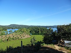
Kaptai Lake is the largest man-made lake in Bangladesh.[1] It is located in the Kaptai Upazila under Rangamati District of Chittagong Division. The lake was created as a result of building the Kaptai Dam on the Karnaphuli River, as part of the Karnaphuli Hydro-electric project. Kaptai Lake's average depth is 100 feet (30 m) and maximum depth is 490 feet (150 m).
| Kaptai Lake, Rangamati | |
|---|---|
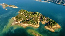 | |
 Kaptai Lake, Rangamati | |
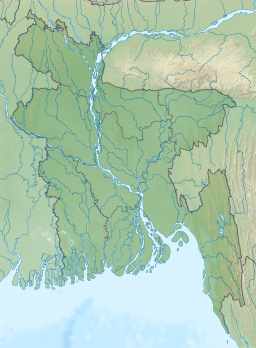
| Location | South-Eastern Bangladesh |
| Coordinates | 22°29′45″N 92°13′45″E / 22.49583°N 92.22917°E |
| Type | reservoir |
| Primary inflows | Karnaphuli River |
| Primary outflows | Karnaphuli River |
| Catchment area | 11,122 km2 (4,294 sq mi) [original research?] |
| Basin countries | Bangladesh |
| Average depth | 100 ft (30 m) |
| Max. depth | 495 ft (151 m) |
History edit
Construction of the reservoir for the hydro-electric plant began in 1956 by the Government of East Pakistan.[2] 54,000 acres (220 km2) of farmland in the Rangamati District was submerged with the creation of the lake. The project was finished in 1961.[3] 40% of the total arable land went underwater as a result of the dam construction and 100,000 people were displaced.[3] The palace of the king of the Chakmas was also flooded and is also underwater.[2] The International Engineering Company and Utah International Inc. received the contract for the construction of the dam. The dam is 670.8 meters long, and 54.7 meters high.[1]
Gallery edit
-
 Hanging Bridge
 -
 the lake
 -
 Wooden boats
 -
 Boat on the lake
 -
 View of Kaptai lake, Rangamati
 -
 Kaptai Dam
 -
 Kaptai
 -
 A Beautiful waterfall


See also edit
References edit
- ^ a b Amin, Sakib Bin (2021). The Economy of Tourism in Bangladesh: Prospects, Constraints, and Policies. Springer Nature. ISBN 9783030729004.
- ^ a b Daily JaiJaiDin, January 10, 2008. Page 10.
- ^ a b Schendel, Willem van (202). A History of Bangladesh. Cambridge University Press. p. 171. ISBN 9781108620338.
External links edit
- Kaptai Lake at Banglapedia
- Kaptai Lake Rangamati at Travel Mate