


Summary
Katesgrove is an inner-town district and electoral ward situated immediately to the south of the centre of the town of Reading, in the English county of Berkshire. The district and ward are largely, but not entirely, coterminous.
| Katesgrove | |
|---|---|
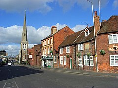 Southampton Street and St Giles' Church | |
 Katesgrove Location within Berkshire | |
| OS grid reference | SU715726 |
| Unitary authority | |
| Ceremonial county | |
| Region | |
| Country | England |
| Sovereign state | United Kingdom |
| Post town | Reading |
| Postcode district | RG1 |
| Dialling code | 0118 |
| Police | Thames Valley |
| Fire | Royal Berkshire |
| Ambulance | South Central |
| UK Parliament | |
District edit
The traditional definition of the district of Katesgrove is bounded on the north by the Inner Distribution Road, on the east by Sidmouth Street, Kendrick Road and Northumberland Avenue, on the south by Long Barn Lane and Rose Kiln Lane and on the west by the River Kennet.[1]
Electoral ward edit
The Katesgrove electoral ward of the Borough of Reading corresponds closely to the district. In addition to the traditional definition of Katesgrove (as given above), the ward includes a strip of land between the A33 and the River Kennet, including the flats on the site of the Reading Central goods depot and the commercial buildings to the south, that would more normally be regarded as part of the districts of Coley and Coley Park. The ward is bordered by Abbey, Redlands, Church, Whitley and Coley wards and forms part of the Reading East parliamentary constituency.[2][3]
Katesgrove elects three councillors to the unitary Reading Borough Council, with each elected in separate years for a four-year term.[4] Traditionally an area of strength for the Labour Party, one of Katesgrove's councillors was Labour's David Sutton, who was leader of the council for thirteen years before his defeat by a Liberal Democrat, Warren Swaine, in 2008.[5] The 2000s witnessed a surge in votes for the Liberal Democrats, resulting in 2007 with the election of Gareth Epps, the constituency's 2010 candidate who achieved second place in that election - culminating in 2010 with all Katesgrove councillors being Liberal Democrats.[6][7] However, the 2011 council election saw Labour candidate Matt Rodda, who is now MP for Reading East, elected, and over the following years Labour regained the remaining seats.[8]
In the 2022 election, at which all councillors faced re-election because of boundary changes, a swing from the Labour Party to the Green Party led to the latter gaining two of the three seats. As a result, the councillors are Liam Challenger of the Labour Party, and Doug Cresswell and Louise Keane, both of the Green Party.[9]
Notable people edit
- Fred Potts VC, holder of the Victoria Cross.[10]
See also edit
References edit
- ^ "Katesgrove Community Association". Katesgrove Community Association. Archived from the original on 13 February 2014. Retrieved 25 June 2014.
- ^ "Wards". Reading Borough Council. Archived from the original on 9 May 2012. Retrieved 5 May 2012.
- ^ Election Maps (Map). Ordnance Survey. Retrieved 15 June 2022.
- ^ "Reading Councillors". Reading Borough Council. Retrieved 22 December 2011.
- ^ "Leader Out After 20 Years – By a Whisker". Reading Post. 6 May 2008. Retrieved 22 December 2011.
- ^ "Reading Election Snaps (2007)". Reading Post. 4 May 2007. Retrieved 22 December 2011.
- ^ "Katesgrove 2010: Final Result". Reading Borough Council. Archived from the original on 15 April 2012. Retrieved 22 December 2011.
- ^ "Katesgrove 2011: Final Result". Reading Borough Council. Archived from the original on 22 March 2012. Retrieved 22 December 2011.
- ^ "Your Councillors". Reading Borough Council. Archived from the original on 9 June 2022. Retrieved 9 June 2022.
- ^ "Potts VC". www.pottsvctrust.org.
External links edit
 Media related to Katesgrove at Wikimedia Commons
- Katesgrove Community Association