


Summary
Kelakam is a small town and Grama Panchayat located in the south eastern part of Kannur district in Kerala state, India.[3][4]
Kelakam | |
|---|---|
Town | |
 | |
 Kelakam Location in Kerala, India  Kelakam Kelakam (India) | |
| Coordinates: 11°53′40″N 75°48′35″E / 11.8945°N 75.8098°E | |
| Country | |
| State | Kerala |
| District | Kannur |
| Taluk | Iritty |
| Government | |
| • Type | Panchayati raj (India) |
| • Body | Kelakam Grama Panchayat |
| Area | |
| • Total | 77.92 km2 (30.09 sq mi) |
| Elevation | 116 m (381 ft) |
| Population (2011)[2] | |
| • Total | 20,747 |
| • Density | 270/km2 (690/sq mi) |
| Languages | |
| • Official | Malayalam, English |
| Time zone | UTC+5:30 (IST) |
| PIN | 670674 |
| Telephone code | 0490 |
| ISO 3166 code | IN-KL |
| Vehicle registration | KL-78 |
| Sex ratio | 1,032 ♂/♀ |
| Literacy | 94.6% |
| Niyamasabha constituency | Peravoor |
| Lok Sabha constituency | Kannur |
| Climate | Mild Climate (Köppen) |
| Website | http://lsgkerala.in/kelakampanchayat/ |

Location edit
Kelakam is located on Hill Highway of about 55 km (34 mi) east of district headquarters Kannur, 48 km (30 mi) north east of Thalassery, 24 km (15 mi) south east of taluk headquarters Iritty and 10 km (6.2 mi) east of Peravoor. The prominent Kottiyoor Temple is just 7 km (4.3 mi) away from here.[5]
Demographics edit
As of 2011 Census, Kelakam had a population of 16,211 of which 7,979 are males and 8,232 are females. Kelakam village spreads over an area of 77.93 km2 (30.09 sq mi) with 4,026 families residing in it. The sex ratio of Kelakam was 1,032 lower than state average of 1,084. Population of children in the age group 0-6 was 1,610 (9.9%) where 823 are males and 787 are females. Kelakam had an overall literacy of 94.6% higher than state average of 94%. The male literacy stands at 95.7% and female literacy was 93.6%.[6]
Geography edit
It is a small town located in hilly regions of the western slope of western ghats. The Bavali River runs through the town, and the Kottiyoor Vadakkeshwaram Temple is seven kilometers away. It is situated near Aralam Wildlife Sanctuary which is ten kilometers away.
Etymology edit
Kelakam got its name from words "kela" "kam" meaning resting place of "bullock" referring to resting place of the bullock of Lord Shiva. It is in the Christian migration belt but different religious groups live harmoniously. The town is known for its hill produce including pepper, rubber, tapioca, and coconut. The land around Kelakam is fertile and is preferred for farming. The town is a centre for textiles and jewelry shops.[7]
Tourism edit
Kelakam town, fast growing, beautiful, serene place in the Kannur district of Kerala. The people are very friendly and peacefully co-existing for about 60–70 years, the time when it started to grow due to the migration of people from the Travancore (South) side of Kerala. It is a centre of Hill-produce, Textiles shops and Jewellery shops. Not many places will be there in Kerala where there are so much Christian churches of various denominations. Long back Father Vadakkan observed fasting for farmers in Kelakam.
Transportation edit
Kerala State Hill highway (SH 59) passes through Kelakam town. The National Highway (NH 66) passes through Thalassery town on the west. Mangalore and Mumbai can be accessed on the northern side and Cochin and Thiruvananthapuram can be accessed on the southern side. The road to the east of Kelakam connects to Mysore and Bangalore through Mananthavadi route. The nearest railway station is Thalassery on Mangalore-Palakkad line. The nearest airport is Kannur International Airport which is 37 km (23 mi) away from Kelakam.
The proposed Mananthavady Mattannur airport four lane road passes through Kelakam where a bypass is being built for the town. It will give easy access for the people from south eastern parts of Kannur district and northern parts of Wayanad districts towards the airport.[8]
Educational institutions edit
St.Thomas Higher Secondary school
Little flower English high School
MGM(Mar Gregorio's Memorial) high school
St.Joseph's high school Adakathode
Manjalapuram UP school
Chettiyamparambu school
Providence L P School Velloonni
St. Mark L P School Chungakkunnu
Govt.U.P School Adakkathode
Govt.LP School Shantigiri
Religious places edit
- St. Thomas Orthodox Salem Church Kelakam
- San Jos Syro Malabar church kelakam (St.Joseph's church)
- Sree Murchilakattu Maha Devi temple Kelakam
- St. George Orthodox Valiyapalli kelakam
- Little Flower Malankara Catholic Church Kelakam
- Immanuel Marthoma Church Kelakam
- Indian Pentecostal Church of God, Kelakam
- Assemblies of God church(Pentecostal church), Kanichar
- The Pentecostal Mission Church, Kelakam
- St. Mary's & St. Thomas Jacobite Syrian Sunoro Church Kelakam
- St. Joseph's church Adakkathode
- St. George Malankara catholic church Adakkathode
- Sree Palliyara mahadevi temple Adakkathode
- St. Mary's Orthodox Church Chettiyamparamba
- St. John the Baptist's Church Chettiyamparamba
- Providence church velloonny
- St. Antony's Church Manjalampuram
- Fathima Matha Forane church Chungakkunnu
Gallery edit
-
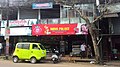 Kelakam Town
 -
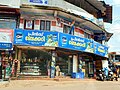 Kelakam Town
 -
 Kelakam Town
 -
 Kelakam Town
 -
 Kelakam Town


References edit
- ^ "kelakam elevation map". topographic-map.com.
- ^ "കണ്ണൂര് ജില്ലയിലെ ഗ്രാമ പഞ്ചായത്തുകളുടെ അടിസ്ഥാന വിവരങ്ങള് | Deparyment of Panchayats".
- ^ "Census of India : Villages with population 5000 & above". Registrar General & Census Commissioner, India. Retrieved 10 December 2008.
- ^ "DE Status".
- ^ "Routes & Location".
- ^ Kerala, Directorate of Census Operations. District Census Handbook, Kannur (PDF). Thiruvananthapuram: Directorateof Census Operations,Kerala. p. 166,167. Retrieved 14 July 2020.
- ^ "Cashew growers' meet to begin at Kelakam on Sunday". The Hindu. 26 September 2008.
- ^ "Bypass at Kelakam and Peravoor; Land acquisition of Mananthavadi-Mattannur four-lane road soon; The speed of the hilly region will increase". Retrieved 27 December 2023.