


Summary
Kentstown (Irish: Baile an Cheantaigh)[2] is a village in County Meath in Ireland at the junction of the R153 and R150 regional roads.
Kentstown
Irish: Baile an Cheantaigh | |
|---|---|
Town | |
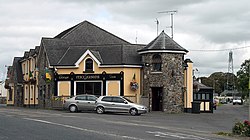 Kentstown on the R150 | |
 Kentstown Location in Ireland | |
| Coordinates: 53°37′39″N 6°31′59″W / 53.62750°N 6.53306°W | |
| Country | Ireland |
| Province | Leinster |
| County | Meath |
| Elevation | 55 m (180 ft) |
| Population | 1,179 |
| Time zone | UTC+0 (WET) |
| • Summer (DST) | UTC-1 (IST (WEST)) |
| Irish Grid Reference | N970651 |
History edit
The ruins of a medieval church can be found in Danestown, Kentstown,[3] while in the present St. Mary's Parish Church (Church of Ireland) an effigy in the shape of a medieval Norman knight is carved on a slab. The knight wears a tight-fitting jupon and has a dagger on his right hip. An inscription, in Latin, accompanies it: "Here lies Thomas de Tuite, Knight, once Lord of Kentstown, who died on 2nd June 1363".[4]
Demographics edit
In the 20 years between the 1996 and 2016 census, the population of Kentstown more than tripled from 324 to 1,179 inhabitants.[1][5] According to the 2016 census, 71% of the village's homes (252 of 353 households) were built between 1991 and 2010.[1]
Transport edit
Kentstown village is served by Bus Éireann route 105, which operates hourly in each direction providing links to Duleek, Drogheda and in the other direction to Ashbourne, Ratoath and Blanchardstown.[6] In addition, route 103X (Dublin-Ashbourne-Navan) provides a limited service of a morning journey to Dublin and an evening journey to Navan Mondays to Fridays inclusive.[7]
Nanny river edit
The Nanny rises outside of Kentstown, and flows about 18 miles to the Irish sea at Laytown.[8]
Notes edit
- ^ a b c "Sapmap Area - Settlements - Kentstown". Census 2016. Central Statistics Office. April 2016. Retrieved 16 February 2020.
- ^ "Baile an Cheantaigh/Kentstown". logainm.ie. Placenames Database of Ireland. Retrieved 15 October 2021.
- ^ "Meath County Council - Record of Protected Structures - County Development Plan 2007-2013 - Adopted 2nd March 2007" (PDF). Archived from the original (PDF) on 20 November 2007. Retrieved 27 August 2008.
- ^ "Historic Meath". octavehouse.com. Archived from the original on 28 July 2009. Retrieved 27 August 2008.
- ^ "Kentstown (Ireland) Census Town". City Population. Retrieved 16 February 2020.
- ^ "Route 105 Timetable" (PDF). buseireann.ie. Bus Éireann. Retrieved 15 October 2021.
- ^ "Route 103X Timetable" (PDF). buseireann.ie. Bus Éireann. Retrieved 15 October 2021.
- ^ O'Reilly, Peter (1 April 2003). Rivers of Ireland: A Flyfisher's Guide. Stackpole Books. p. 226.