


Summary
Kerinci is a regency (kabupaten) in Jambi province, on the island of Sumatra, Indonesia. The regency has an area of 3,448.90 km2 (1,331.63 sq mi). Kerinci Regency had a population of 229,495 at the 2010 Census[2] and 250,259 at the 2020 Census;[3] the official estimate as at mid 2022 was 253,863 (comprising 127,245 males and 126,618 females).[1] The regency largely surrounds the city of Sungai Penuh, which until its separation on 24 June 2008 was part of the regency but is now independent of it. The regency seat is at Siulak. Kerinci is located 50 km (31 mi) from Jambi City, the capital of Jambi Province. Much of the landmass of the Kerinci regency is within the boundaries of the Kerinci Seblat National Park
Kerinci Regency
Kabupaten Kerinci | |
|---|---|
 Coat of arms | |
| Motto: Sakti Alam Kerinci | |
 | |
| Country | Indonesia |
| Province | Jambi |
| Regency seat | Siulak |
| Area | |
| • Total | 3,807.28 km2 (1,470.00 sq mi) |
| Population (mid 2022 estimate)[1] | |
| • Total | 253,863 |
| • Density | 67/km2 (170/sq mi) |
| Time zone | UTC+7 (WIB) |
| Website | kerincikab.go.id |
Geography edit
Mount Kerinci, the highest volcano in Indonesia and all of Southeast Asia, is found in the northern part of the Kerinci regency, in the Kayu Aro highland plateau, bordering West Sumatra. Lake Kerinci, a large lake and important source of fish for the region, is found in the central/southern parts of the Kerinci valley. An azure-blue, spring-fed lake called Lake Kaco is located in the rainforest near the village of Lempur in the Gunung Raya ("Mountain Kingdom") District.[4]
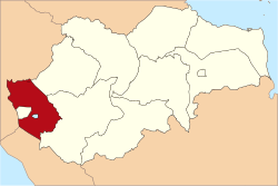
Administrative districts edit
At the 2010 Census there were twelve districts (kecamatan), but four more were added in 2013 and another two in 2020. The eighteen districts currently forming the Regency are listed below with their areas and their populations at the 2010 Census[2] and the 2020 Census,[3] together with the official estimates as at mid 2022.[1] The table also includes the locations of the district administrative centres, the number of villages in each district (totaling 285 rural desa and 2 urban kelurahan), and its post code.
| Kode Wilayah |
Name of District (kecamatan) |
Area in km2 |
Pop'n Census 2010 |
Pop'n Census 2020 |
Pop'n Estimate mid 2022 |
Admin centre |
No. of villages |
Post code |
|---|---|---|---|---|---|---|---|---|
| 15.01.01 | Gunung Raya | 389.26 | 13,928 | 8,415 | 8,484 | Lempur Tengah | 12 (1) | 37174 |
| 15.01.20 | Bukit Kerman | 213.69 | (b) | 12,369 | 12,508 | Pondok | 15 | 37176 |
| 15.01.07 | Batang Meringin | 507.65 | 16,887 | 11,859 | 11,900 | Tamiai | 9 | 37175 |
| 15.01.08 | Keliling Danau | 303.76 | 21,969 | 25,454 | 13,586 | Jujun | 18 | 37173 |
| 15.01.23 | Danau Kerinci Barat (West Danau Kerinci) |
59.94 | (c) | (c) | 12,510 | Serumpun Pauh | 14 | |
| 15.01.02 | Danau Kerinci | 220.92 | 15,743 | 17,856 | 13,655 | Sanggaran Agung | 13 | 37172 |
| 15.01.22 | Tanah Cogok | 14.46 | (c) | (c) | 9,106 | Koto Tuo Ujung Pasir | 12 | |
| 15.01.04 | Sitinjau Laut | 52.24 | 13,943 | 14,611 | 10,167 | Hiang | 14 | 37171 |
| 15.01.05 | Air Hangat | 211.35 | 19,456 | 11,474 | 11,514 | Semurup | 16 | 37168 |
| 15.01.11 | Air Hangat Timur (East Air Hangat) |
181.43 | 17,459 | 19,556 | 19,918 | Sungai Tutung | 25 | 37167 |
| 15.01.17 | Depati VII (d) (Depati Tujuh) |
27.71 | 14,423 | 16,790 | 17,229 | Koto Tuo | 20 | 37161 |
| 15.01.21 | Air Hangat Barat (West Air Hangat) |
14.13 | (b) | 9,906 | 10,192 | Koto Cayo | 12 | 37166 |
| 15.01.06 | Gunung Kerinci | 344.99 | 11,601 | 12,760 | 12,951 | Siulak Deras | 16 (e) | 37162 |
| 15.01.16 | Siulak | 142.78 | 30,742 | 22,884 | 23,441 | Dusun Baru | 26 | 37160 |
| 15.01.18 | Siulak Mukai | 275.47 | (b) | 11,139 | 11,145 | Mukai Pintu | 14 | 37169 |
| 15.01.09 | Kayu Aro | 114.66 | 39,308 | 19,754 | 19,873 | Tanjung Bungo | 21 | 37164 |
| 15.01.15 | Gunung Tujuh | 166.59 | 14,036 | 14,950 | 15,079 | Pelompek | 13 | 37163 |
| 15.01.19 | Kayu Aro Barat (West Kayu Aro) |
207.84 | (b) | 20,482 | 20,605 | Bedeng Dua | 17 | 37165 |
| Total Regency | 3,448.90 | 229,495 | 250,259 | 253,863 | Siulak | 287 |
Note: (a) including one kelurahan - Lempur Tengah. (b) The 2010 populations of these new districts are included with that of the existing districts from which they were cut out in 2013.
(c) The 2010 and 2020 populations of these new districts are included with that of the existing districts from which they were cut out in 2020.
(d) Depati VII District lies on the north side of Sungai Penuh city, to which it is largely suburban. (e) including one kelurahan - Siulak Deras.
Mount Seven Lake edit
Mount Seven Lake is the highest caldera in Southeast Asia 1,950 m (6,400 ft) at above mean sea level, with a lake area of 960 hectares (2,400 acres). The mount is called Mount Seven because there are seven summits. Mount Seven is located in Kerinci Seblat National Park. The lake has a white sandy beach and Mount Seven Waterfall.[5]
See also edit
References edit
- ^ a b c Badan Pusat Statistik, Jakarta, 2023, Kabupaten Kerinci Dalam Angka 2023 (Katalog-BPS 1102001.1501)
- ^ a b Biro Pusat Statistik, Jakarta, 2011.
- ^ a b Badan Pusat Statistik, Jakarta, 2021.
- ^ Kompas.com: Danau bercahaya dimalam hari Archived 2014-05-06 at the Wayback Machine Publikasi: 8 Mei 2010
- ^ "Danau Gunung Tujuh: Danau Para Dewa yang Menyimpan Pesona Sekaligus Misteri". Archived from the original on November 29, 2014. Retrieved November 22, 2014.
2°05′02″S 101°28′48″E / 2.08389°S 101.48000°E