


Summary
Khaf County (Persian: شهرستان خواف, Šahrestâne Xvâf) is in Razavi Khorasan province, Iran. Its capital is the city of Khaf.[3]
Khaf County
Persian: شهرستان خواف | |
|---|---|
County | |
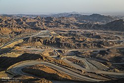 Iron quarry, Sangan | |
 Location of Khaf County in Razavi Khorasan province (bottom right, yellow) | |
 Location of Razavi Khorasan province in Iran | |
| Coordinates: 34°26′N 60°09′E / 34.433°N 60.150°E[1] | |
| Country | |
| Province | Razavi Khorasan |
| Capital | Khaf |
| Districts | Central, Jolgeh Zozan, Salami, Sangan |
| Area | |
| • Total | 9,827 km2 (3,794 sq mi) |
| Population (2016)[2] | |
| • Total | 138,972 |
| • Density | 14/km2 (37/sq mi) |
| Time zone | UTC+3:30 (IRST) |
| Khaf County at GEOnet Names Server | |
At the 2006 census, the county's population was 108,964 in 23,896 households.[4] The following census in 2011 counted 121,859 people in 29,923 households.[5] At the 2016 census, the county's population was 138,972 in 36,399 households.[2]
The historical city of Zozan is located close to Khaf and has been submitted to World Heritage tentative lists by UNESCO.[6]
Administrative divisions edit
The population history of Khaf County's administrative divisions over three consecutive censuses is shown in the following table. The latest census shows four districts, eight rural districts, and five cities.[2]
After the census, the village of Sedeh was elevated to the status of a city.[7]
| Administrative Divisions | 2006[4] | 2011[5] | 2016[2] |
|---|---|---|---|
| Central District | 40,652 | 46,273 | 52,899 |
| Miyan Khaf RD | 11,135 | 8,537 | 8,782 |
| Nashtifan RD | 1,810 | 1,866 | 1,752 |
| Khaf (city) | 21,160 | 28,444 | 33,189 |
| Nashtifan (city) | 6,547 | 7,426 | 9,176 |
| Jolgeh Zozan District | 18,928 | 19,523 | 22,062 |
| Keybar RD | 8,934 | 8,548 | 9,915 |
| Zozan RD | 5,972 | 6,561 | 7,002 |
| Qasemabad (city) | 4,022 | 4,414 | 5,145 |
| Salami District | 29,658 | 33,867 | 37,447 |
| Bala Khaf RD | 16,278 | 18,842 | 20,394 |
| Salami RD | 7,324 | 8,444 | 9,498 |
| Salami (city) | 6,056 | 6,581 | 7,555 |
| Sedeh (city)1 | |||
| Sangan District | 19,726 | 22,196 | 26,564 |
| Bostan RD | 7,316 | 8,248 | 9,344 |
| Pain Khaf RD | 3,692 | 4,448 | 4,777 |
| Sangan (city) | 8,718 | 9,500 | 12,443 |
| Total | 108,964 | 121,859 | 138,972 |
| RD: Rural District 1Became a city after the 2016 census[7] | |||
References edit
- ^ OpenStreetMap contributors (1 May 2023). "Khaf County" (Map). OpenStreetMap. Retrieved 1 May 2023.
- ^ a b c d "Census of the Islamic Republic of Iran, 1395 (2016)". AMAR (in Persian). The Statistical Center of Iran. p. 09. Archived from the original (Excel) on 2 April 2022. Retrieved 19 December 2022.
- ^ Habibi, Hassan (21 June 1369). "Approval of the organization and chain of citizenship of the elements and units of the divisions of Khorasan province, centered in Mashhad". Islamic Parliament Research Center (in Persian). Ministry of Interior, Defense Political Commission of the Government Board. Archived from the original on 17 November 2015. Retrieved 6 January 2024.
- ^ a b "Census of the Islamic Republic of Iran, 1385 (2006)". AMAR (in Persian). The Statistical Center of Iran. p. 09. Archived from the original (Excel) on 20 September 2011. Retrieved 25 September 2022.
- ^ a b "Census of the Islamic Republic of Iran, 1390 (2011)". Syracuse University (in Persian). The Statistical Center of Iran. p. 09. Archived from the original (Excel) on 20 January 2023. Retrieved 19 December 2022.
- ^ "Zosan". World Heritage Convention: Tentative Lists. UNESCO. 9 August 2007. Retrieved 6 December 2022.
...the authenticity and integrity of the works over there have been nicely kept.
- ^ a b Jahangiri, Ishaq (22 February 1400). "Letter of approval regarding the conversion of the village of Sedeh village of Bala Khaf Rural District, Salami District of Khaf County, Khorasan Razavi province, into a city". Laws and Regulations Portal of the Islamic Republic of Iran (in Persian). Ministry of Interior, Council of Ministers. Archived from the original on 7 January 2024. Retrieved 7 January 2024.