
KNOWPIA
WELCOME TO KNOWPIA

Kildinstroy 
Summary
Kildinstroy (Russian: Кильдинстрой) is an urban locality (an urban-type settlement) in Kolsky District of Murmansk Oblast, Russia, located on the Kola Peninsula on the lower Kola River, 9 kilometers (5.6 mi) south of Murmansk. Population: 2,063 (2010 Russian census);[5] 2,861 (2002 Census);[6] 3,731 (1989 Census).[7]
Kildinstroy
Кильдинстрой | |
|---|---|
 Kola in Kildinstroy | |
Location of Kildinstroy .mw-parser-output .locmap .od{position:absolute}.mw-parser-output .locmap .id{position:absolute;line-height:0}.mw-parser-output .locmap .l0{font-size:0;position:absolute}.mw-parser-output .locmap .pv{line-height:110%;position:absolute;text-align:center}.mw-parser-output .locmap .pl{line-height:110%;position:absolute;top:-0.75em;text-align:right}.mw-parser-output .locmap .pr{line-height:110%;position:absolute;top:-0.75em;text-align:left}.mw-parser-output .locmap .pv>div{display:inline;padding:1px}.mw-parser-output .locmap .pl>div{display:inline;padding:1px;float:right}.mw-parser-output .locmap .pr>div{display:inline;padding:1px;float:left}html.skin-theme-clientpref-night .mw-parser-output .od,html.skin-theme-clientpref-night .mw-parser-output .od .pv>div,html.skin-theme-clientpref-night .mw-parser-output .od .pl>div,html.skin-theme-clientpref-night .mw-parser-output .od .pr>div{background:#000;color:#fff}html.skin-theme-clientpref-night .mw-parser-output .locmap{filter:grayscale(0.6)}@media(prefers-color-scheme:dark){html.skin-theme-clientpref-os .mw-parser-output .locmap{filter:grayscale(0.6)}html.skin-theme-clientpref-os .mw-parser-output .od,html.skin-theme-clientpref-os .mw-parser-output .od .pv>div,html.skin-theme-clientpref-os .mw-parser-output .od .pl>div,html.skin-theme-clientpref-os .mw-parser-output .od .pr>div{background:#000;color:#fff}}  Kildinstroy Location of Kildinstroy 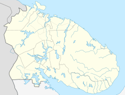 Kildinstroy Kildinstroy (Murmansk Oblast) | |
| Coordinates: 68°47′N 33°06′E / 68.783°N 33.100°E | |
| Country | Russia |
| Federal subject | Murmansk Oblast |
| Administrative district | Kolsky District |
| Founded | 1936 |
| Elevation | 27 m (89 ft) |
| Population | |
| • Total | 2,063 |
| • Estimate (2018)[2] | 1,922 (−6.8%) |
| • Municipal district | Kolsky Municipal District |
| • Urban settlement | Kildinstroy Urban Settlement |
| Time zone | UTC+3 (MSK |
| Postal code(s)[4] | 184367 |
| Dialing code(s) | +7 81553 |
| OKTMO ID | 47605158051 |
It was founded around 1935.[citation needed] By the All-Russian Central Executive Committee (VTsIK) Resolution of October 1937, it was granted the work settlement status.[8]
References edit
Notes edit
- ^ Статистический сборник Численность, размещение и возрастно-половой состав населения Мурманской области. Итоги Всероссийской переписи населения. Том 1. 2012 Archived December 22, 2012, at the Wayback Machine / Федеральная служба государственной статистики, Территориальный орган Федеральной службы государственной статистики по Мурманской области. Мурманск, 2012 — 75 с.
- ^ "26. Численность постоянного населения Российской Федерации по муниципальным образованиям на 1 января 2018 года". Federal State Statistics Service. Retrieved January 23, 2019.
- ^ "Об исчислении времени". Официальный интернет-портал правовой информации (in Russian). June 3, 2011. Retrieved January 19, 2019.
- ^ ИНФОРМАЦИЯ ОБ ОБЪЕКТЕ ПОЧТОВОЙ СВЯЗИ (in Russian). Russian Post. Archived from the original on March 3, 2016. Retrieved March 16, 2010.
- ^ Russian Federal State Statistics Service (2011). Всероссийская перепись населения 2010 года. Том 1 [2010 All-Russian Population Census, vol. 1]. Всероссийская перепись населения 2010 года [2010 All-Russia Population Census] (in Russian). Federal State Statistics Service.
- ^ Federal State Statistics Service (May 21, 2004). Численность населения России, субъектов Российской Федерации в составе федеральных округов, районов, городских поселений, сельских населённых пунктов – районных центров и сельских населённых пунктов с населением 3 тысячи и более человек [Population of Russia, Its Federal Districts, Federal Subjects, Districts, Urban Localities, Rural Localities—Administrative Centers, and Rural Localities with Population of Over 3,000] (XLS). Всероссийская перепись населения 2002 года [All-Russia Population Census of 2002] (in Russian).
- ^ Всесоюзная перепись населения 1989 г. Численность наличного населения союзных и автономных республик, автономных областей и округов, краёв, областей, районов, городских поселений и сёл-райцентров [All Union Population Census of 1989: Present Population of Union and Autonomous Republics, Autonomous Oblasts and Okrugs, Krais, Oblasts, Districts, Urban Settlements, and Villages Serving as District Administrative Centers]. Всесоюзная перепись населения 1989 года [All-Union Population Census of 1989] (in Russian). Институт демографии Национального исследовательского университета: Высшая школа экономики [Institute of Demography at the National Research University: Higher School of Economics]. 1989 – via Demoscope Weekly.
- ^ A Guide to the State Archives, p. 195
Sources edit
- Архивохранилище документов новейшей политической истории Государственного архива Мурманской области (2002). Архивохранилище документов новейшей политической истории Государственного архива Мурманской области. Путеводитель [A Guide to the Archival Depository of the State Archives of Murmansk Oblast. Documents Pertaining to the Newest Political History] (in Russian). ISBN 5-7870-0067-6. Archived from the original on July 24, 2011. Retrieved April 27, 2011.