


Summary
Kilgariff is a suburb of Alice Springs located in the Northern Territory of Australia about 1,290 kilometres (800 mi) south of the territory capital of Darwin[5] and about 7 kilometres (4.3 mi) south of the municipal seat in the Alice Springs central business district. Kilgariff is located within the federal division of Lingiari, the territory electoral division of Braitling and the local government area of the Town of Alice Springs.[9][8][1] It is on the traditional Country of the Arrernte people.[10]
| Kilgariff Alice Springs, Northern Territory | |||||||||||||||
|---|---|---|---|---|---|---|---|---|---|---|---|---|---|---|---|
 Kilgariff | |||||||||||||||
 | |||||||||||||||
| Coordinates | 23°46′30″S 133°53′09″E / 23.77507°S 133.88572°E[1] | ||||||||||||||
| Population | 349 (2016 census)(part only)[2][a] | ||||||||||||||
| • Density | 34.55/km2 (89.5/sq mi) | ||||||||||||||
| Established | 24 July 2013[4] | ||||||||||||||
| Postcode(s) | 0873[5] | ||||||||||||||
| Elevation | 546 m (1,791 ft)(airport)[6] | ||||||||||||||
| Area | 10.1 km2 (3.9 sq mi)[7] | ||||||||||||||
| Time zone | ACST (UTC+9:30) | ||||||||||||||
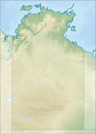
| Location |
| ||||||||||||||
| LGA(s) | Town of Alice Springs[1] | ||||||||||||||
| Territory electorate(s) | Braitling[8] | ||||||||||||||
| Federal division(s) | Lingiari[9] | ||||||||||||||
| |||||||||||||||
| |||||||||||||||
| Footnotes | Adjoining suburbs[3] | ||||||||||||||
History edit
Kilgariff is situated on the traditional Country of the Arrernte people.[11][12]
The suburb's name is derived from Bernie Kilgariff, an Alice Springs resident who served as the first Speaker of the Northern Territory Legislative Assembly at its creation in 1974 and who was elected in 1975 as one of the first two senators elected to represent the Northern Territory in the Australian Senate.[1]
Geography edit
Kilgariff consists of the land bounded by the Stuart Highway to the west, Roger Vale Drive in part to the south and the watercourse of the Todd River to the north-west. As of 2020, its area was 10.1 square kilometres (3.9 sq mi).[3][7] The land which was formerly part of the suburb of Connellan was created on 24 July 2013.[4][3][13]
References edit
Notes edit
- ^ For the 2016 census, Kilgariff was divided into two by the Australian Bureau of Statistics with people living north of Colonel Rose Drive being counted in the "State Suburb of Kilgariff" while those living south of Colonel Rose Drive were counted in the "State Suburb of Connellan".[2][3]
Citations edit
- ^ a b c d "Place Names Register Extract – Kilgariff". NT Place Names Register. Northern Territory Government. 24 July 2013. Retrieved 28 July 2019.
- ^ a b Australian Bureau of Statistics (27 June 2017). "Kilgariff (State Suburb)". 2016 Census QuickStats. Retrieved 29 July 2019.
- ^ a b c d "Suburb of Kilgariff – Alice Springs, (compiled plan) CP 5436" (PDF). Northern Territory Government. 23 May 2013. Archived from the original (PDF) on 18 March 2019. Retrieved 28 July 2019.
- ^ a b Chandler, Peter Glen (24 July 2013). "Place Names Act, NAMING OF PLACE IN ALICE SPRINGS" (PDF). The Northern Territory Government Gazette. Northern Territory Government. p. 2. Retrieved 28 July 2019.
that a new suburb in Alice Springs be named Kilgariff, as indicated on Compiled Plan 5436.
- ^ a b c "Kilgariff Postcode". postcode-finders.com.au. Retrieved 7 April 2020.
- ^ a b c d "Monthly climate statistics: Summary statistics ALICE SPRINGS AIRPORT (nearest weather station)". Commonwealth of Australia , Bureau of Meteorology. Retrieved 7 April 2020.
- ^ a b "Kilgariff". Australias Guide Pty Ltd. Retrieved 29 January 2020.
- ^ a b "Division of Braitling". Northern Territory Electoral Commission. Archived from the original on 28 July 2019. Retrieved 28 July 2019.
- ^ a b "Federal electoral division of Lingiari". Australian Electoral Commission. Retrieved 12 June 2019.
- ^ "A Brief History". Alice Springs Town Council. Retrieved 17 April 2024.
- ^ "C8: Arrernte". Australian Institute of Aboriginal and Torres Strait Islander Studies. Federal government. 26 July 2019. Retrieved 25 January 2021.
- ^ "A Brief History". Alice Springs Town Council. Retrieved 4 April 2024.
- ^ "Localities within the Alice Springs Sub-region (CP 5075)". Northern Territory Government. 5 April 2007. Retrieved 31 January 2020.