


Summary
Kilifarevo Island (Bulgarian: остров Килифарево, romanized: Ostrov Kilifarevo, IPA: [ˈɔstrof kiliˈfarɛvo]) is an ice-free island in the Aitcho group on the west side of English Strait in the South Shetland Islands, Antarctica. The island is situated 850 m (930 yd) northwest of Jorge Island, 460 m (500 yd) north of Riksa Islands and 350 m (380 yd) southeast of Morris Rock. Extending 640 by 350 m (700 by 380 yd), surface area 11 hectares (27 acres).[1] The area was visited by early 19th century sealers.
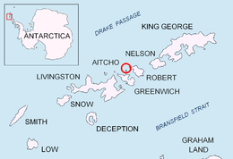 Location of Kilifarevo Island in the South Shetland Islands | |
 Kilifarevo Island Location of Kilifarevo Island  Kilifarevo Island Kilifarevo Island (Antarctic Peninsula) | |
| Geography | |
|---|---|
| Location | |
| Coordinates | 62°22′26″S 59°47′14″W / 62.37389°S 59.78722°W |
| Archipelago | Aitcho group |
| Area | 11 ha (27 acres) |
| Length | 0.64 km (0.398 mi) |
| Width | 0.35 km (0.217 mi) |
| Administration | |
| Administered under the Antarctic Treaty System | |
| Demographics | |
| Population | Uninhabited |

Kilifarevo Island is named after the town of Kilifarevo in northern Bulgaria.
Location edit
The island is located at 62°22′26″S 59°47′14″W / 62.37389°S 59.78722°W. Bulgarian mapping in 2009.
See also edit
Notes edit
References edit
- Kilifarevo Island. SCAR Composite Antarctic Gazetteer
- Bulgarian Antarctic Gazetteer. Antarctic Place-names Commission. (details in Bulgarian, basic data in English)
External links edit
- Kilifarevo Island. Adjusted Copernix satellite image
This article includes information from the Antarctic Place-names Commission of Bulgaria which is used with permission.
