
KNOWPIA
WELCOME TO KNOWPIA

King Island Airport 
Summary
King Island Airport (IATA: KNS, ICAO: YKII) is a small regional airport located near the town of Currie on King Island off the north-west coast of Tasmania, Australia. The airport is owned and operated by the King Island Council.
King Island Airport | |||||||||||||||||||
|---|---|---|---|---|---|---|---|---|---|---|---|---|---|---|---|---|---|---|---|
| Summary | |||||||||||||||||||
| Airport type | Public | ||||||||||||||||||
| Operator | King Island Council | ||||||||||||||||||
| Serves | King Island | ||||||||||||||||||
| Location | Currie, Tasmania | ||||||||||||||||||
| Elevation AMSL | 132 ft / 40 m | ||||||||||||||||||
| Coordinates | 39°52′39″S 143°52′42″E / 39.87750°S 143.87833°E | ||||||||||||||||||
| Maps | |||||||||||||||||||
.mw-parser-output .locmap .od{position:absolute}.mw-parser-output .locmap .id{position:absolute;line-height:0}.mw-parser-output .locmap .l0{font-size:0;position:absolute}.mw-parser-output .locmap .pv{line-height:110%;position:absolute;text-align:center}.mw-parser-output .locmap .pl{line-height:110%;position:absolute;top:-0.75em;text-align:right}.mw-parser-output .locmap .pr{line-height:110%;position:absolute;top:-0.75em;text-align:left}.mw-parser-output .locmap .pv>div{display:inline;padding:1px}.mw-parser-output .locmap .pl>div{display:inline;padding:1px;float:right}.mw-parser-output .locmap .pr>div{display:inline;padding:1px;float:left}html.skin-theme-clientpref-night .mw-parser-output .od,html.skin-theme-clientpref-night .mw-parser-output .od .pv>div,html.skin-theme-clientpref-night .mw-parser-output .od .pl>div,html.skin-theme-clientpref-night .mw-parser-output .od .pr>div{background:#000;color:#fff}html.skin-theme-clientpref-night .mw-parser-output .locmap{filter:grayscale(0.6)}@media(prefers-color-scheme:dark){html.skin-theme-clientpref-os .mw-parser-output .locmap{filter:grayscale(0.6)}html.skin-theme-clientpref-os .mw-parser-output .od,html.skin-theme-clientpref-os .mw-parser-output .od .pv>div,html.skin-theme-clientpref-os .mw-parser-output .od .pl>div,html.skin-theme-clientpref-os .mw-parser-output .od .pr>div{background:#000;color:#fff}}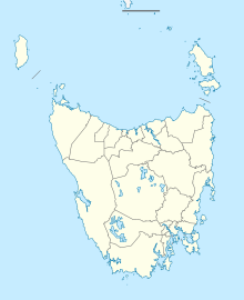 YKII Location in Tasmania | |||||||||||||||||||
 | |||||||||||||||||||
| Runways | |||||||||||||||||||
| |||||||||||||||||||
Airlines and destinations edit
Passenger edit
| Airlines | Destinations |
|---|---|
| King Island Airlines | Melbourne–Moorabbin |
| Rex Airlines | Melbourne–Tullamarine |
| Sharp Airlines | Burnie, Hobart, Launceston, Melbourne–Essendon |
Cargo edit
| Airlines | Destinations |
|---|---|
| Southern Airlines | Melbourne–Moorabbin |
Accidents and incidents edit
The airport was the site of a light plane crash on 26 November 1998, when a Piper Lance crashed shortly after takeoff on its way to Moorabbin, Victoria, killing three Melbourne nurses on board. It was suspected that a strong gust of wind just after takeoff caused the plane to stall and crash.
See also edit
References edit
- ^ YKII – King Island (PDF). AIP En Route Supplement from Airservices Australia, effective 21 March 2024, Aeronautical Chart
External links edit
- King Island Council: King Island Airport