


Summary
The Kings Highway station is an express station on the BMT Brighton Line of the New York City Subway. It is located at Kings Highway between East 15th and East 16th Streets on the border of Midwood and Sheepshead Bay neighborhoods of Brooklyn. The station is served by the Q train at all times and by the B train on weekdays only.
Kings Highway | ||||||||||||||||||||||||||||||||||||||||||||||||||||||||||||||||||||||||||||||||||||||||||||||||||||||||||||||||||||||||||||
|---|---|---|---|---|---|---|---|---|---|---|---|---|---|---|---|---|---|---|---|---|---|---|---|---|---|---|---|---|---|---|---|---|---|---|---|---|---|---|---|---|---|---|---|---|---|---|---|---|---|---|---|---|---|---|---|---|---|---|---|---|---|---|---|---|---|---|---|---|---|---|---|---|---|---|---|---|---|---|---|---|---|---|---|---|---|---|---|---|---|---|---|---|---|---|---|---|---|---|---|---|---|---|---|---|---|---|---|---|---|---|---|---|---|---|---|---|---|---|---|---|---|---|---|---|
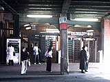
 Platforms view | ||||||||||||||||||||||||||||||||||||||||||||||||||||||||||||||||||||||||||||||||||||||||||||||||||||||||||||||||||||||||||||
| Station statistics | ||||||||||||||||||||||||||||||||||||||||||||||||||||||||||||||||||||||||||||||||||||||||||||||||||||||||||||||||||||||||||||
| Address | Kings Highway & East 16th Street Brooklyn, NY 11229 | |||||||||||||||||||||||||||||||||||||||||||||||||||||||||||||||||||||||||||||||||||||||||||||||||||||||||||||||||||||||||||
| Borough | Brooklyn | |||||||||||||||||||||||||||||||||||||||||||||||||||||||||||||||||||||||||||||||||||||||||||||||||||||||||||||||||||||||||||
| Locale | Midwood, Sheepshead Bay | |||||||||||||||||||||||||||||||||||||||||||||||||||||||||||||||||||||||||||||||||||||||||||||||||||||||||||||||||||||||||||
| Coordinates | 40°36′33″N 73°57′32″W / 40.609229°N 73.95884°W | |||||||||||||||||||||||||||||||||||||||||||||||||||||||||||||||||||||||||||||||||||||||||||||||||||||||||||||||||||||||||||
| Division | B (BMT)[1] | |||||||||||||||||||||||||||||||||||||||||||||||||||||||||||||||||||||||||||||||||||||||||||||||||||||||||||||||||||||||||||
| Line | BMT Brighton Line | |||||||||||||||||||||||||||||||||||||||||||||||||||||||||||||||||||||||||||||||||||||||||||||||||||||||||||||||||||||||||||
| Services | B Q | |||||||||||||||||||||||||||||||||||||||||||||||||||||||||||||||||||||||||||||||||||||||||||||||||||||||||||||||||||||||||||
| Transit | ||||||||||||||||||||||||||||||||||||||||||||||||||||||||||||||||||||||||||||||||||||||||||||||||||||||||||||||||||||||||||||
| Structure | Embankment | |||||||||||||||||||||||||||||||||||||||||||||||||||||||||||||||||||||||||||||||||||||||||||||||||||||||||||||||||||||||||||
| Platforms | 2 island platforms cross-platform interchange | |||||||||||||||||||||||||||||||||||||||||||||||||||||||||||||||||||||||||||||||||||||||||||||||||||||||||||||||||||||||||||
| Tracks | 4 | |||||||||||||||||||||||||||||||||||||||||||||||||||||||||||||||||||||||||||||||||||||||||||||||||||||||||||||||||||||||||||
| Other information | ||||||||||||||||||||||||||||||||||||||||||||||||||||||||||||||||||||||||||||||||||||||||||||||||||||||||||||||||||||||||||||
| Opened | original station: July 2, 1878 | |||||||||||||||||||||||||||||||||||||||||||||||||||||||||||||||||||||||||||||||||||||||||||||||||||||||||||||||||||||||||||
| Rebuilt | current station: August 23, 1907 | |||||||||||||||||||||||||||||||||||||||||||||||||||||||||||||||||||||||||||||||||||||||||||||||||||||||||||||||||||||||||||
| Accessible | ||||||||||||||||||||||||||||||||||||||||||||||||||||||||||||||||||||||||||||||||||||||||||||||||||||||||||||||||||||||||||||
| Opposite- direction transfer | Yes | |||||||||||||||||||||||||||||||||||||||||||||||||||||||||||||||||||||||||||||||||||||||||||||||||||||||||||||||||||||||||||
| Traffic | ||||||||||||||||||||||||||||||||||||||||||||||||||||||||||||||||||||||||||||||||||||||||||||||||||||||||||||||||||||||||||||
| 2023 | 4,244,252[2] | |||||||||||||||||||||||||||||||||||||||||||||||||||||||||||||||||||||||||||||||||||||||||||||||||||||||||||||||||||||||||||
| Rank | 61 out of 423[2] | |||||||||||||||||||||||||||||||||||||||||||||||||||||||||||||||||||||||||||||||||||||||||||||||||||||||||||||||||||||||||||
| ||||||||||||||||||||||||||||||||||||||||||||||||||||||||||||||||||||||||||||||||||||||||||||||||||||||||||||||||||||||||||||
| ||||||||||||||||||||||||||||||||||||||||||||||||||||||||||||||||||||||||||||||||||||||||||||||||||||||||||||||||||||||||||||
| ||||||||||||||||||||||||||||||||||||||||||||||||||||||||||||||||||||||||||||||||||||||||||||||||||||||||||||||||||||||||||||
| ||||||||||||||||||||||||||||||||||||||||||||||||||||||||||||||||||||||||||||||||||||||||||||||||||||||||||||||||||||||||||||
| ||||||||||||||||||||||||||||||||||||||||||||||||||||||||||||||||||||||||||||||||||||||||||||||||||||||||||||||||||||||||||||


History edit
On January 10, 1951, a new entrance to Quentin Road and East 16th Street was opened with a modern station house. The $250,000 project took approximately a year to be completed.[4]
A renovation of the Kings Highway station was funded as part of the MTA's 1980–1984 capital plan.[5] The MTA received a $106 million grant from the Urban Mass Transit Administration in October 1983; most of the grant would fund the renovation of eleven stations,[6][7] including Kings Highway.[6]
This station underwent reconstruction from 2009 to 2011, which included installation of ADA-accessible elevators to the full-time fare control area and rebuilding of the platforms and station houses. A temporary platform was used to provide service that would normally stop at the closed platform.[8]
Station layout edit
| Platform level | Northbound local | ← |
| Island platform | ||
| Northbound express | ← | |
| Southbound express | | |
| Island platform | ||
| Southbound local | | |
| Ground | Street level | Entrances/exits, station house and agent, MetroCard machines |
This station has four tracks and two island platforms.[9] The Q stops here at all times and is local, while the B stops here only on weekdays during the day and is express. The next stop to the north is Avenue M for local trains and Newkirk Plaza for express trains, while the next stop to the south is Avenue U for local trains and Sheepshead Bay for express trains.[10]
The two platforms are offset from each other, with the northbound platform located roughly 75 feet (23 m) further north than the southbound platform. It has three fare control areas at street level—two to Kings Highway/East 16th Street and one to Quentin Road/East 16th Street. The two mezzanines at Kings Highway, located directly underneath the subway embankment, were constructed in the original BMT format, but fully renovated in the 1980s, during which two identical sets of porcelain enamel artwork (Kings Highway Hieroglyphs by Rhoda Andors) were installed, one set in each mezzanine.
South of Kings Highway are a series of switches that allow trains to switch from the local tracks to the express ones, and vice versa.[11] Before Brighton signal replacement during the 1990s, a switch tower was in operation about 150 feet (46 m) south of the station, facing the southbound local track; this tower has been abandoned, and control of the switches has passed to a master tower at DeKalb Avenue. During the signal replacement, a new signal electrical tower was installed over the express tracks at the south end of the station.[9]
Exits edit
The entrance on the south side is normally the full-time entrance/exit, containing a turnstile bank, token booth, two staircases to each platform, and one exit-only turnstile from the Coney Island-bound platform. The one on the north is HEET access only, containing three turnstiles, a staircase to each platform and its MetroCard Vending Machines were installed on the sidewalk.[12]
The part-time Quentin Road station house, located to the east of the embankment, has a turnstile bank, part-time booth, and two staircases to each platform. It was built after the station's opening to accommodate growing passenger flow as evidenced by its newer-style tiling and signage. Platform extensions are clearly present at the north end of the station. It has a token booth, turnstile bank, and two staircases to each platform with the southbound side requiring a short walk.[12]
Gallery edit
-
 Kings Highway station, early 1980s
 -
 Quentin Road station house
 -
 Entrance at the north side of Kings Highway
 -
 North of Kings Highway Station
 -
 South of Kings Highway Station
 -


References edit
- ^ "Glossary". Second Avenue Subway Supplemental Draft Environmental Impact Statement (SDEIS) (PDF). Vol. 1. Metropolitan Transportation Authority. March 4, 2003. pp. 1–2. Archived from the original (PDF) on February 26, 2021. Retrieved January 1, 2021.
- ^ a b "Annual Subway Ridership (2018–2023)". Metropolitan Transportation Authority. 2023. Retrieved April 20, 2024.
- ^ "Annual Subway Ridership (2018–2023)". Metropolitan Transportation Authority. 2023. Retrieved April 20, 2024.
- ^ "BMT Station's Ritzy Entrance to Open Today". New York Daily News. January 10, 1951. Retrieved November 21, 2022.
- ^ Goldman, Ari L. (April 28, 1983). "M.T.A. Making Major Addition to Capital Plan". The New York Times. ISSN 0362-4331. Archived from the original on April 25, 2022. Retrieved May 4, 2023.
- ^ a b Moses, Charles T. (October 3, 1983). "TA Gets Funds to Fix Subways". Newsday. p. 3. ISSN 2574-5298. Retrieved May 5, 2023.
- ^ Gargan, Edward A. (October 3, 1983). "City Speeding Its Subway Repairs". The New York Times. ISSN 0362-4331. Archived from the original on April 28, 2022. Retrieved May 5, 2023.
- ^ "Press Release - NYC Transit - Temporary Loss of Brighton Line Express". Metropolitan Transportation Authority. July 29, 2009. Archived from the original on August 12, 2017. Retrieved August 11, 2017.
- ^ a b Dougherty, Peter (2006) [2002]. Tracks of the New York City Subway 2006 (3rd ed.). Dougherty. OCLC 49777633 – via Google Books.
- ^ "Subway Map" (PDF). Metropolitan Transportation Authority. September 2021. Retrieved September 17, 2021.
- ^ "Track Map: Brooklyn 3". www.nycsubway.org.
- ^ a b "MTA Neighborhood Maps: Midwood" (PDF). mta.info. Metropolitan Transportation Authority. 2015. Retrieved August 2, 2015.
External links edit
- nycsubway.org – BMT Brighton Line: Kings Highway
- Station Reporter — B Train
- Station Reporter — Q Train
- Artwork: "Kings Highway Hieroglyphics", Rhoda Yohai Andors (1987)
- MTA's Arts For Transit — Kings Highway (BMT Brighton Line)
- The Subway Nut — Kings Highway Pictures
- Kings Highway entrance — south side from Google Maps Street View
- Kings Highway entrance — north side from Google Maps Street View
- Quentin Road entrance from Google Maps Street View
- Platforms from Google Maps Street View