


Summary
Kingston upon Thames was an ancient parish in the county of Surrey, England. By 1839 it contained these chapelries, curacies or ecclesiastical parishes which eventually became civil parishes in their own right:[1]
| Kingston upon Thames | |
|---|---|
| History | |
| • Abolished | 1894 |
| • Succeeded by | Various (see text) |
| Status | Civil parish before which Parish (meaning combined civil and ecclesiastic functions, and pre-1066-incepted, known today as ancient parish) |
| Daughter parish | Creation of vestry | Notes as to its vestry/Borough | Notes as to creation | Local authority today |
|---|---|---|---|---|
| Claygate | 1861 | Board was Esher and the Dittons Urban District from 1895[2] | From Thames Ditton[3] | Elmbridge |
| East Molesey | 1769 | Local board from 1866 | Elmbridge | |
| Ham with Hatch* | 1866 | Local board from 1858 | Richmond-upon-Thames | |
| Hook* | 1866 | Local board from 1866[4] | First church built 1838 made a Chapelry 1839.[5] | Kingston upon Thames |
| Kew | 1769[6] | Absorbed by Borough of Richmond in 1892 | Richmond-upon-Thames | |
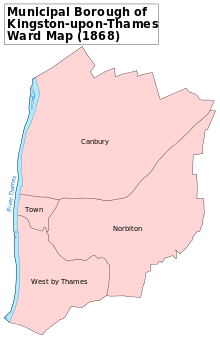
| Kingston upon Thames* | 1484 | Parish vestry powers mainly vested in identical-area Municipal Borough of Kingston-upon-Thames (abbrev. Kingston M.B.) | Kingston upon Thames | |
| New Malden | 1894 | Local board from 1866 | Kingston upon Thames | |
| Petersham | 1769 | Absorbed by Borough of Richmond in 1892 | Attached to Kew until 1891[7] | Richmond-upon-Thames |
| Richmond (previously Sheen) | 1849[8] remained with those marked * in 1769 | Became Borough of Richmond in 1890 | Richmond-upon-Thames | |
| Surbiton | 1894 | Improvement commissioners from 1855 | Kingston upon Thames | |
| Thames Ditton | 1769 | School Board from 1881. Board: Esher and the Dittons Urban District from 1895 [2] | Elmbridge |
It follows from the above list of chapelries and the hamlet of Hook, frequently listed in the medieval age that, well before the Conquest, the ancient parish was the Kingston hundred (of Surrey). There soon was a southern exception to this. By the 1086 snapshot of the Domesday Book, Long Ditton (which included exclave Tolworth east of Hook hamlet) had a fully-fledged church likely gaining its independence around that time as recorded throughout the high medieval age and onwards. Thus, in the grant of Kingston church and Long Ditton church to Merton Priory, soon after its foundation in 1117, Long Ditton does not appear as a chapelry of Kingston.[9]
The residual Church of England ecclesiastical parish essentially divides sixfold:
- All Saints - whole riverside strip - 1 church[10]
- St Peter, Norbiton - 2 churches[11]
- St Luke - 1 church - between railway and the Kingston Academy/Wolsey park[12]
- Kingston Hill, St Paul - 1 church[13]
- Kingston upon Thames, St John the Evangelist - Penrhyn Road & The Grove southern area - 1 church[14]
- Kingston Vale, St John the Baptist - 1 church[15]
References edit
- ^ Youngs, Frederic (1979). Guide to the Local Administrative Units of England. Vol. I: Southern England. London: Royal Historical Society. ISBN 0-901050-67-9.
- ^ a b "Esher and the Dittons UD through time | Census tables with data for the Local Government District". Archived from the original on 7 May 2014.
- ^ 'Parishes: Thames Ditton', in A History of the County of Surrey: Volume 3, ed. H E Malden (London, 1911), pp. 462-467. British History Online http://www.british-history.ac.uk/vch/surrey/vol3/pp462-467
- ^ "Hook CP/Hmlt through time | Census tables with data for the Parish-level Unit". Archived from the original on 14 March 2016.
- ^ "HOOK | As described in John Marius Wilson's Imperial Gazetteer of England and Wales (1870-72)". Archived from the original on 7 December 2019.
- ^ Private Act, Kingston upon Thames (Surrey) Vicarage Division Act 1769 (9 Geo. 3. c. 65)
- ^ Kew and Petersham Vicarage Acts 1891
- ^ Local Act, 12 & 13 Vict. cap. 42.
- ^ 'Parishes: Long Ditton', in A History of the County of Surrey: Volume 3, ed. H E Malden (London, 1911), pp. 516-522. British History Online http://www.british-history.ac.uk/vch/surrey/vol3/pp516-522
- ^ Map of All Saints parish
- ^ Map of St Peter's parish
- ^ Map of St Luke's parish
- ^ Map of St Paul's parish
- ^ Map of St John the Evangelist's parish
- ^ Map of St John the Baptist's parish
51°24′43″N 0°18′00″W / 51.412°N 0.300°W