


Summary
Kita-ku (北区) is one of four wards of Okayama, Okayama Prefecture, Japan. The ward has an area of 451.03 km2 and a population of 295,312. The population density is 655 per square kilometer. The name means "North Ward."

The wards of Okayama were established when Okayama became a city designated by government ordinance on April 1, 2009.
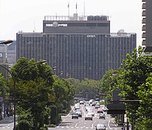
The city has its municipal headquarters in kita-ku.
The South Korean government maintains the Korea Education Institution (Korean: 오카야마한국교육원, Japanese: 岡山韓国教育院) in Kita-ku.[1]
Geography edit
Climate edit
Kurashiki has a humid subtropical climate (Köppen climate classification Cfa). The average annual temperature in Kurashiki is 14.0 °C (57.2 °F). The average annual rainfall is 1,249.8 mm (49.20 in) with September as the wettest month. The temperatures are highest on average in August, at around 26.3 °C (79.3 °F), and lowest in January, at around 2.5 °C (36.5 °F).[2] The highest temperature ever recorded in Kurashiki was 39.0 °C (102.2 °F) on 16 July 1994; the coldest temperature ever recorded was −10.1 °C (13.8 °F) on 9 January 2021.[3]
| Climate data for Fukuwatari, Kita-ku (1991−2020 normals, extremes 1979−present) | |||||||||||||
|---|---|---|---|---|---|---|---|---|---|---|---|---|---|
| Month | Jan | Feb | Mar | Apr | May | Jun | Jul | Aug | Sep | Oct | Nov | Dec | Year |
| Record high °C (°F) | 16.8 (62.2) |
21.9 (71.4) |
24.4 (75.9) |
29.7 (85.5) |
32.8 (91.0) |
35.7 (96.3) |
39.0 (102.2) |
38.3 (100.9) |
36.4 (97.5) |
31.8 (89.2) |
25.0 (77.0) |
19.7 (67.5) |
39.0 (102.2) |
| Mean daily maximum °C (°F) | 8.6 (47.5) |
9.8 (49.6) |
13.6 (56.5) |
19.6 (67.3) |
24.6 (76.3) |
27.4 (81.3) |
31.1 (88.0) |
32.5 (90.5) |
28.3 (82.9) |
22.6 (72.7) |
16.5 (61.7) |
10.9 (51.6) |
20.5 (68.8) |
| Daily mean °C (°F) | 2.5 (36.5) |
3.3 (37.9) |
6.7 (44.1) |
12.2 (54.0) |
17.3 (63.1) |
21.5 (70.7) |
25.5 (77.9) |
26.3 (79.3) |
22.2 (72.0) |
15.9 (60.6) |
9.7 (49.5) |
4.5 (40.1) |
14.0 (57.1) |
| Mean daily minimum °C (°F) | −2.3 (27.9) |
−1.9 (28.6) |
0.7 (33.3) |
5.4 (41.7) |
10.9 (51.6) |
16.6 (61.9) |
21.4 (70.5) |
21.9 (71.4) |
17.6 (63.7) |
10.9 (51.6) |
4.7 (40.5) |
−0.1 (31.8) |
8.8 (47.9) |
| Record low °C (°F) | −10.1 (13.8) |
−9.5 (14.9) |
−6.5 (20.3) |
−3.7 (25.3) |
0.5 (32.9) |
6.6 (43.9) |
12.0 (53.6) |
13.9 (57.0) |
5.6 (42.1) |
0.2 (32.4) |
−3.1 (26.4) |
−7.7 (18.1) |
−10.1 (13.8) |
| Average precipitation mm (inches) | 40.4 (1.59) |
48.5 (1.91) |
91.9 (3.62) |
102.1 (4.02) |
131.0 (5.16) |
171.0 (6.73) |
200.3 (7.89) |
111.2 (4.38) |
159.2 (6.27) |
95.6 (3.76) |
56.5 (2.22) |
46.7 (1.84) |
1,249.8 (49.20) |
| Average precipitation days (≥ 1.0 mm) | 5.4 | 6.6 | 9.2 | 9.1 | 9.6 | 11.0 | 11.3 | 8.4 | 9.5 | 7.2 | 6.2 | 6.0 | 99.5 |
| Mean monthly sunshine hours | 144.1 | 142.3 | 174.0 | 192.3 | 202.9 | 142.1 | 156.6 | 193.8 | 157.8 | 169.6 | 147.6 | 139.1 | 1,962.1 |
| Source: Japan Meteorological Agency[2][3] | |||||||||||||
| Climate data for Okayama Airport/Nichiō-ji, Kita-ku (2003−2020 normals, extremes 2003−present) | |||||||||||||
|---|---|---|---|---|---|---|---|---|---|---|---|---|---|
| Month | Jan | Feb | Mar | Apr | May | Jun | Jul | Aug | Sep | Oct | Nov | Dec | Year |
| Record high °C (°F) | 15.8 (60.4) |
21.0 (69.8) |
23.1 (73.6) |
28.5 (83.3) |
31.1 (88.0) |
34.1 (93.4) |
37.0 (98.6) |
36.4 (97.5) |
36.0 (96.8) |
30.7 (87.3) |
23.7 (74.7) |
18.9 (66.0) |
37.0 (98.6) |
| Mean daily maximum °C (°F) | 7.7 (45.9) |
8.9 (48.0) |
12.7 (54.9) |
18.4 (65.1) |
23.3 (73.9) |
26.2 (79.2) |
29.6 (85.3) |
31.4 (88.5) |
27.3 (81.1) |
21.8 (71.2) |
16.0 (60.8) |
9.9 (49.8) |
19.4 (67.0) |
| Daily mean °C (°F) | 2.9 (37.2) |
3.9 (39.0) |
7.1 (44.8) |
12.6 (54.7) |
17.7 (63.9) |
21.4 (70.5) |
25.1 (77.2) |
26.4 (79.5) |
22.5 (72.5) |
16.8 (62.2) |
10.9 (51.6) |
5.2 (41.4) |
14.4 (57.9) |
| Mean daily minimum °C (°F) | −1.4 (29.5) |
−0.8 (30.6) |
1.7 (35.1) |
6.9 (44.4) |
12.2 (54.0) |
17.3 (63.1) |
21.7 (71.1) |
22.6 (72.7) |
18.7 (65.7) |
12.3 (54.1) |
6.2 (43.2) |
0.7 (33.3) |
9.8 (49.7) |
| Record low °C (°F) | −9.1 (15.6) |
−8.1 (17.4) |
−4.9 (23.2) |
−2.1 (28.2) |
3.4 (38.1) |
9.1 (48.4) |
14.8 (58.6) |
15.4 (59.7) |
10.7 (51.3) |
4.6 (40.3) |
−2.3 (27.9) |
−5.9 (21.4) |
−9.1 (15.6) |
| Average precipitation mm (inches) | 30.4 (1.20) |
50.6 (1.99) |
85.4 (3.36) |
100.8 (3.97) |
116.5 (4.59) |
170.1 (6.70) |
208.3 (8.20) |
104.8 (4.13) |
155.8 (6.13) |
96.3 (3.79) |
57.3 (2.26) |
52.0 (2.05) |
1,228.3 (48.36) |
| Average precipitation days (≥ 1.0 mm) | 4.6 | 6.8 | 8.2 | 8.9 | 8.8 | 10.7 | 10.8 | 7.5 | 9.1 | 7.3 | 6.0 | 5.7 | 94.4 |
| Source: Japan Meteorological Agency[4][5] | |||||||||||||
References edit
- ^ "Home". Korean Cultural Center. Retrieved 2020-05-16.
(〒700-0023) 1-5-21 Ekimae-cho Kita-ku Okayama-city Okayama-ken, Japan
- ^ a b 気象庁 / 平年値(年・月ごとの値). JMA. Retrieved May 11, 2022.
- ^ a b 観測史上1~10位の値(年間を通じての値). JMA. Retrieved May 11, 2022.
- ^ 気象庁 / 平年値(年・月ごとの値). JMA. Retrieved May 11, 2022.
- ^ 観測史上1~10位の値(年間を通じての値). JMA. Retrieved May 11, 2022.
External links edit
![]() Media related to Kita-ku, Okayama at Wikimedia Commons
Media related to Kita-ku, Okayama at Wikimedia Commons
- 岡山市北区役所 (Ward office official home page)
34°39′18″N 133°55′10″E / 34.65500°N 133.91944°E