
KNOWPIA
WELCOME TO KNOWPIA

Kolondieba Cercle 
Summary
Kolondiéba Cercle is an administrative subdivision of the Sikasso Region of Mali. The administrative center (chef-lieu) is the town of Kolondiéba.
Kolondiéba Cercle | |
|---|---|
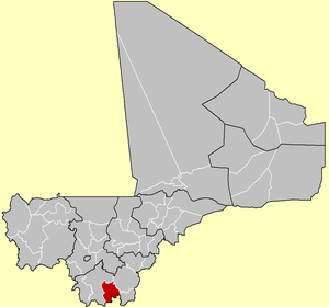 Location of the Cercle of Kolondieba in Mali | |
| Country | |
| Region | Sikasso Region |
| Admin HQ (Chef-lieu) | Kolondiéba |
| Area | |
| • Total | 9,200 km2 (3,600 sq mi) |
| Population (2009 census)[2] | |
| • Total | 202,618 |
| • Density | 22/km2 (57/sq mi) |
| Time zone | UTC+0 (GMT) |
The cercle is divided into the urban commune of Kolondiéba and 11 rural communes:[3][4]
| Name | Population 1998[5] | Population 2009[6] | Average Annual Change |
|---|---|---|---|
| Kolondiéba | 37,945 | 57,898 | 3.9 |
| Bougoula | 3,716 | 6,257 | 4.9 |
| Fakola | 14,668 | 28,101 | 6.1 |
| Farako | 10,370 | 15,391 | 3.7 |
| Kadiana | 15,745 | 21,548 | 2.9 |
| Kébila | 24,796 | 36,367 | 3.5 |
| Kolosso | 5,391 | 8,986 | 4.8 |
| Ména | 5,003 | 3,042 | -4.4 |
| N'Golodiana | 5,385 | 3,567 | -3.7 |
| Nangalasso | 8,629 | 11,079 | 2.3 |
| Tiongui | 6,573 | 7,611 | 1.3 |
| Tousséguéla | 3,640 | 2,771 | -2.4 |
References edit
- ^ Synthèsis des Plans de Securité Alimentaire des Communes du Cercle Kolondièba 2007-2011 (PDF) (in French), Commissariat à la Sécurité Alimentaire, République du Mali, USAID-Mali, 2007, archived from the original (PDF) on 2011-09-06, retrieved 2011-02-05.
- ^ Resultats Provisoires RGPH 2009 (Région de Sikasso) (PDF) (in French), République de Mali: Institut National de la Statistique, archived from the original (PDF) on July 27, 2012.
- ^ Loi N°99-035/ Du 10 Aout 1999 Portant Création des Collectivités Territoriales de Cercles et de Régions (PDF) (in French), Ministère de l'Administration Territoriales et des Collectivités Locales, République du Mali, 1999, archived from the original (PDF) on 2012-03-09.
- ^ Communes de la Région de Sikasso (PDF) (in French), Ministère de l’administration territoriale et des collectivités locales, République du Mali, archived from the original (PDF) on 2013-12-03.
- ^ "Archived copy" (PDF). Archived from the original (PDF) on July 27, 2012. Retrieved November 24, 2013.
{{cite web}}: CS1 maint: archived copy as title (link) - ^ "Archived copy" (PDF). Archived from the original (PDF) on July 27, 2012. Retrieved November 24, 2013.
{{cite web}}: CS1 maint: archived copy as title (link)
10°55′N 6°45′W / 10.917°N 6.750°W