


Summary
Kouvaras (Greek: Κουβαράς) is a village and a former community in East Attica, Greece. Since the 2011 local government reform it is part of the municipality Saronikos, of which it is a municipal unit.[2] The municipal unit has an area of 24.371 km2.[3]
Kouvaras
Κουβαράς | |
|---|---|
 Kouvaras Location within the regional unit 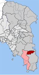 | |
| Coordinates: 37°50′N 23°58′E / 37.833°N 23.967°E | |
| Country | Greece |
| Administrative region | Attica |
| Regional unit | East Attica |
| Municipality | Saronikos |
| Area | |
| • Municipal unit | 24.371 km2 (9.410 sq mi) |
| Elevation | 209 m (686 ft) |
| Population (2021)[1] | |
| • Municipal unit | 1,932 |
| • Municipal unit density | 79/km2 (210/sq mi) |
| Time zone | UTC+2 (EET) |
| • Summer (DST) | UTC+3 (EEST) |
| Postal code | 190 03 |
| Area code(s) | 22910 |
| Vehicle registration | Z |
| Website | www.koinotita-kouvara.gr |

Geography edit
Kouvaras is situated in the southeastern part of the Attica peninsula. There are several low mountains around Kouvaras, including Mount Paneion to its southwest and Merenta to its north. It is 2 km north of Keratea, 4 km southeast of Kalyvia Thorikou and 27 km southeast of Athens city centre. The Greek National Road 89 (Gerakas - Koropi - Lavrio - Sounio) passes southwest of the town. The municipal unit Kouvaras also includes the village Neos Kouvaras (pop. 566), 1 km to the southwest.
Historical population edit
| Year | Village population | Municipal unit population |
|---|---|---|
| 1981 | 1,194 | - |
| 1991 | 928 | 1,369 |
| 2001 | 1,091 | 1,542 |
| 2011 | 1,426 | 2,008 |
| 2021 | 1,341 | 1,932 |
Historical monuments edit
The church of St. George. A wall painting monument (1743) of Georgios Markou the Argus, the great and prolific post-Byzantine ecclesiastic iconographer of the 18th century[4] (".... San Giorgio (agiografia su gli anni 1743), che si trova al paesino di Cuvara, dell 'Attica...." Evangelos Andreou http://ketlib.lib.unipi.gr/xmlui/handle/ket/849
References edit
- ^ "Αποτελέσματα Απογραφής Πληθυσμού - Κατοικιών 2021, Μόνιμος Πληθυσμός κατά οικισμό" [Results of the 2021 Population - Housing Census, Permanent population by settlement] (in Greek). Hellenic Statistical Authority. 29 March 2024.
- ^ "ΦΕΚ B 1292/2010, Kallikratis reform municipalities" (in Greek). Government Gazette.
- ^ "Population & housing census 2001 (incl. area and average elevation)" (PDF) (in Greek). National Statistical Service of Greece. Archived from the original (PDF) on 2015-09-21.
- ^ ".:BiblioNet : Γεώργιος Μάρκου ο Αργείος / Ανδρέου, Ευάγγελος". www.biblionet.gr. Retrieved 2018-11-16.
External links edit
- Official website (in Greek)
- News