


Summary
Krasnoarmeysk (Russian: Красноарме́йск) is a town in Saratov Oblast, Russia, located 75 kilometers (47 mi) south of Saratov, the administrative center of the oblast. Population: 24,364 (2010 Russian census);[2] 25,411 (2002 Census);[9] 24,055 (1989 Soviet census).[10]
Krasnoarmeysk
Красноармейск | |
|---|---|
 Coat of arms | |
Location of Krasnoarmeysk .mw-parser-output .locmap .od{position:absolute}.mw-parser-output .locmap .id{position:absolute;line-height:0}.mw-parser-output .locmap .l0{font-size:0;position:absolute}.mw-parser-output .locmap .pv{line-height:110%;position:absolute;text-align:center}.mw-parser-output .locmap .pl{line-height:110%;position:absolute;top:-0.75em;text-align:right}.mw-parser-output .locmap .pr{line-height:110%;position:absolute;top:-0.75em;text-align:left}.mw-parser-output .locmap .pv>div{display:inline;padding:1px}.mw-parser-output .locmap .pl>div{display:inline;padding:1px;float:right}.mw-parser-output .locmap .pr>div{display:inline;padding:1px;float:left}html.skin-theme-clientpref-night .mw-parser-output .od,html.skin-theme-clientpref-night .mw-parser-output .od .pv>div,html.skin-theme-clientpref-night .mw-parser-output .od .pl>div,html.skin-theme-clientpref-night .mw-parser-output .od .pr>div{background:#000;color:#fff}html.skin-theme-clientpref-night .mw-parser-output .locmap{filter:grayscale(0.6)}@media(prefers-color-scheme:dark){html.skin-theme-clientpref-os .mw-parser-output .locmap{filter:grayscale(0.6)}html.skin-theme-clientpref-os .mw-parser-output .od,html.skin-theme-clientpref-os .mw-parser-output .od .pv>div,html.skin-theme-clientpref-os .mw-parser-output .od .pl>div,html.skin-theme-clientpref-os .mw-parser-output .od .pr>div{background:#000;color:#fff}}  Krasnoarmeysk Location of Krasnoarmeysk 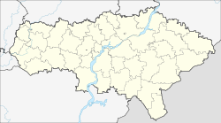 Krasnoarmeysk Krasnoarmeysk (Saratov Oblast) | |
| Coordinates: 51°01′23″N 45°42′11″E / 51.02306°N 45.70306°E | |
| Country | Russia |
| Federal subject | Saratov Oblast[1] |
| Founded | 1764–1766 |
| Town status since | 1918 |
| Elevation | 210 m (690 ft) |
| Population | |
| • Total | 24,364 |
| • Estimate (2018)[3] | 22,994 (−5.6%) |
| • Subordinated to | Krasnoarmeysk Town Under Oblast Jurisdiction |
| • Capital of | Krasnoarmeysky District,[4] Krasnoarmeysk Town Under Oblast Jurisdiction |
| • Municipal district | Krasnoarmeysky Municipal District[5] |
| • Urban settlement | Krasnoarmeysk Urban Settlement[5] |
| • Capital of | Krasnoarmeysky Municipal District,[6] Krasnoarmeysk Urban Settlement[5] |
| Time zone | UTC+4 (MSK+1 |
| Postal code(s)[8] | 412800–412802, 412804 |
| Dialing code(s) | +7 84550 |
| OKTMO ID | 63622101001 |
History edit
It was founded in 1764—1766 as the German colony of Baltser (Russian: Ба́льцер; German: Balzer); the last name[11] of one of the colonists. The other name of the colony was Goly Karamysh (Голый Карамыш), after the river on which it was located.[11] The "Karamysh" part in the river's name means muddy, silty, smudgy, while the "Goly" part alludes to the steppes and the lack of forests in the area; cf. Lesnoy Karamysh River (lit. the Karamysh River in the forests).[11]
In the mid-19th century, the double name of Goly Karamysh (Balzer) (Голый Карамыш (Бальзер)) was officially used, but it was shortened to just Baltser in 1926.[11] Town status was granted in 1918.[citation needed] During World War II, the region was cleansed of German geographic names, with Baltser renamed Krasnoarmeysk (after the Red Army) in 1942.[11]
Administrative and municipal status edit
Within the framework of administrative divisions, Krasnoarmeysk serves as the administrative center of Krasnoarmeysky District,[4] even though it is not a part of it.[12] As an administrative division, it is incorporated separately as Krasnoarmeysk Town Under Oblast Jurisdiction[12]—an administrative unit with the status equal to that of the districts.[citation needed] As a municipal division, Krasnoarmeysk Town Under Oblast Jurisdiction is incorporated within Krasnoarmeysky Municipal District as Krasnoarmeysk Urban Settlement.[5]
References edit
Notes edit
- ^ a b Charter of Saratov Oblast
- ^ a b Russian Federal State Statistics Service (2011). Всероссийская перепись населения 2010 года. Том 1 [2010 All-Russian Population Census, vol. 1]. Всероссийская перепись населения 2010 года [2010 All-Russia Population Census] (in Russian). Federal State Statistics Service.
- ^ "26. Численность постоянного населения Российской Федерации по муниципальным образованиям на 1 января 2018 года". Federal State Statistics Service. Retrieved January 23, 2019.
- ^ a b Государственный комитет Российской Федерации по статистике. Комитет Российской Федерации по стандартизации, метрологии и сертификации. №ОК 019-95 1 января 1997 г. «Общероссийский классификатор объектов административно-территориального деления. Код 63 222», в ред. изменения №278/2015 от 1 января 2016 г.. (State Statistics Committee of the Russian Federation. Committee of the Russian Federation on Standardization, Metrology, and Certification. #OK 019-95 January 1, 1997 Russian Classification of Objects of Administrative Division (OKATO). Code 63 222, as amended by the Amendment #278/2015 of January 1, 2016. ).
- ^ a b c d Law #110-ZSO
- ^ Law #78-ZSO
- ^ "Об исчислении времени". Официальный интернет-портал правовой информации (in Russian). June 3, 2011. Retrieved January 19, 2019.
- ^ Почта России. Информационно-вычислительный центр ОАСУ РПО. (Russian Post). Поиск объектов почтовой связи (Postal Objects Search) (in Russian)
- ^ Federal State Statistics Service (May 21, 2004). Численность населения России, субъектов Российской Федерации в составе федеральных округов, районов, городских поселений, сельских населённых пунктов – районных центров и сельских населённых пунктов с населением 3 тысячи и более человек [Population of Russia, Its Federal Districts, Federal Subjects, Districts, Urban Localities, Rural Localities—Administrative Centers, and Rural Localities with Population of Over 3,000] (XLS). Всероссийская перепись населения 2002 года [All-Russia Population Census of 2002] (in Russian).
- ^ Всесоюзная перепись населения 1989 г. Численность наличного населения союзных и автономных республик, автономных областей и округов, краёв, областей, районов, городских поселений и сёл-райцентров [All Union Population Census of 1989: Present Population of Union and Autonomous Republics, Autonomous Oblasts and Okrugs, Krais, Oblasts, Districts, Urban Settlements, and Villages Serving as District Administrative Centers]. Всесоюзная перепись населения 1989 года [All-Union Population Census of 1989] (in Russian). Институт демографии Национального исследовательского университета: Высшая школа экономики [Institute of Demography at the National Research University: Higher School of Economics]. 1989 – via Demoscope Weekly.
- ^ a b c d e Pospelov, p. 31
- ^ a b Государственный комитет Российской Федерации по статистике. Комитет Российской Федерации по стандартизации, метрологии и сертификации. №ОК 019-95 1 января 1997 г. «Общероссийский классификатор объектов административно-территориального деления. Код 63 418», в ред. изменения №278/2015 от 1 января 2016 г.. (State Statistics Committee of the Russian Federation. Committee of the Russian Federation on Standardization, Metrology, and Certification. #OK 019-95 January 1, 1997 Russian Classification of Objects of Administrative Division (OKATO). Code 63 418, as amended by the Amendment #278/2015 of January 1, 2016. ).
Sources edit
- Саратовская областная Дума. Закон №46-ЗСО от 2 июня 2005 г. «Устав (Основной Закон) Саратовской области», в ред. Закона №54-ЗСО от 28 апреля 2015 г. «О внесении изменений в Устав (Основной Закон) Саратовской области». Вступил в силу после официального опубликования. Опубликован: "Неделя области", Спецвыпуск, №38 (156), 4 июня 2005 г. (Saratov Oblast Duma. Law #46-ZSO of June 2, 2005 Charter (Basic Law) of Saratov Oblast, as amended by the Law #54-ZSO of April 28, 2015 On Amending the Charter (Basic Law) of Saratov Oblast. Effective as of after the official publication.).
- Саратовская областная Дума. Закон №79-ЗСО от 23 декабря 2004 г «О городских округах». Вступил в силу с 1 января 2005 г. Опубликован: "Саратов — столица Поволжья", №264 (1215), 24 декабря 2004 г. (Saratov Oblast Duma. Law #79-ZSO of December 23, 2004 On the Urban Okrugs. Effective as of January 1, 2005.).
- Саратовская областная Дума. Закон №110-ЗСО от 27 декабря 2004 г «О муниципальных образованиях, входящих в состав Красноармейского муниципального района», в ред. Закона №65-ЗСО от 2 июня 2015 г. «О преобразовании Каменского и Меловского муниципальных образований Красноармейского муниципального района Саратовской области и о внесении изменений в Закон Саратовской области "О муниципальных образованиях, входящих в состав Красноармейского муниципального района"». Вступил в силу с 1 января 2005 г. Опубликован: "Саратов — столица Поволжья", №11–12 (1234–1235), 21 января 2005 г. (Saratov Oblast Duma. Law #110-ZSO of December 27, 2004 On the Municipal Formations Constituting Krasnoarmeysky Municipal District, as amended by the Law #65-ZSO of June 2, 2015 On the Transformation of Kamenskoye and Melovskoye Municipal Formations in Krasnoarmeysky Municipal District of Saratov Oblast and on Amending the Law of Saratov Oblast "On the Municipal Formations Constituting Krasnoarmeysky Municipal District". Effective as of January 1, 2005.).
- Е. М. Поспелов (Ye. M. Pospelov). "Имена городов: вчера и сегодня (1917–1992). Топонимический словарь." (City Names: Yesterday and Today (1917–1992). Toponymic Dictionary.) Москва, "Русские словари", 1993.
External links edit
- Unofficial website of Krasnoarmeysk (in Russian)