


Summary
Krasnozavodsk (Russian: Краснозаво́дск; lit. "red factory") is a town in Sergiyevo-Posadsky District of Moscow Oblast, Russia, located on the Kunya River (Dubna's tributary) 88 kilometers (55 mi) northeast of Moscow and 15 kilometers (9.3 mi) north of Sergiyev Posad, the administrative center of the district. Population: 13,392 (2010 Russian census);[2] 13,549 (2002 Census);[7] 29,786 (1989 Soviet census).[8]
Krasnozavodsk
Краснозаводск | |
|---|---|
 House of Culture in Krasnozavodsk | |
 Flag  Coat of arms | |
Location of Krasnozavodsk .mw-parser-output .locmap .od{position:absolute}.mw-parser-output .locmap .id{position:absolute;line-height:0}.mw-parser-output .locmap .l0{font-size:0;position:absolute}.mw-parser-output .locmap .pv{line-height:110%;position:absolute;text-align:center}.mw-parser-output .locmap .pl{line-height:110%;position:absolute;top:-0.75em;text-align:right}.mw-parser-output .locmap .pr{line-height:110%;position:absolute;top:-0.75em;text-align:left}.mw-parser-output .locmap .pv>div{display:inline;padding:1px}.mw-parser-output .locmap .pl>div{display:inline;padding:1px;float:right}.mw-parser-output .locmap .pr>div{display:inline;padding:1px;float:left}html.skin-theme-clientpref-night .mw-parser-output .od,html.skin-theme-clientpref-night .mw-parser-output .od .pv>div,html.skin-theme-clientpref-night .mw-parser-output .od .pl>div,html.skin-theme-clientpref-night .mw-parser-output .od .pr>div{background:#000;color:#fff}html.skin-theme-clientpref-night .mw-parser-output .locmap{filter:grayscale(0.6)}@media(prefers-color-scheme:dark){html.skin-theme-clientpref-os .mw-parser-output .locmap{filter:grayscale(0.6)}html.skin-theme-clientpref-os .mw-parser-output .od,html.skin-theme-clientpref-os .mw-parser-output .od .pv>div,html.skin-theme-clientpref-os .mw-parser-output .od .pl>div,html.skin-theme-clientpref-os .mw-parser-output .od .pr>div{background:#000;color:#fff}}  Krasnozavodsk Location of Krasnozavodsk 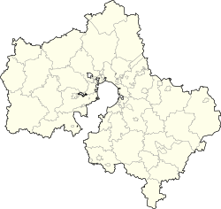 Krasnozavodsk Krasnozavodsk (Moscow Oblast) | |
| Coordinates: 56°26′N 38°14′E / 56.433°N 38.233°E | |
| Country | Russia |
| Federal subject | Moscow Oblast[1] |
| Administrative district | Sergiyevo-Posadsky District[1] |
| Town | Krasnozavodsk[1] |
| Founded | 1915 |
| Town status since | 1940 |
| Elevation | 220 m (720 ft) |
| Population | |
| • Total | 13,392 |
| • Estimate (2018)[3] | 13,076 (−2.4%) |
| • Capital of | Town of Krasnozavodsk[1] |
| • Municipal district | Sergiyevo-Posadsky Municipal District[4] |
| • Urban settlement | Krasnozavodsk Urban Settlement[4] |
| • Capital of | Krasnozavodsk Urban Settlement[4] |
| Time zone | UTC+3 (MSK |
| Postal code(s)[6] | 141321 |
| OKTMO ID | 46615103001 |
| Website | krasnozavodsk |
History edit
It was founded in 1915 as a settlement servicing a mechanical factory and initially had no name.[citation needed] After 1917, it was called Vozrozhdeniye (Возрожде́ние, lit. revival), Zagorsky (Заго́рский), due to its vicinity to Zagorsk (now Sergiyev Posad); and Krasnozavodsky (Краснозаво́дский).[citation needed] In 1940, it was granted town status and given its present name.[citation needed] On December 8, 1999, a part of Krasnozavodsk containing the research institute and the nearby settlement of Novostroyka were incorporated into the new town of Peresvet.[9] The process was finalized on March 28, 2000.[10]
Administrative and municipal status edit
Within the framework of administrative divisions, it is, together with two rural localities, incorporated within Sergiyevo-Posadsky District as the Town of Krasnozavodsk.[1] As a municipal division, the Town of Krasnozavodsk is incorporated within Sergiyevo-Posadsky Municipal District as Krasnozavodsk Urban Settlement.[4]
References edit
Notes edit
- ^ a b c d e f Resolution #123-PG
- ^ a b Russian Federal State Statistics Service (2011). Всероссийская перепись населения 2010 года. Том 1 [2010 All-Russian Population Census, vol. 1]. Всероссийская перепись населения 2010 года [2010 All-Russia Population Census] (in Russian). Federal State Statistics Service.
- ^ "26. Численность постоянного населения Российской Федерации по муниципальным образованиям на 1 января 2018 года". Federal State Statistics Service. Retrieved January 23, 2019.
- ^ a b c d Law #60/2005-OZ
- ^ "Об исчислении времени". Официальный интернет-портал правовой информации (in Russian). June 3, 2011. Retrieved January 19, 2019.
- ^ Почта России. Информационно-вычислительный центр ОАСУ РПО. (Russian Post). Поиск объектов почтовой связи (Postal Objects Search) (in Russian)
- ^ Federal State Statistics Service (May 21, 2004). Численность населения России, субъектов Российской Федерации в составе федеральных округов, районов, городских поселений, сельских населённых пунктов – районных центров и сельских населённых пунктов с населением 3 тысячи и более человек [Population of Russia, Its Federal Districts, Federal Subjects, Districts, Urban Localities, Rural Localities—Administrative Centers, and Rural Localities with Population of Over 3,000] (XLS). Всероссийская перепись населения 2002 года [All-Russia Population Census of 2002] (in Russian).
- ^ Всесоюзная перепись населения 1989 г. Численность наличного населения союзных и автономных республик, автономных областей и округов, краёв, областей, районов, городских поселений и сёл-райцентров [All Union Population Census of 1989: Present Population of Union and Autonomous Republics, Autonomous Oblasts and Okrugs, Krais, Oblasts, Districts, Urban Settlements, and Villages Serving as District Administrative Centers]. Всесоюзная перепись населения 1989 года [All-Union Population Census of 1989] (in Russian). Институт демографии Национального исследовательского университета: Высшая школа экономики [Institute of Demography at the National Research University: Higher School of Economics]. 1989 – via Demoscope Weekly.
- ^ Московская областная Дума. Решение №21/77 от 8 декабря 1999 г. «Об образовании новой административно-территориальной единицы — города районного подчинения на территории Сергиево-Посадского района и присвоении ему наименования». (Moscow Oblast Duma. Resolution #21/77 of December 8, 1999 On the Formation of a New Administrative-Territorial Unit—a Town Under District Jurisdiction—on the Territory of Sergiyevo-Posadsky District and on Naming It. ).
- ^ Правительство Российской Федерации. Постановление №274 от 28 марта 2000 г. «О присвоении наименований географическим объектам в Удмуртской Республике, Кировской, Московской, Псковской и Ростовской областях». (Government of the Russian Federation. Act #274 of March 28, 2000 On Assigning Names to Geographical Objects in the Udmurt Republic, Kirov, Moscow, Pskov, and Rostov Oblasts. ).
Sources edit
- Губернатор Московской области. Постановление №123-ПГ от 28 сентября 2010 г. «Об учётных данных административно-территориальных и территориальных единиц Московской области», в ред. Постановления №252-ПГ от 26 июня 2015 г. «О внесении изменения в учётные данные административно-территориальных и территориальных единиц Московской области». Опубликован: "Информационный вестник Правительства МО", №10, 30 октября 2010 г. (Governor of Moscow Oblast. Resolution #123-PG of September 28, 2010 On the Inventory Data of the Administrative-Territorial and Territorial Units of Moscow Oblast, as amended by the Resolution #252-PG of June 26, 2015 On Amending the Inventory Data of the Administrative-Territorial and Territorial Units of Moscow Oblast. ).
- Московская областная Дума. Закон №60/2005-ОЗ от 28 февраля 2005 г. «О статусе и границах Сергиево-Посадского муниципального района и вновь образованных в его составе муниципальных образований», в ред. Закона №161/2011-ОЗ от 14 октября 2011 г. «О внесении изменений в Закон Московской области "О статусе и границах Сергиево-Посадского муниципального района и вновь образованных в его составе муниципальных образований"». Вступил в силу со дня официального опубликования. Опубликован: "Ежедневные Новости. Подмосковье", №42, 10 марта 2005 г. (Moscow Oblast Duma. Law #60/2005-OZ of February 28, 2005 On the Status and the Borders of Sergiyevo-Posadsky Municipal District and the Newly Established Municipal Formations Comprising It, as amended by the Law #161/2011-OZ of October 14, 2011 On Amending the Law of Moscow Oblast "On the Status and the Borders of Sergiyevo-Posadsky Municipal District and the Newly Established Municipal Formations Comprising It". Effective as of the day of the official publication.).