


Summary
Kyonan (鋸南町, Kyonan-machi) is a town located in Chiba Prefecture, Japan. As of 1 November 2020[update], the town had an estimated population of 7,409 in 3543 households and a population density of 160 persons per km².[1] The total area of the city is 45.16 square kilometres (17.44 sq mi).
Kyonan
鋸南町 | |
|---|---|
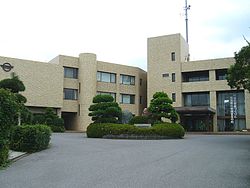 Kyonan Town Office | |
 Flag  Seal | |
 Location of Kyonan in Chiba Prefecture | |
 Kyonan | |
| Coordinates: 35°07′N 139°50′E / 35.117°N 139.833°E | |
| Country | Japan |
| Region | Kantō |
| Prefecture | Chiba |
| District | Awa |
| Area | |
| • Total | 45.16 km2 (17.44 sq mi) |
| Population (December 31, 2020) | |
| • Total | 7,409 |
| • Density | 160/km2 (420/sq mi) |
| Time zone | UTC+9 (Japan Standard Time) |
| - Tree | Camellia |
| - Flower | Narcissus |
| Phone number | 0470-55-2111 |
| Address | 3458 Sakuma, Kyonan-machi, Awa-gun, Chiba-ken 299-2115 |
| Website | Official website |


Geography edit
Kyonan is located in southwestern Bōsō Peninsula, about 60 kilometers from the prefectural capital at Chiba and 60 to 70 kilometers from central Tokyo. Facing the Tokyo Bay coast, the inland mountainous area is part of the Bōsō Hill Range. At the southern end is Nishigasaki, which juts out into the Uraga Channel. The coastline is rugged and has fishing ports such as Yasuda and Katsuyama. There are also many islands and reefs. The town extends approximately 10.75 kilometers east to west by 7.3 kilometers north and south. The coastal portion of the town is within the boundaries of the Minami Bōsō Quasi-National Park.
Neighboring municipalities edit
Chiba Prefecture
Climate edit
Kyonan has a humid subtropical climate (Köppen Cfa) characterized by warm summers and cool winters with light to no snowfall. The average annual temperature in Kyonan is 15.2 °C. The average annual rainfall is 1804 mm with September as the wettest month. The temperatures are highest on average in August, at around 26.1 °C, and lowest in January, at around 5.4 °C.[2]
Demographics edit
Per Japanese census data,[3] the population of Kyonan has declined by more than half over the past 70 years.
| Year | Pop. | ±% |
|---|---|---|
| 1920 | 12,977 | — |
| 1930 | 13,094 | +0.9% |
| 1940 | 12,574 | −4.0% |
| 1950 | 16,508 | +31.3% |
| 1960 | 15,131 | −8.3% |
| 1970 | 13,316 | −12.0% |
| 1980 | 12,843 | −3.6% |
| 1990 | 11,696 | −8.9% |
| 2000 | 10,521 | −10.0% |
| 2010 | 8,950 | −14.9% |
| 2020 | 6,993 | −21.9% |
History edit
The area of present-day Kyonan was part of ancient Awa Province. The villages of Katayama and Ota were established with the creation of the modern municipalities system on April 1, 1889. Katsuyama was raised to town status in January 1896 and Hota in January 1897. The town of Kyonan was formed by the merger of Katsuyama and Hota on March 30, 1959. With the creation of the city of Minamibōsō in 2006, Kyonan is the only remaining unincorporated portion of Awa District.
Government edit
Kyonan has a mayor-council form of government with a directly elected mayor and a unicameral town council of 12 members. Kyonan, together with the city of Minamibōsō, contributes one member to the Chiba Prefectural Assembly. In terms of national politics, the city is part of Chiba 12th district of the lower house of the Diet of Japan.
Economy edit
Kyonan serves as a commercial center for the surrounding region of southwest-central Chiba Prefecture. The primary industry is commercial fishing and agriculture (rice and flowers). Mount Saga has been used for narcissus cultivation at least from the Edo period 1603–1868, and Kyonan remains one of the largest producers of the flower in Japan.[4] The tourist industry is a growing component of the local economy.
Education edit
Kyonan has one public elementary school, Kyonan Elementary School (鋸南小学校); and one public junior high school, Kyonan Junior High School (鋸南中学校), operated by the town government.[5] The former Katsuyama Elementary School (勝山小学校) and Yasuda Elementary School (保田小学校) merged into Kyonan Elementary in 2014, with the Katsuyama building becoming the Kyonan Elementary building.[6]
The town does not have a high school; however, the Chiba Prefectural Board of Education operates one special education school for the handicapped.
Hota Shiosai Elementary School (保田しおさい学校) is physically located in Kyonan, but it is a municipally-operated school by Katsushika City, Tokyo.[7]
Transportation edit
Railway edit
Highway edit
Noted people edit
- Hishikawa Moronobu (1618–1694), ukiyoe artist of the Edo period, was born in the village of Hodomura in present-day Kyonan. The Hishikawa family practiced dyeing and a gold and silver-thread embroidery in the area. The Hishikawa Moronobu Memorial Hall was built in Kyonan to commemorate his life and work.[8]
Local attractions edit

- Mount Nokogiri
- Nihon-ji temple complex
- Narcissus fields on Mount Saga
- Hota Beach, visited by Natsume Sōseki in 1899
- Hishikawa Moronobu Memorial Hall
References edit
- ^ "Kyonan town official statistics" (in Japanese). Japan.
- ^ Kyonan climate data
- ^ Kyonan population statistics
- ^ 嵯峨山(in Japanese)
- ^ "学校閉庁日のお知らせ". Kyonan. Retrieved 2022-12-13.
- ^ "思い出胸に新たな歩み 勝山小、保田小が閉校 4月から「鋸南小」スタート | ちばとぴ ちばの耳より情報満載 千葉日報ウェブ". Chiba Nippo. Retrieved 2022-12-13.
- ^ "アクセスマップ" (in Japanese). Hota Shiosai Elementary School. Retrieved 2022-12-10.
〒299-1909 千葉県安房郡鋸南町大六180-2
- ^ 菱川師宣記念館 Archived 2012-01-12 at the Wayback Machine(in Japanese)
External links edit
- Official Website (in Japanese)