
KNOWPIA
WELCOME TO KNOWPIA

Laiyuan County 
Summary
Laiyuan County (simplified Chinese: 涞源县; traditional Chinese: 淶源縣; pinyin: Láiyuán Xiàn) is a county in western Hebei province, China, bordering Shanxi province to the west. It is under the jurisdiction of the prefecture-level city of Baoding, and, as of 2006[update], it had a population of 270,000 residing in an area of 2,430 km2 (940 sq mi).
Laiyuan County
涞源县 | |
|---|---|
 Baishishan (白石山) Section of the Great Wall | |
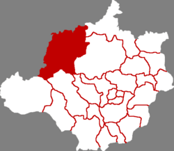 Laiyuan in Baoding | |
 Baoding in Hebei | |
| Coordinates: 39°21′36″N 114°41′38″E / 39.360°N 114.694°E | |
| Country | People's Republic of China |
| Province | Hebei |
| Prefecture-level city | Baoding |
| County seat | Laiyuan Town (涞源镇) |
| Area [citation needed] | |
| • Total | 2,430 km2 (940 sq mi) |
| Elevation | 859 m (2,818 ft) |
| Population (2006)[citation needed] | |
| • Total | 270,000 |
| • Density | 110/km2 (290/sq mi) |
| Time zone | UTC+8 (China Standard) |
| Postal code | 074300 |
Administrative divisions edit
There are 7 towns and 10 townships under the county's administration.[1]
|
Towns:
|
Townships:
|
Climate edit
| Climate data for Laiyuan (1991–2020 normals, extremes 1981–2010) | |||||||||||||
|---|---|---|---|---|---|---|---|---|---|---|---|---|---|
| Month | Jan | Feb | Mar | Apr | May | Jun | Jul | Aug | Sep | Oct | Nov | Dec | Year |
| Record high °C (°F) | 15.0 (59.0) |
21.0 (69.8) |
27.8 (82.0) |
34.9 (94.8) |
36.6 (97.9) |
38.0 (100.4) |
39.8 (103.6) |
35.1 (95.2) |
34.8 (94.6) |
27.7 (81.9) |
23.6 (74.5) |
17.6 (63.7) |
39.8 (103.6) |
| Mean daily maximum °C (°F) | 0.8 (33.4) |
4.2 (39.6) |
10.5 (50.9) |
18.2 (64.8) |
24.0 (75.2) |
27.4 (81.3) |
28.2 (82.8) |
26.9 (80.4) |
22.8 (73.0) |
16.7 (62.1) |
8.6 (47.5) |
1.9 (35.4) |
15.9 (60.5) |
| Daily mean °C (°F) | −7.6 (18.3) |
−4.1 (24.6) |
2.6 (36.7) |
10.3 (50.5) |
16.6 (61.9) |
20.6 (69.1) |
22.3 (72.1) |
20.7 (69.3) |
15.4 (59.7) |
8.7 (47.7) |
0.7 (33.3) |
−5.8 (21.6) |
8.4 (47.1) |
| Mean daily minimum °C (°F) | −13.8 (7.2) |
−10.7 (12.7) |
−4.3 (24.3) |
2.7 (36.9) |
8.9 (48.0) |
13.9 (57.0) |
17.1 (62.8) |
15.4 (59.7) |
9.2 (48.6) |
2.3 (36.1) |
−5.1 (22.8) |
−11.4 (11.5) |
2.0 (35.6) |
| Record low °C (°F) | −24.7 (−12.5) |
−26.9 (−16.4) |
−18.5 (−1.3) |
−10.5 (13.1) |
−3.4 (25.9) |
3.7 (38.7) |
7.6 (45.7) |
4.2 (39.6) |
−2.8 (27.0) |
−11.6 (11.1) |
−21.2 (−6.2) |
−25.3 (−13.5) |
−26.9 (−16.4) |
| Average precipitation mm (inches) | 2.0 (0.08) |
4.4 (0.17) |
8.9 (0.35) |
20.0 (0.79) |
39.2 (1.54) |
85.4 (3.36) |
135.7 (5.34) |
107.9 (4.25) |
65.1 (2.56) |
25.8 (1.02) |
9.6 (0.38) |
2.5 (0.10) |
506.5 (19.94) |
| Average precipitation days (≥ 0.1 mm) | 1.8 | 2.7 | 3.9 | 5.4 | 8.5 | 12.6 | 14.5 | 13.3 | 9.8 | 6.0 | 3.1 | 1.7 | 83.3 |
| Average snowy days | 2.3 | 3.9 | 3.4 | 1.2 | 0 | 0 | 0 | 0 | 0 | 0.2 | 2.9 | 2.8 | 16.7 |
| Average relative humidity (%) | 45 | 43 | 42 | 43 | 47 | 60 | 74 | 77 | 72 | 61 | 53 | 47 | 55 |
| Mean monthly sunshine hours | 204.2 | 196.6 | 234.4 | 249.0 | 270.6 | 234.0 | 213.4 | 216.2 | 214.4 | 216.4 | 199.3 | 200.0 | 2,648.5 |
| Percent possible sunshine | 67 | 64 | 63 | 62 | 61 | 53 | 47 | 52 | 58 | 63 | 67 | 69 | 61 |
| Source: China Meteorological Administration[2][3] | |||||||||||||
Transportation edit
External links edit
- ^ 2011年统计用区划代码和城乡划分代码:阜平县 (in Chinese). National Bureau of Statistics of the People's Republic of China. Retrieved 2012-07-18.
- ^ 中国气象数据网 – WeatherBk Data (in Simplified Chinese). China Meteorological Administration. Retrieved 25 August 2023.
- ^ 中国气象数据网 (in Simplified Chinese). China Meteorological Administration. Retrieved 25 August 2023.