


Summary
Lake Bernard Frank (also Lake Frank), is a 54-acre (220,000 m2) reservoir on the North Branch of Rock Creek in Derwood, Maryland, U.S., just east of Rockville. In the late 1960s it was renamed after Bernard Frank, a wilderness activist and a co-founder of The Wilderness Society.[2] The lake's boundaries are, approximately, Route 28, East Gude Drive, Avery Road, and Muncaster Mill Road. Lake Frank was created in 1966 as Lake Norbeck to aid in flood and sediment control, as well as to provide recreation. It has an earthen dam, installed in 1967, on its southern side. It was created as a sister lake to Lake Needwood. Lake Frank is owned by the Maryland-National Capital Park and Planning Commission (M–NCPPC).
| Lake Bernard Frank | |
|---|---|
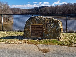 Dedication stone at Lake Bernard Frank | |
 Lake Bernard Frank  Lake Bernard Frank | |
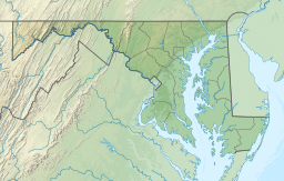
| Location | Derwood, Maryland |
| Coordinates | 39°06′23″N 77°06′48″W / 39.1062972°N 77.1133011°W[1] |
| Type | reservoir |
| Primary inflows | North Branch of Rock Creek (Potomac River) |
| Primary outflows | North Branch of Rock Creek (Potomac River) |
| Catchment area | 12.2 sq mi (32 km2) |
| Basin countries | United States |
| Managing agency | Montgomery Parks, M–NCPPC |
| Built | 1966 |
| Construction engineer | |
| Max. length | 0.85 mi (1.37 km) |
| Max. width | 950 ft (290 m) |
| Surface area | 54 acres (22 ha) |
| Average depth | 12.8 ft (3.9 m) |
| Max. depth | 26.5 ft (8.1 m) |
| Water volume | 233,000,000 US gal (880,000 m3) |
| Surface elevation | 299 feet (91 m)[1] |
| Website | www |
| References | [2] |
The lake's secluded location within Rock Creek Regional Park is another of its assets. Visitors to the lake must bike or walk about 1/4 of a mile from all parking lots to get to the lakeshore. The Lake Frank & Meadowside Trails surround the lake, making it a favorite hiking spot. Also, locals enjoy fishing from the shoreline, though a license is needed to do so. However, swimming, boating, and ice skating are prohibited.[3]
The main trail around Lake Frank, the Lakeside Trail, is a 31⁄4 mile long loop. Approximately 2/3 of the trail is unpaved and traverses the woods surrounding the lake. The other part of the trail is wider and paved. At the approximate half-way point of the trail, there is a creek that must be crossed. Though there are a group of rocks which form a bridge-like path across, the creek may be impassable depending on the water level.
Water Quality edit
In 1998, the Maryland Department of the Environment (MDE) identified Lake Frank as "impaired by nutrients" on its list of impaired surface waters. Eutrophic conditions in the lake were described at that time, evidenced by excessive algal growth and low dissolved oxygen levels. In 2002, MDE prepared a report based on more recent monitoring data which indicated improved conditions. The 2002 report proposed that the lake be removed from the impairment listing.[4]
In 2017-2019, the Maryland-National Capital Park and Planning Commission warned of the lake water contamination with microcystin.[5] Microcystin is a toxic substance produced by some species of blue-green algae (cyanobacteria) and is toxic to the liver.[6]
References edit
- ^ a b U.S. Geological Survey Geographic Names Information System: Lake Bernard Frank
- ^ a b "History: Lake Frank". MontgomeryParks.org. Retrieved June 15, 2019.
...a man-made 54-acre water impoundment with an earthen dam. ...designed by the Soil Conservation Service and authorized under Public Law 566, took two years to construct. ...filled to its normal pool level in 1966. Originally named Lake Norbeck, the lake was later renamed to honor Bernard Frank, a local conservationist and forester who helped spearhead the its [sic] creation.
- ^ "Meadowside Nature Center Trails". Montgomery Parks. Retrieved 2021-02-14.
- ^ Maryland Department of the Environment. Baltimore, MD."Water Quality Analyses (WQA) with EPA Concurrence of MDE's Findings: Lake Bernard Frank." Archived August 11, 2004, at the Wayback Machine January 22, 2003.
- ^ Announcements; News; Releases, Press (2017-07-24). "Montgomery Parks Reports Elevated Levels of Microcystin at Lake Needwood and Lake Frank; Visitors Asked to Use Caution". Montgomery Parks. Retrieved 2019-09-29.
{{cite web}}:|last2=has generic name (help) - ^ "Montgomery Parks Reports Elevated Levels of Microcystin at Lake Needwood and Lake Frank; Visitors Asked to Use Caution" (Press release). Silver Spring, MD: Montgomery Parks. Maryland-National Capital Park and Planning Commission. July 24, 2017. Retrieved June 15, 2019.
External links edit
- Official website

- March 2019 map of Lake Frank and Meadowside Trails at Montgomery Parks
- GIS map of the Lake Frank Trail Connector at Montgomery Parks
- Rock Creek Regional Park brochure with trail maps, from Montgomery Parks
- Depth chart by iboating