


Summary
Lake King is a town in the eastern Wheatbelt region of Western Australia, 464 kilometres (288 mi) from Perth along State Route 40 between Kelmscott and Ravensthorpe. As of 2016, the town had a population of 95.[2] The 2011 census recorded both the population of the town and the surrounding area for a population of 332.[3]
| Lake King Western Australia | |
|---|---|
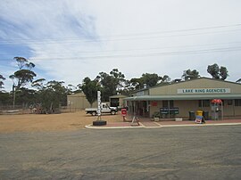 Lake King Agencies, 2015 | |
 Lake King | |
 | |
| Coordinates | 33°05′06″S 119°41′20″E / 33.085°S 119.689°E |
| Population | 84 (SAL 2021)[1] |
| Established | 1936 |
| Postcode(s) | 6356 |
| Elevation | 344 m (1,129 ft) |
| Area | 1,373.6 km2 (530.3 sq mi) |
| Location |
|
| LGA(s) | Shire of Lake Grace |
| State electorate(s) | Roe |
| Federal division(s) | O'Connor |
Lake King is named after a nearby lake which in turn was named after the Surveyor General of Western Australia, Henry Sandford King, by Marshall Fox, District Surveyor (Narrogin).
In 1926, following completion of an initial land classification survey of the Lake King district that defined 230,000 acres as suitable for settlement,[4][5] a large official inspection party was led by Surveyor General John Percy Camm, Sydney Stubbs (MLA Wagin), Edwin Wilkie Corboy (MLA Yilgan), and James Cornell (MLC South Province).[6] The area was surveyed and access roads built during 1927, and land released in 1928 at prices from 4/6 to 16/- per acre.[7] The town struggled through the depression but thrived in the postwar years on the back of high wool and wheat prices.[8]
The Lake King Progress Association lobbied the government to declare a townsite in 1935 and the town was gazetted in 1936.[9]
The surrounding areas produce wheat and other cereal crops. The town is a receival site for Cooperative Bulk Handling.[10]
References edit
- ^ Australian Bureau of Statistics (28 June 2022). "Lake King (suburb and locality)". Australian Census 2021 QuickStats. Retrieved 28 June 2022.
- ^ Australian Bureau of Statistics (27 June 2017). "Lake King (State Suburb)". 2016 Census QuickStats. Retrieved 4 May 2020.
- ^ Australian Bureau of Statistics (31 October 2012). "Lake King (State Suburb)". 2011 Census QuickStats. Retrieved 4 May 2020.
- ^ "Land Classification". Great Southern Leader. Pingelly, WA. 15 October 1926. p. 8. Retrieved 4 May 2020.
- ^ "Land Settlement". Western lMail. Perth, WA. 4 November 1926. Retrieved 4 May 2020.
- ^ "Lake King". The Wagin Argus and Arthur, Dumbleyung, Lake Grace Express. 1 October 1926. pp. 3–4. Retrieved 4 May 2020.
- ^ "Government Land". Bruce Rock Post and Corrigin and Narembeen Guardian. 30 March 1928. p. 6. Retrieved 4 May 2020.
- ^ "The history of Lake King". 2006. Archived from the original on 21 July 2008. Retrieved 29 September 2008.
- ^ "History of country town names – L". Western Australian Land Information Authority. Archived from the original on 14 March 2022. Retrieved 30 September 2008.
- ^ "CBH receival sites" (PDF). 2011. Archived from the original (PDF) on 18 March 2012. Retrieved 1 April 2013.